MyTopo
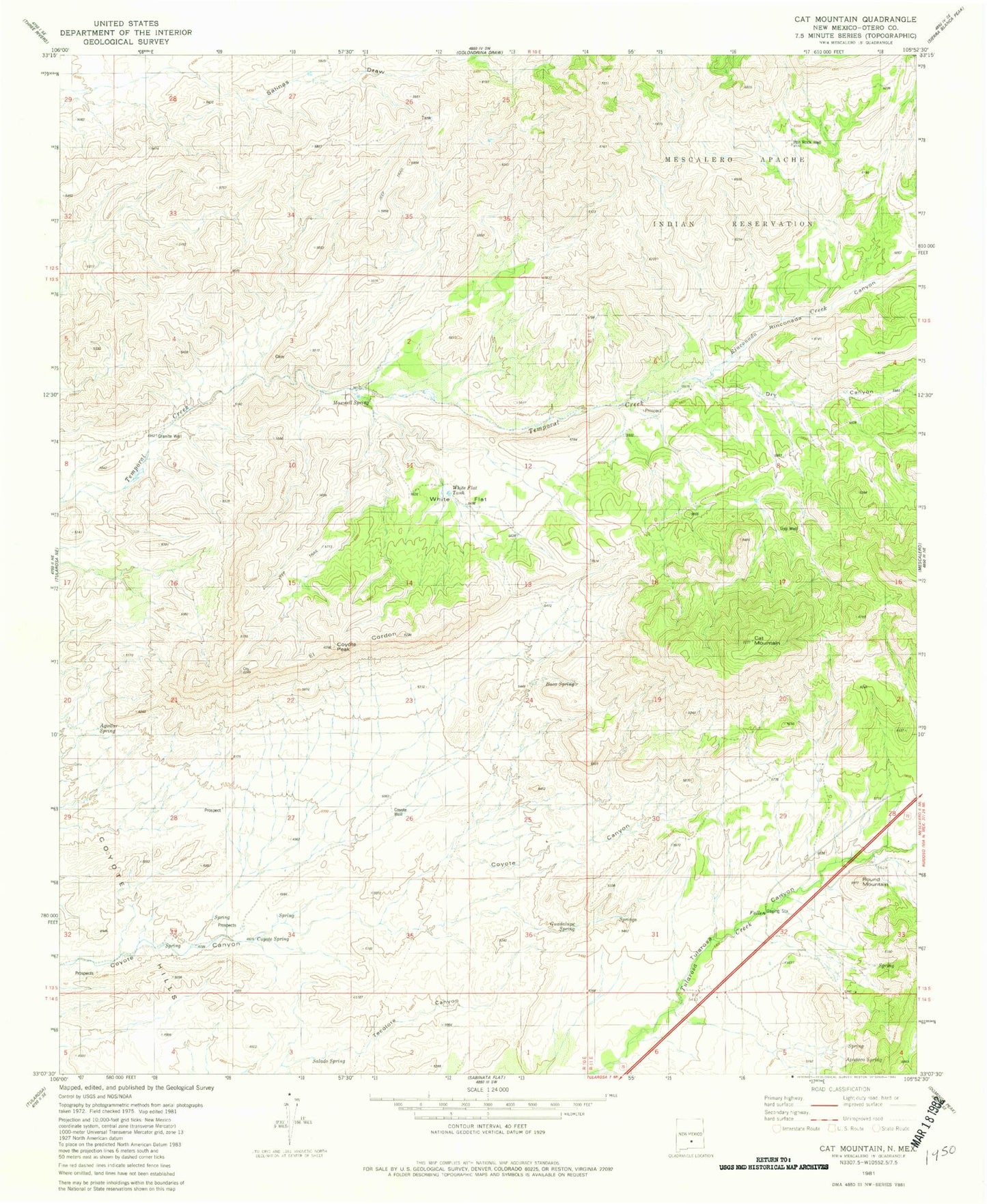
Classic USGS Cat Mountain New Mexico 7.5'x7.5' Topo Map
Couldn't load pickup availability
Historical USGS topographic quad map of Cat Mountain in the state of New Mexico. Map scale may vary for some years, but is generally around 1:24,000. Print size is approximately 24" x 27"
This quadrangle is in the following counties: Otero.
The map contains contour lines, roads, rivers, towns, and lakes. Printed on high-quality waterproof paper with UV fade-resistant inks, and shipped rolled.
Contains the following named places: Aguilar Spring, Apodaca Spring, Baca Spring, Buck Camp, Cat Mountain, Coyote Peak, Coyote Spring, Coyote Well, Dry Canyon, Granite Well, Guadalupe Spring, Gyp Well, Iron Rock Well, KPSA-FM (Alamogordo), Maxwell Spring, Rinconada Canyon, Rinconada Creek, Round Mountain, Round Mountain Historical Marker, Salado Spring, White Flat, White Flat Tank, ZIP Code: 88352