MyTopo
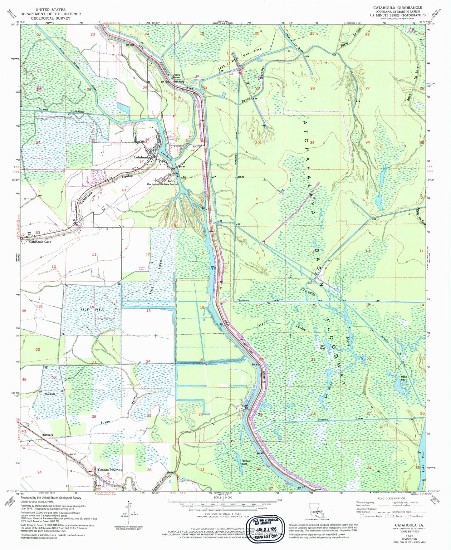
Classic USGS Catahoula Louisiana 7.5'x7.5' Topo Map
Couldn't load pickup availability
Historical USGS topographic quad map of Catahoula in the state of Louisiana. Map scale may vary for some years, but is generally around 1:24,000. Print size is approximately 24" x 27"
This quadrangle is in the following counties: St. Martin.
The map contains contour lines, roads, rivers, towns, and lakes. Printed on high-quality waterproof paper with UV fade-resistant inks, and shipped rolled.
Contains the following named places: Bankers, Bay Baron, Bay Toni, Bayou Garotier, Bayou Junction, Bayou La Rose Gas Field, Bayou Mersier, Bayou Veillon, Catahoula, Catahoula Census Designated Place, Catahoula Coulee, Catahoula Cove, Catahoula Elementary School, Catahoula Lake, Catahoula Lake Fire Department, Coteau Holmes, Crocodile Bayou, Crocodile Bayou Oil Field, Cypress Brake, Grand Coulee, Haha Bay, Indian Mound Cemetery, Lake La Rose, Lake La Rose Gas Field, Our Lady of the Lake Cemetery, Parish Governing Authority District 5, Saint Isabel Church, Sandy's Trailer Park, Willow Lake