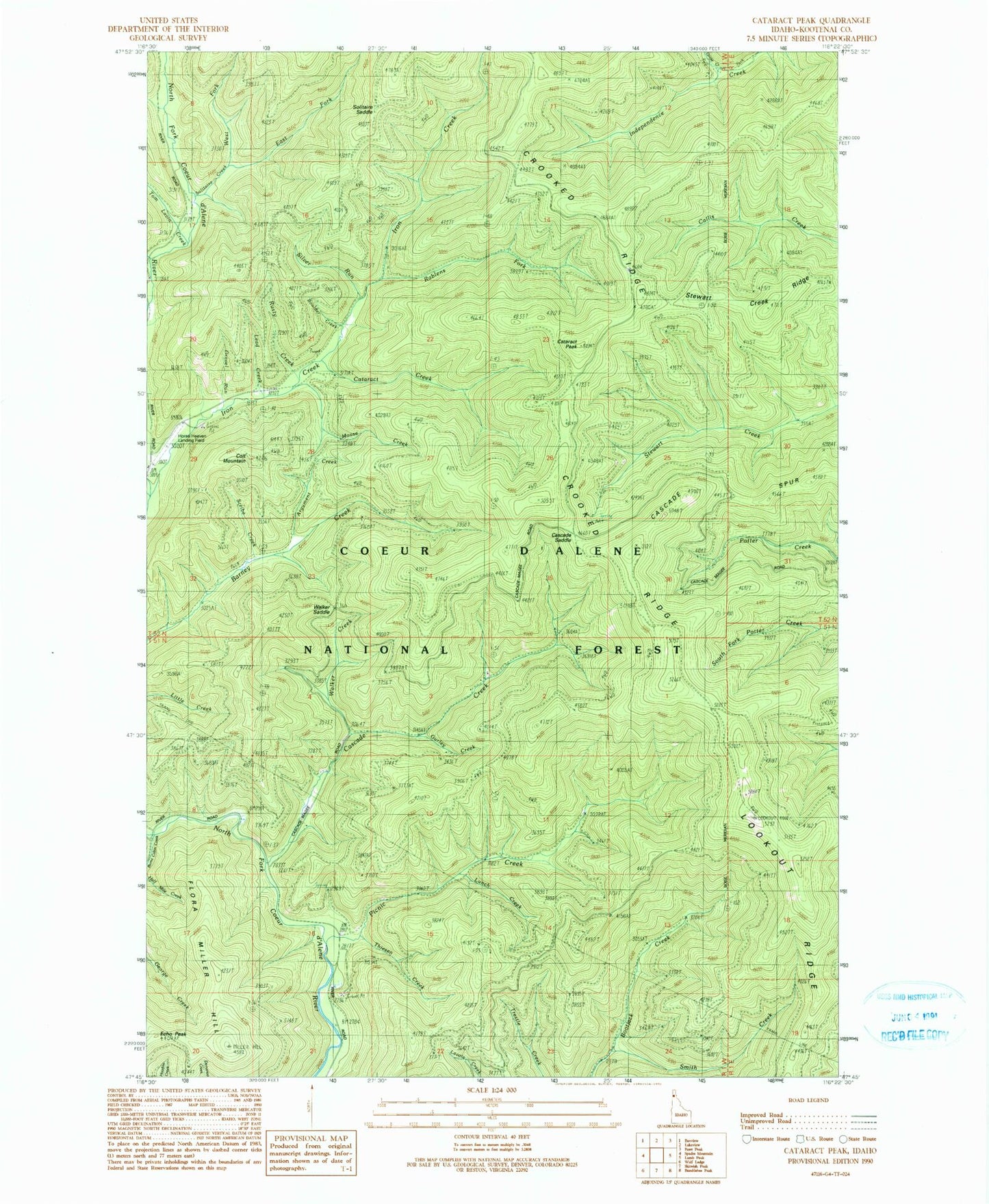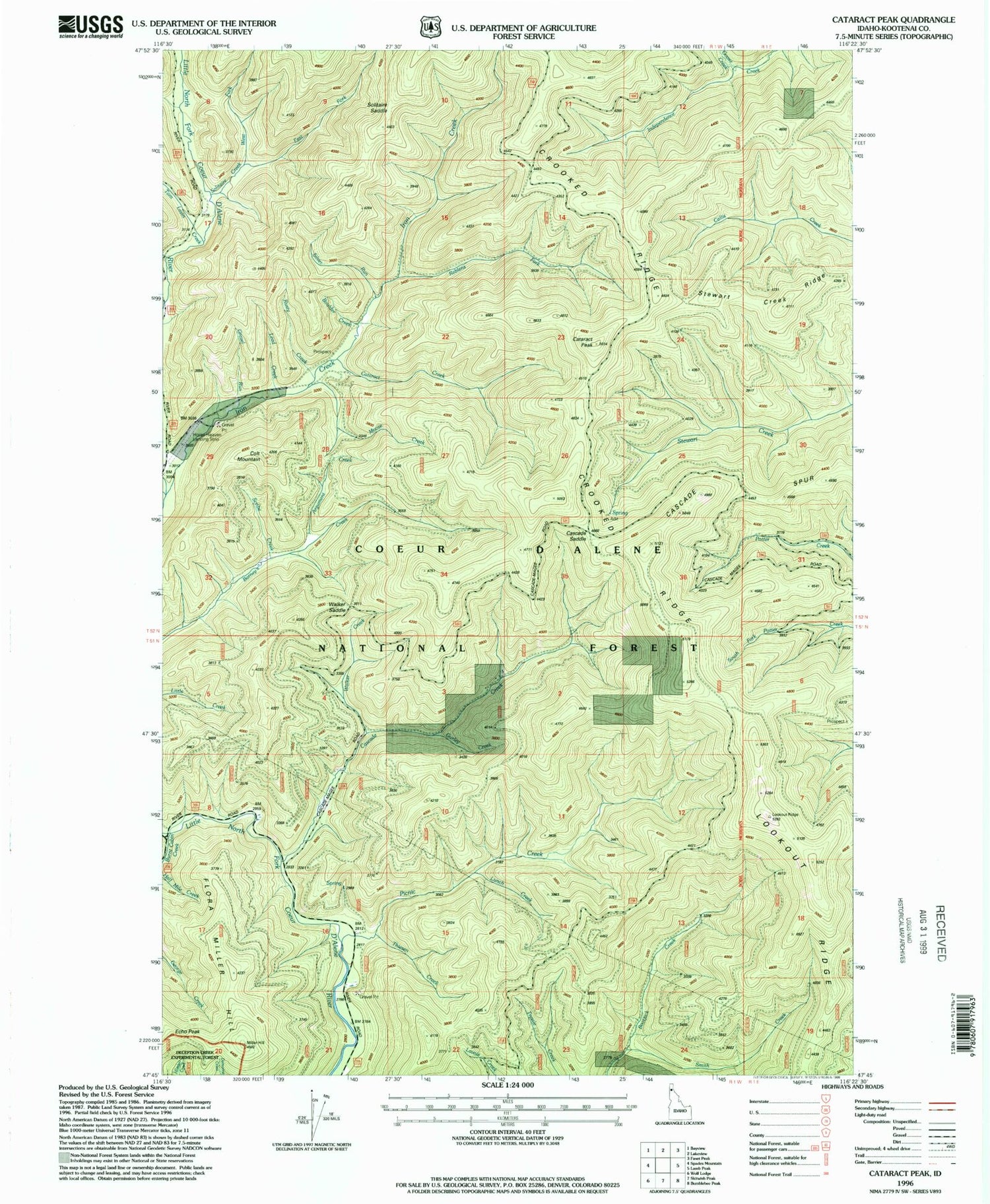
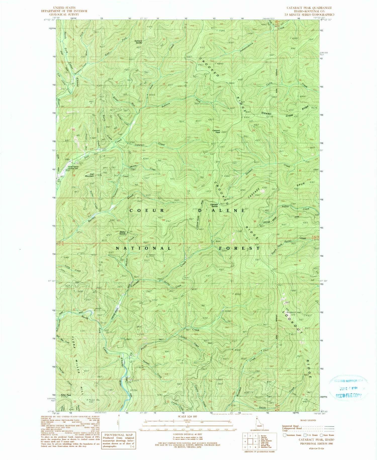
MyTopo
Classic USGS Cataract Peak Idaho 7.5'x7.5' Topo Map
Couldn't load pickup availability
Historical USGS topographic quad map of Cataract Peak in the state of Idaho. Map scale may vary for some years, but is generally around 1:24,000. Print size is approximately 24" x 27"
This quadrangle is in the following counties: Kootenai.
The map contains contour lines, roads, rivers, towns, and lakes. Printed on high-quality waterproof paper with UV fade-resistant inks, and shipped rolled.
Contains the following named places: Argument Creek, Boulder Creek, Burnt Cabin Creek, Cascade Creek, Cascade Saddle, Cascade Spur, Cataract Creek, Cataract Peak, Colt Mountain, Crooked Ridge, East Fork Solitaire Creek, Echo Peak, Flora Miller Hill, Goose Creek, Gravel Run, Gurley Creek, Independence Saddle, Lead Creek, Lookout Ridge, Lunch Creek, Moose Creek, Picnic Creek, Rablens Fork, Rusty Creek, Scribe Creek, Silver Run, Smith Creek, Solitaire Creek, Solitare Saddle, Stewart Creek Ridge, Thiesen Creek, Tom Lavin Creek, Walker Creek, Walker Saddle, West Fork Solitaire Creek