MyTopo
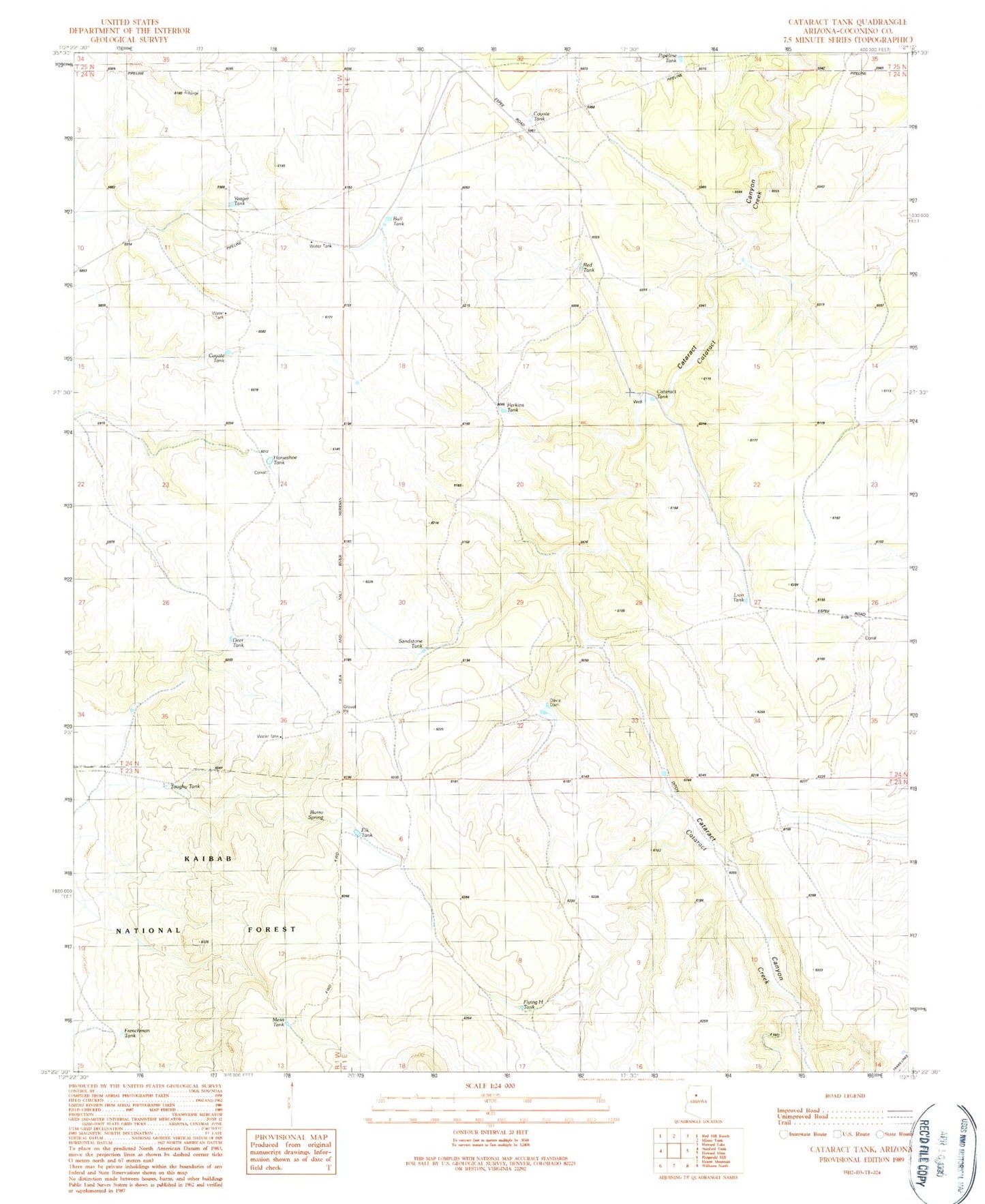
Classic USGS Cataract Tank Arizona 7.5'x7.5' Topo Map
Regular price
$16.95
Regular price
Sale price
$16.95
Unit price
per
Couldn't load pickup availability
Historical USGS topographic quad map of Cataract Tank in the state of Arizona. Map scale may vary for some years, but is generally around 1:24,000. Print size is approximately 24" x 27"
This quadrangle is in the following counties: Coconino.
The map contains contour lines, roads, rivers, towns, and lakes. Printed on high-quality waterproof paper with UV fade-resistant inks, and shipped rolled.
Contains the following named places: Bull Tank, Burro Spring, Cataract Tank, Coyote Tank, Davis Dam, Deer Tank, Elk Tank, Flying H Tank, Frenchman Tank, Horseshoe Tank, Lion Tank, Mesa Tank, Perkins Tank, Pipeline Tank, Red Tank, Robert Tank, Sandstone Tank, Toughy Tank, Yeager Tank