MyTopo
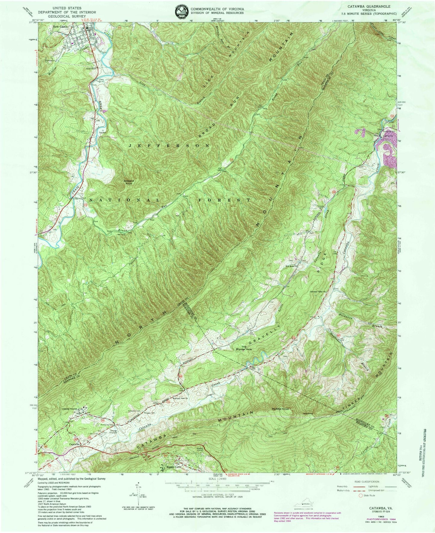
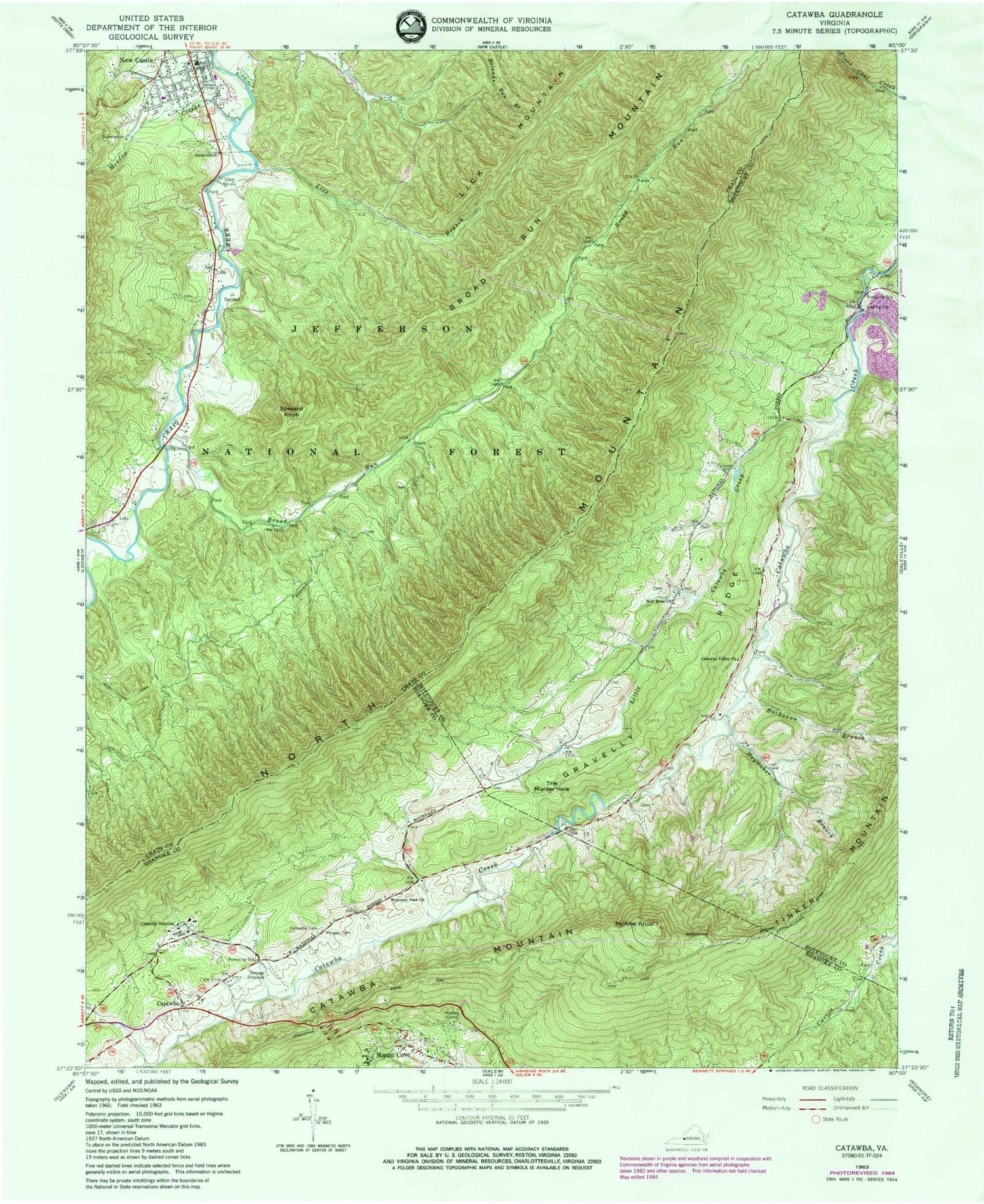
Classic USGS Catawba Virginia 7.5'x7.5' Topo Map
Couldn't load pickup availability
Historical USGS topographic quad map of Catawba in the state of Virginia. Typical map scale is 1:24,000, but may vary for certain years, if available. Print size: 24" x 27"
This quadrangle is in the following counties: Botetourt, Craig, Roanoke.
The map contains contour lines, roads, rivers, towns, and lakes. Printed on high-quality waterproof paper with UV fade-resistant inks, and shipped rolled.
Contains the following named places: Broad Run, Broad Run Mountain, Buchanan Branch, Catawba Cemetery, Catawba Valley Church, Gravelly Ridge, Haymaker Branch, Lick Branch, Little Catawba Creek, McAfee Knob, Meadow Creek, Medley Camp, Morgan Cemetery, Mountain View Church, New Hope Church, Spesard Knob, The Murder Hole, North Mountain Trail, Catawba Hospital, Catawba, Catawba Mountain, Lick Mountain, North Mountain, New Castle International Airport, Tinker (historical), Catawba Elementary School, Roanoke Red Sulphur Springs, Roanoke County Sheriffs Office, Roanoke County Fire and Rescue Station 4 - Catawba Fire Department, New Castle Volunteer Fire Department, Catawba Post Office