
MyTopo
Classic USGS Catfish Lake Louisiana 7.5'x7.5' Topo Map
Couldn't load pickup availability
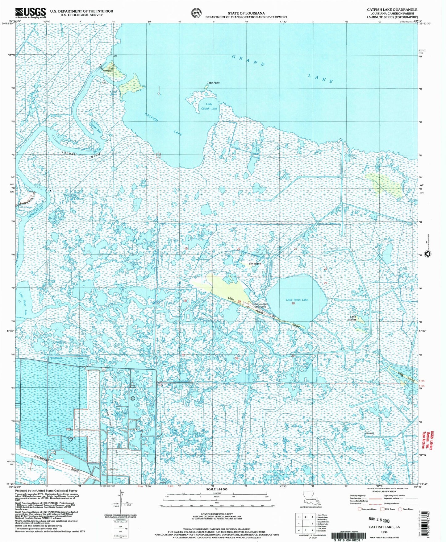
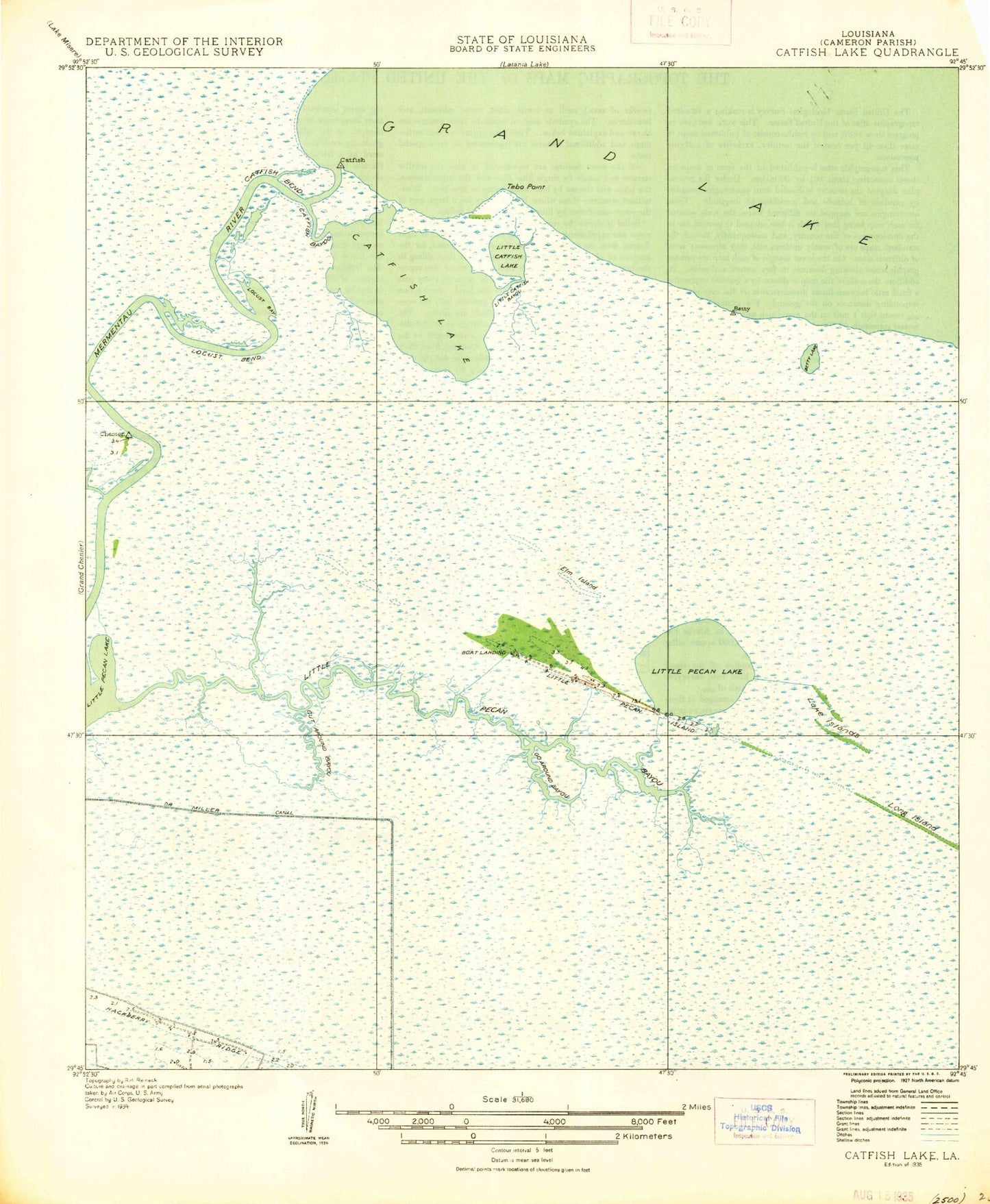
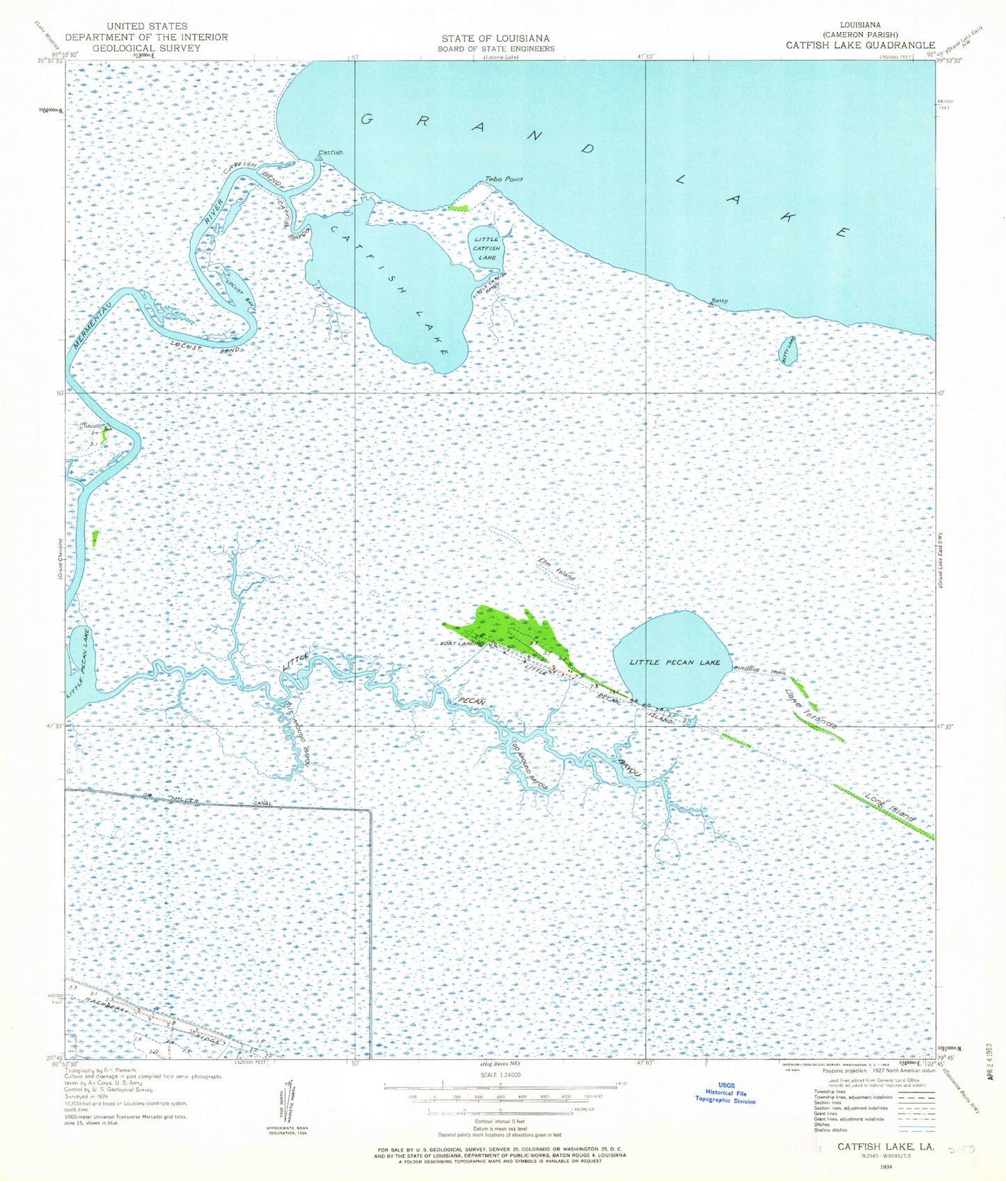
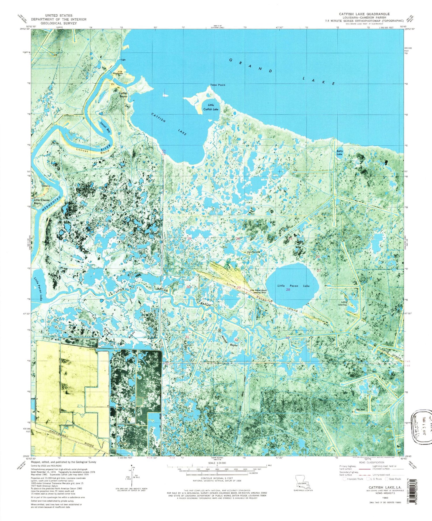
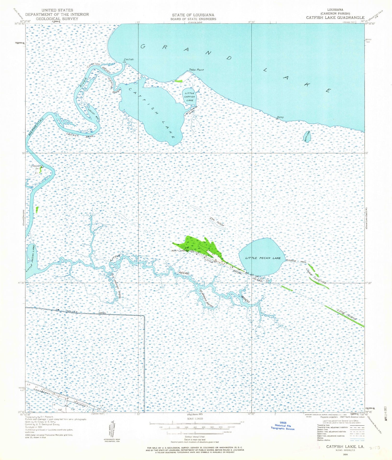
Historical USGS topographic quad map of Catfish Lake in the state of Louisiana. Map scale may vary for some years, but is generally around 1:24,000. Print size is approximately 24" x 27"
This quadrangle is in the following counties: Cameron.
The map contains contour lines, roads, rivers, towns, and lakes. Printed on high-quality waterproof paper with UV fade-resistant inks, and shipped rolled.
Contains the following named places: Betty Lake, Betty Lake Gas Field, Catfish Bayou, Catfish Bend, Catfish Lake, Cut Around Bayou, Dr Miller Canal, Elm Island, Garnd Chenier Gas Field, Go Around Bayou, Go Around Bayou Gas Field, Lake Islands, Little Catfish Bayou, Little Catfish Lake, Little Pecan Bayou, Little Pecan Canal, Little Pecan Island, Little Pecan Island Airport, Little Pecan Lake, Locust Bay, Locust Bend, Long Island, Parish Governing Authority District 4, Pirogue Trail, Tebo Point, ZIP Code: 70643