MyTopo
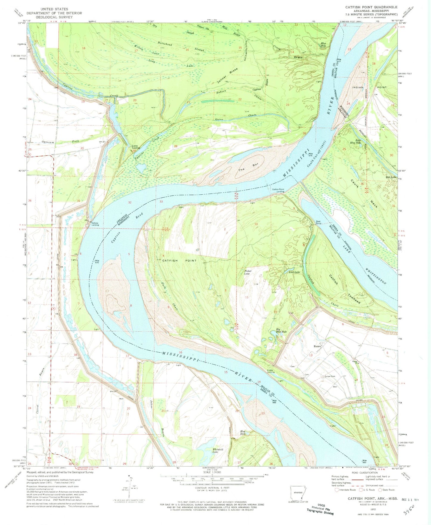
Classic USGS Catfish Point Mississippi 7.5'x7.5' Topo Map
Couldn't load pickup availability
Historical USGS topographic quad map of Catfish Point in the states of Mississippi, Arkansas. Map scale may vary for some years, but is generally around 1:24,000. Print size is approximately 24" x 27"
This quadrangle is in the following counties: Bolivar, Desha.
The map contains contour lines, roads, rivers, towns, and lakes. Printed on high-quality waterproof paper with UV fade-resistant inks, and shipped rolled.
Contains the following named places: Big Blue Hole, Blue Hole, Bobs Blue Hole, Catfish Chute, Catfish Point, Catfish Point Airport, Catfish Point Landing, Catfish Towhead, Caulk Cut-off, Caulk Landing, Caulk Neck, Chicot Landing, Crazy Bayou, Cypress Bayou, Cypress Bend, Cypress Bend Revetment, Cypress Creek, DeSoto Landing, Dry Slough, Duck Chute, Eutaw, Eutaw Cemetery, Eutaw Church, Eutaw Landing, Eutaw Store, Hobson Chute, Horsehead Slough, Island Number Seventyseven, Johns Bayou, Lake Whittington, Long Lake, Lost Lake, Lucca Bar, Lucca Landing, Mills Bayou Ditch, Nebletts Landing, Outer Chute, Ozark Chute, Picket Lake, Potlatch Corporation Ambulance, Prentiss, The Bar, Township of Franklin, Whitehill Lake, Willow Lake, Zellner Brake