MyTopo
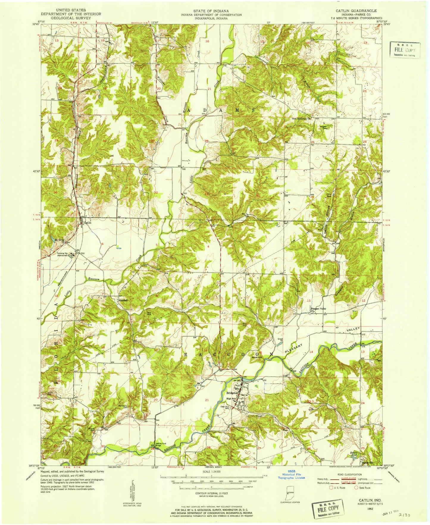
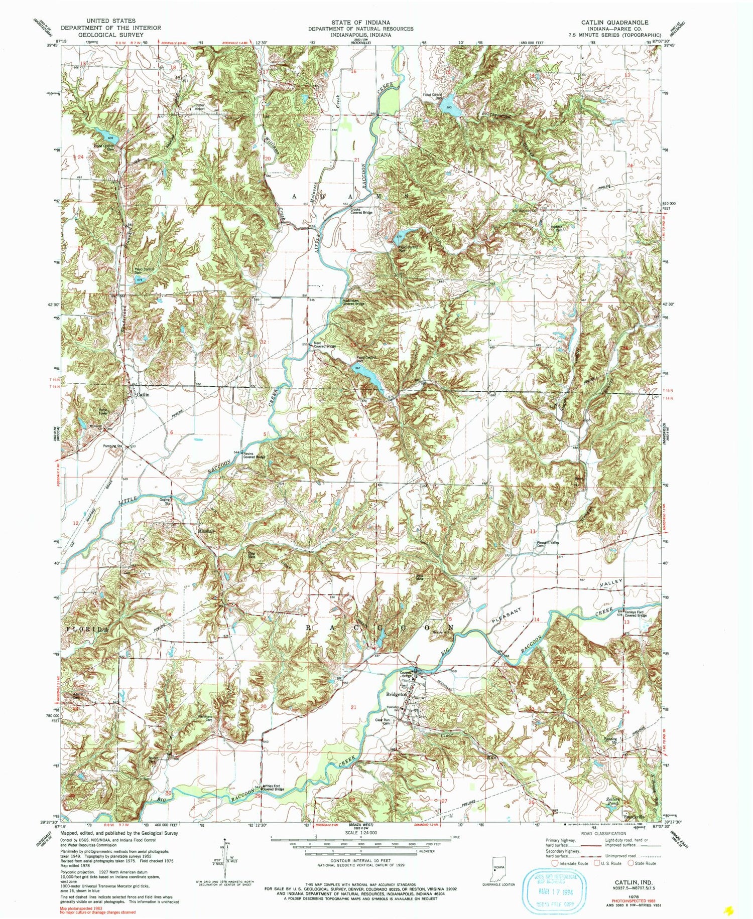
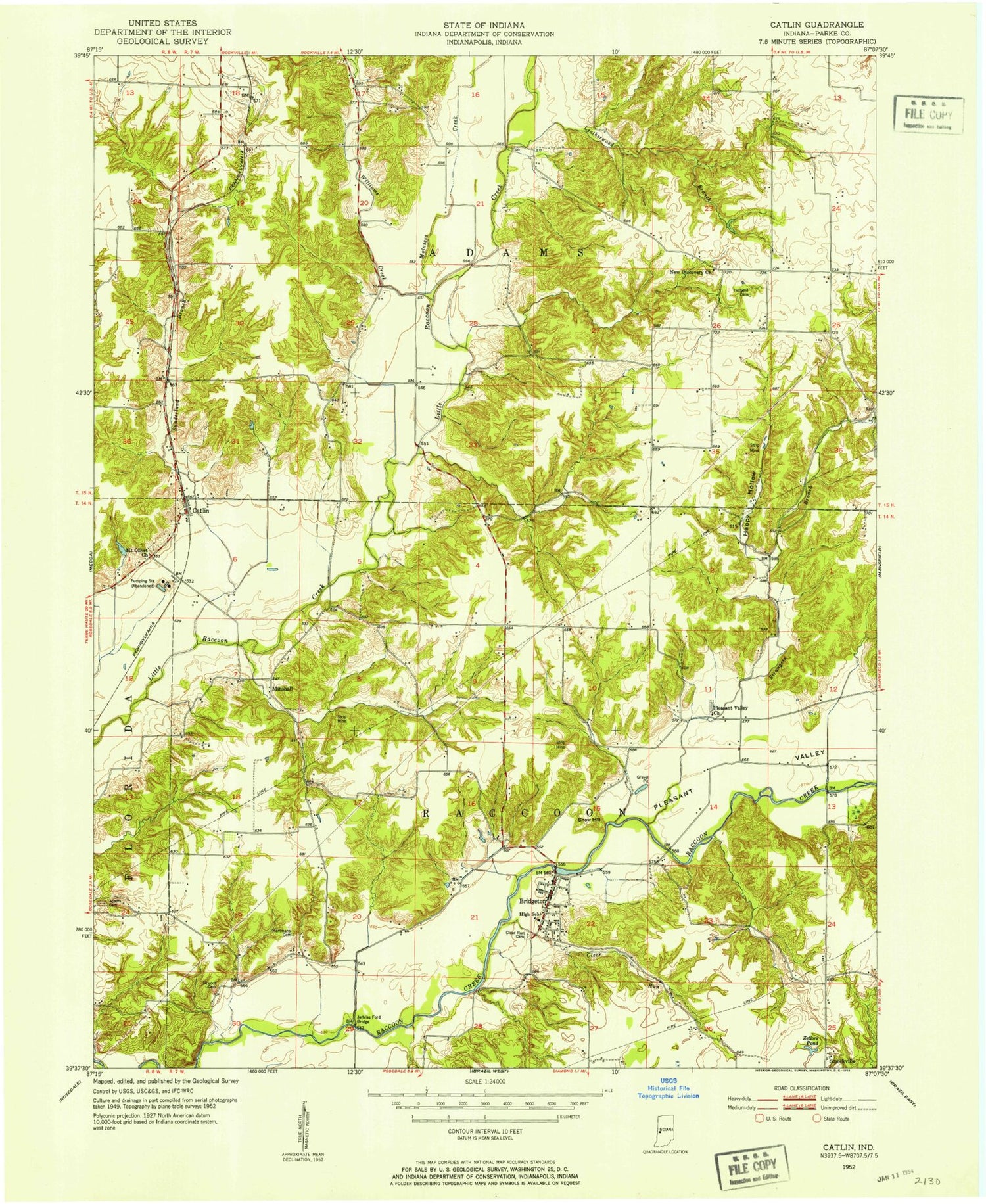
Classic USGS Catlin Indiana 7.5'x7.5' Topo Map
Couldn't load pickup availability
Historical USGS topographic quad map of Catlin in the state of Indiana. Map scale may vary for some years, but is generally around 1:24,000. Print size is approximately 24" x 27"
This quadrangle is in the following counties: Parke.
The map contains contour lines, roads, rivers, towns, and lakes. Printed on high-quality waterproof paper with UV fade-resistant inks, and shipped rolled.
Contains the following named places: Adams Lee Cemetery, Aitken Lake Dam, Bridgeton, Bridgeton Bridge, Bridgeton Elementary and Junior High School, Bridgeton Fire Department, Bridgeton Post Office, Bridgeton Volunteer Fire Department, Brunot Cemetery, Butler Field, Case Lake, Catlin, Clear Run, Clear Run Cemetery, Conleys Ford Covered Bridge, Crooks Covered Bridge, Ferguson Branch, Ford Run, Happy Hollow, Hartman Family Cemetery, Hatfield Cemetery, Hopper Branch, Jeffries Ford Bridge, Jeffries Run, Lakeland, Lakeys Branch, Leatherwood Branch, Little Raccoon Structure Number 16, McAllisters Covered Bridge, Minshall, Molasses Creek, Mount Olivet Church, Neet Covered Bridge, Nevins Covered Bridge, New Discovery, New Discovery Church, Piattsville, Pleasant Valley, Pleasant Valley Church, Smockville, Snow Hill, Strange Branch, Sunderland Branch, Superior, Township of Adams, Township of Raccoon, Walton, Williams Creek, Zellors Pond, ZIP Code: 47836