MyTopo
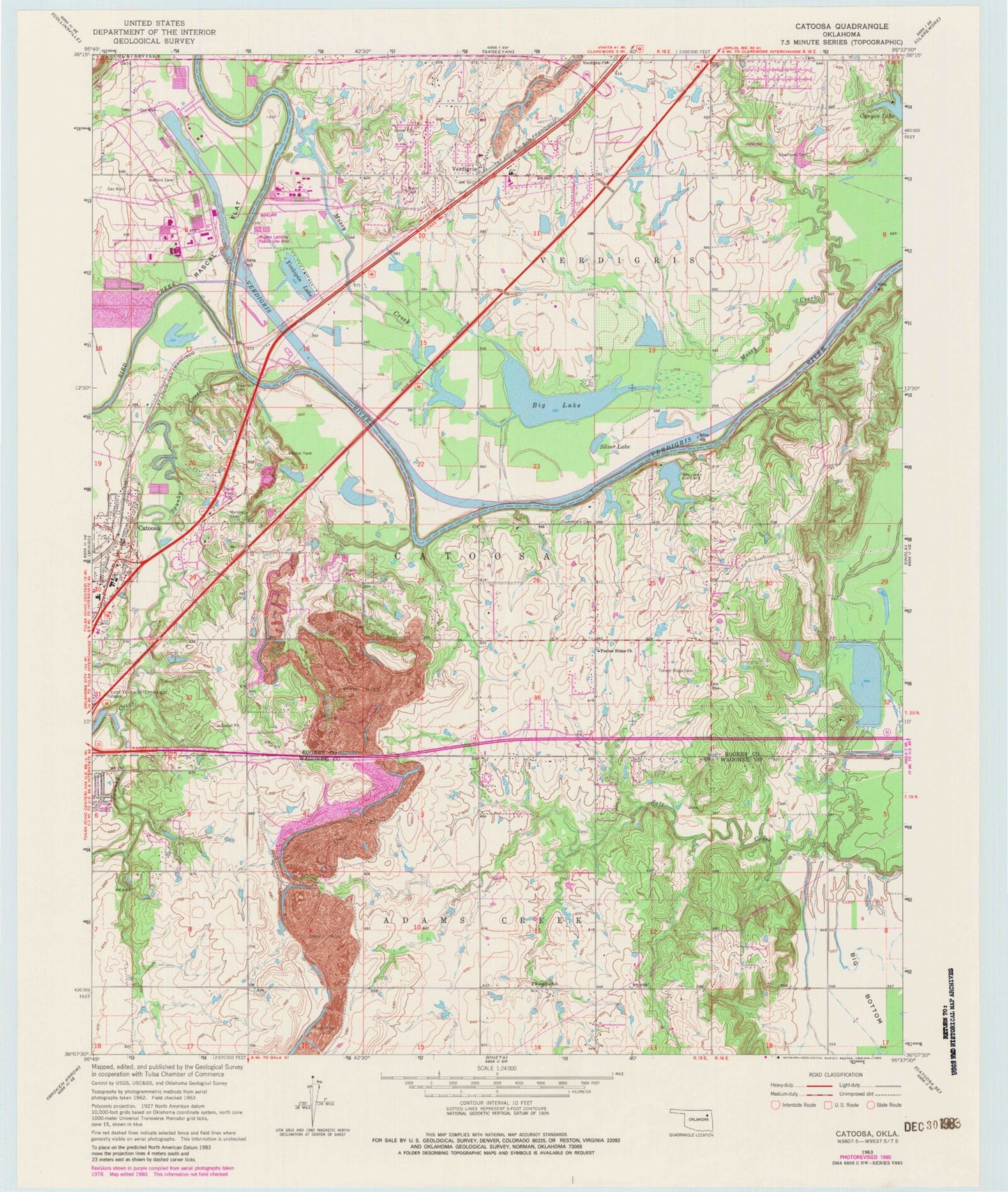
Classic USGS Catoosa Oklahoma 7.5'x7.5' Topo Map
Couldn't load pickup availability
Historical USGS topographic quad map of Catoosa in the state of Oklahoma. Map scale may vary for some years, but is generally around 1:24,000. Print size is approximately 24" x 27"
This quadrangle is in the following counties: Rogers, Wagoner.
The map contains contour lines, roads, rivers, towns, and lakes. Printed on high-quality waterproof paper with UV fade-resistant inks, and shipped rolled.
Contains the following named places: Big Lake, Bird Creek, Canyon Lake, Catoosa, Catoosa Fire Department Station 1, Catoosa First Assembly of God, Catoosa Police Department, Catoosa Ultralight Airpark, Catoosa United Methodist Church, Chambers Cemetery, Cherokee Elementary School, Crutchfield Cemetery, Fair Oaks, First Baptist Church, Helen Paul Learning Center, Konklin School, Marshall Cemetery, Mossy Creek, Oak Grove Fire Station, Oknoname 131004 Dam, Oknoname 131004 Reservoir, Oknoname 131005 Dam, Oknoname 131005 Reservoir, Pafford Emergency Medical Services, Port of Catoosa, Rascal Flat, River Hill Cemetery, Rock House, Rogers Landing Public Use Area, Rolling Hills Shopping Center, Sam Riggs Airpark, Silver Lake, Spunky Creek, Timber Ridge Cemetery, Timber Ridge Church, Town of Fair Oaks, Township of Catoosa, Verdigris, Verdigris Church, Verdigris Fire Protection District Fire Station, Verdigris High School, Verdigris Lower Elementary School, Verdigris Police Department, Verdigris Upper Elementary School, Wofford Cemetery, Woodcrest Free Will Baptist Church, Yonkipin Lake, Yonkipin Lake Dam, ZIP Code: 74015