MyTopo
Classic USGS Cattail Ranch Wyoming 7.5'x7.5' Topo Map
Regular price
$16.95
Regular price
Sale price
$16.95
Unit price
per
Couldn't load pickup availability
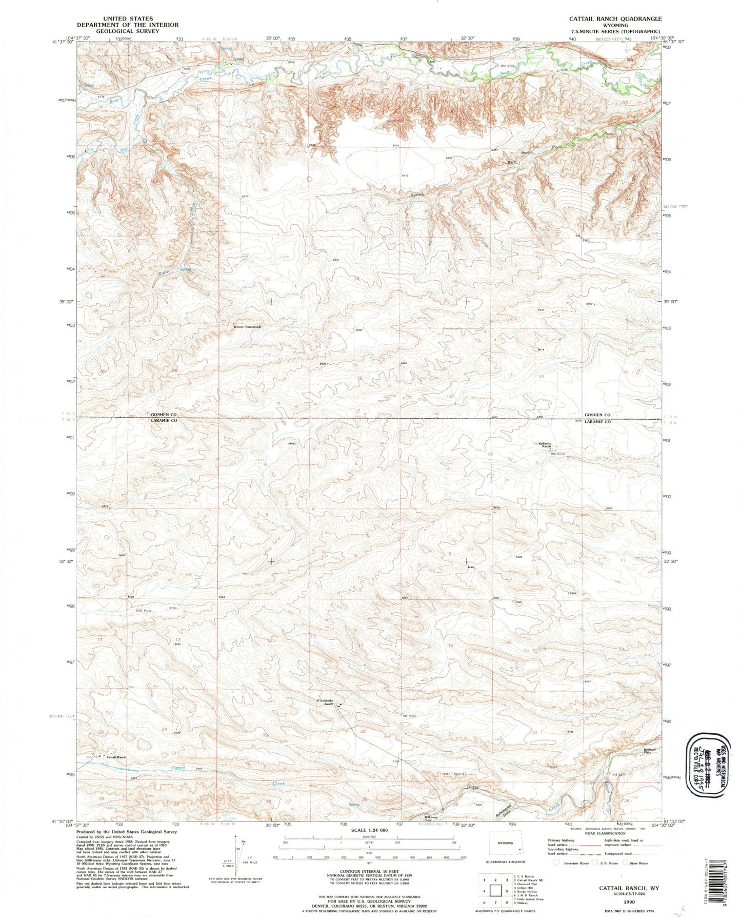
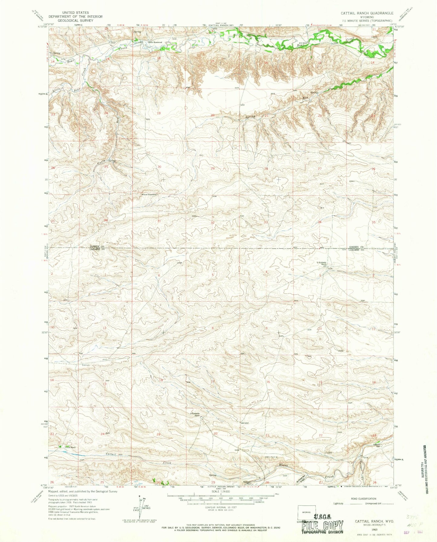
Historical USGS topographic quad map of Cattail Ranch in the state of Wyoming. Map scale may vary for some years, but is generally around 1:24,000. Print size is approximately 24" x 27"
This quadrangle is in the following counties: Goshen, Laramie.
The map contains contour lines, roads, rivers, towns, and lakes. Printed on high-quality waterproof paper with UV fade-resistant inks, and shipped rolled.
Contains the following named places: Bullwhacker Draw, Cattail Creek, Cattail Ranch, Curty Run, D Kirkbride Ranch, Durbin Ditch, Griffin Homestead, L Kirkbride Ranch, Little Bear Creek, Robinson Place, Sprager Creek, Weaver Homestead, Wilkinson Place