MyTopo
Classic USGS Cattaraugus New York 7.5'x7.5' Topo Map
Couldn't load pickup availability
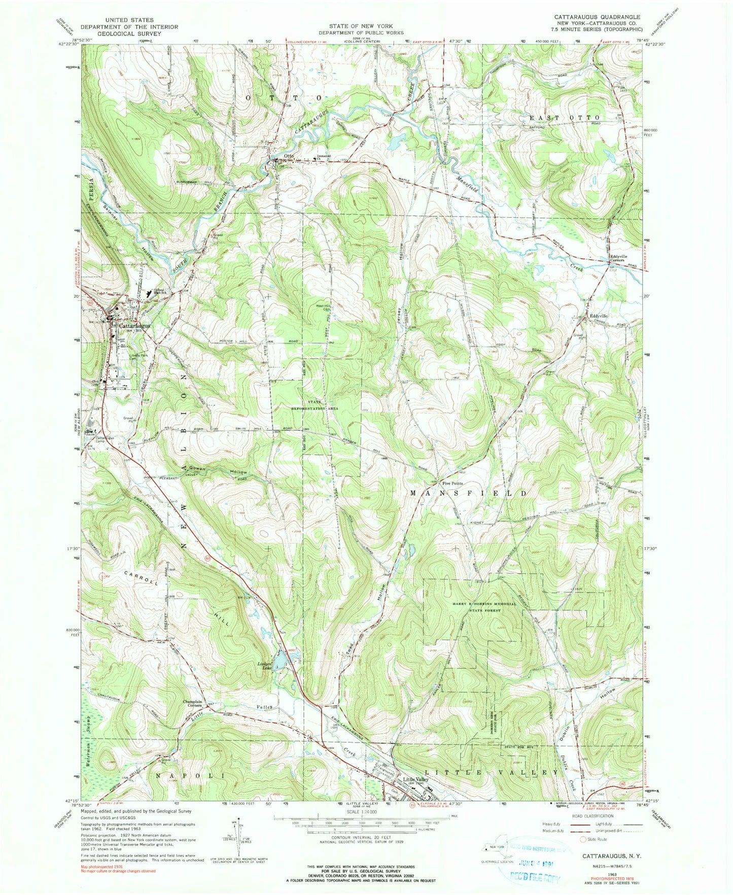
Historical USGS topographic quad map of Cattaraugus in the state of New York. Map scale may vary for some years, but is generally around 1:24,000. Print size is approximately 24" x 27"
This quadrangle is in the following counties: Cattaraugus.
The map contains contour lines, roads, rivers, towns, and lakes. Printed on high-quality waterproof paper with UV fade-resistant inks, and shipped rolled.
Contains the following named places: Berdick Field, California Mill School, Carroll Hill, Cattaraugus, Cattaraugus - Little Valley High School, Cattaraugus - Little Valley Middle School, Cattaraugus Area Ambulance Service, Cattaraugus Camp, Cattaraugus Campus Elementary School, Cattaraugus County Sheriff's Office, Cattaraugus Free Library, Cattaraugus Post Office, Cattaraugus Volunteer Fire Company, Champlain Corners, Community Church of Eddyville, Dublin School, East Hill Cemetery, Eddyville, Eddyville Cemetery, Eddyville Corners, Faith Baptist Church, Five Points, Five Points School, Gowan Hollow, Harry E Dobbins Memorial State Forest, Immanuel Lutheran Cemetery, Immanuel Lutheran Church of Otto, Jersey Hollow, Jersey School, Liberty Park Cemetery, Linlyco Lake, Little Valley, Little Valley Rural Cemetery, Little Valley United Methodist Church, Mansfield Creek, Milk School, Otto, Otto Post Office, Otto Volunteer Fire Department, Reed School, Roberts Memorial Free Methodist Church, Rumsey Cemetery, Saint John's United Church of Christ, Saint Mary's Church, Scott School, Sinn Valley Gardens, Sprague School, Toad Hollow, Toad Hollow School, Town of Mansfield, Ultralight Port, Village of Cattaraugus, Waite Hollow, Wesleyan Church, Wesleyan Church of Cattaraugus, West Hill Cemetery, Wilson Cemetery