MyTopo
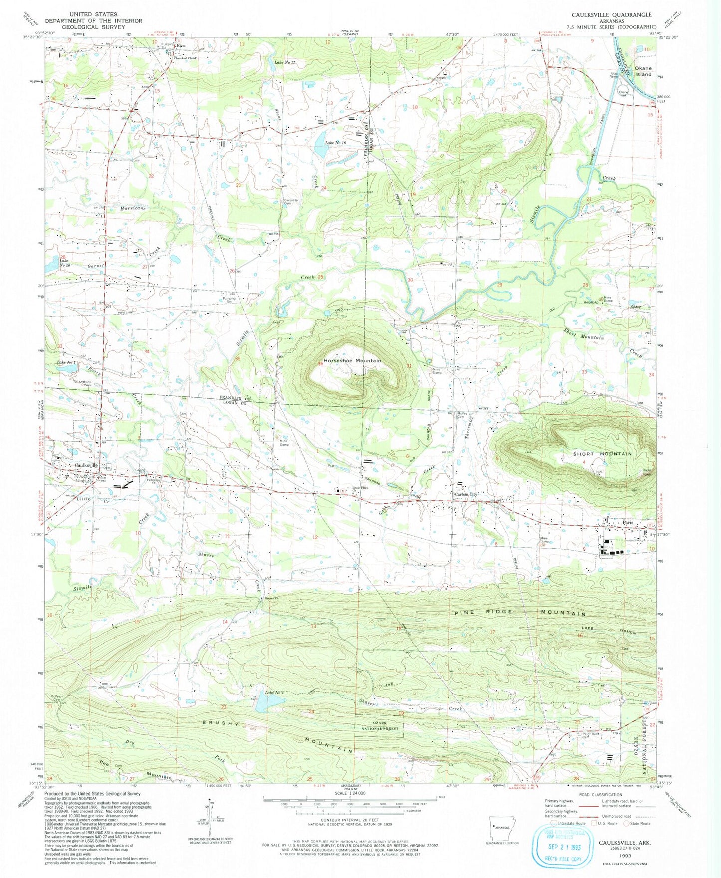
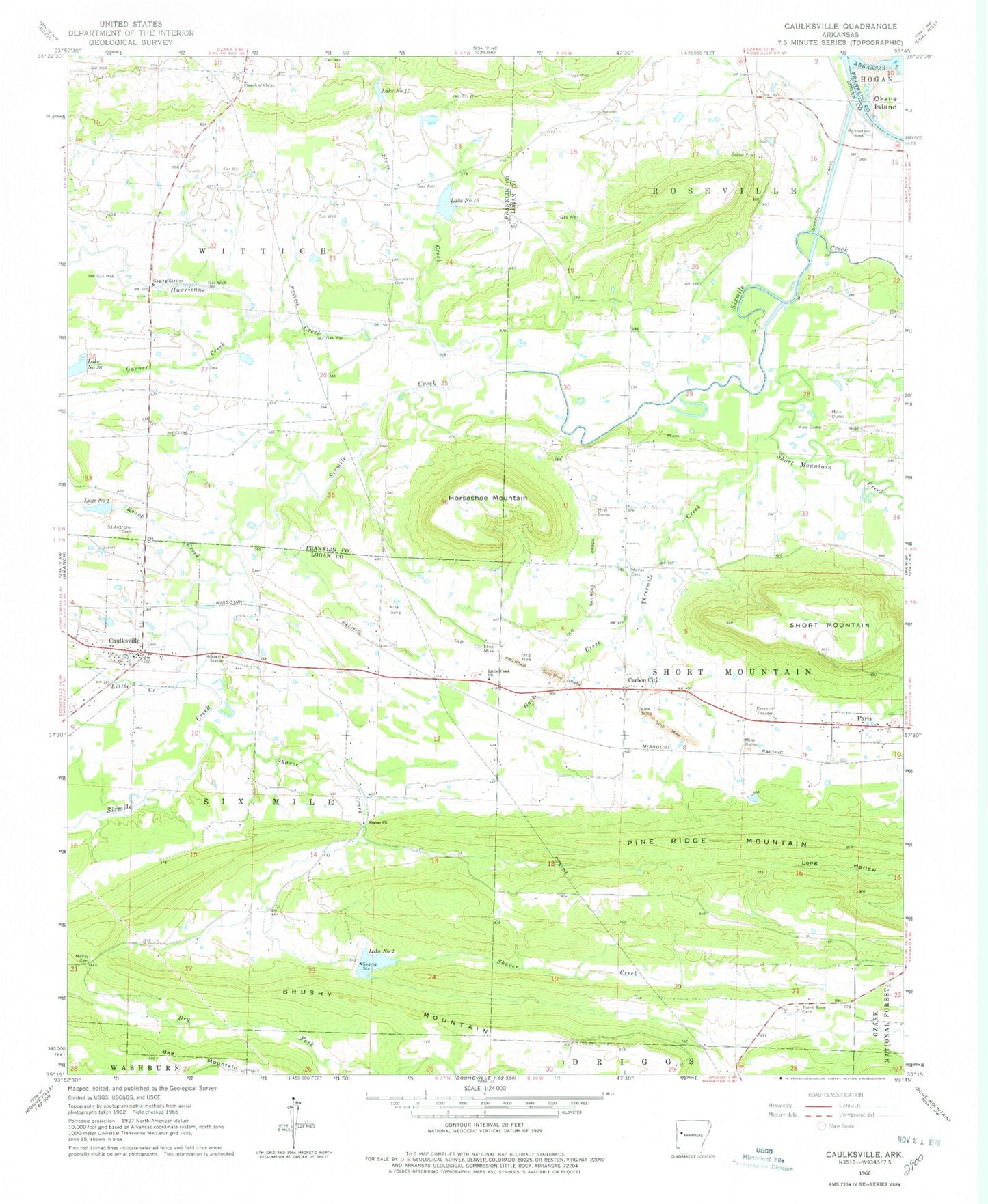
Classic USGS Caulksville Arkansas 7.5'x7.5' Topo Map
Couldn't load pickup availability
Historical USGS topographic quad map of Caulksville in the state of Arkansas. Map scale may vary for some years, but is generally around 1:24,000. Print size is approximately 24" x 27"
This quadrangle is in the following counties: Franklin, Logan.
The map contains contour lines, roads, rivers, towns, and lakes. Printed on high-quality waterproof paper with UV fade-resistant inks, and shipped rolled.
Contains the following named places: Agape Fellowship Church, Brushy Mountain, Carbon City, Carpenter Cemetery, Caulksville, Caulksville Volunteer Fire Department, Church of Christ, Etna, ETNA Airport, Gack Creek, Garner Creek, Horseshoe Mountain, Hurricane Creek, Infant Cemetery, KCCL-AM (Paris), KCCL-FM (Paris), Lake Number One, Lake Number Seventeen, Lake Number Sixteen, Lake Number Twentysix, Lake Number Two, Little Creek, Little Flock Church, McVay Cemetery, Oak Bend Etna Fire Department, O'Kane Park, Paint Rock Cemetery, Pine Ridge Mountain, Roark Creek, Saint Anthony Cemetery, Shaver Church, Shaver Creek, Short Mountain, Short Mountain Creek, Sixmile Creek Site 16 Dam, Sixmile Creek Site 17 Dam, Sixmile Creek Site 17 Reservoir, Sixmile Creek Site 26 Dam, Sixmile Creek Site One Dam, Sixmile Creek Watershed Site Two Dam, Sixmile Creek Watershed Site Two Reservoir, Stone Creek, Threemile Creek, Town of Caulksville, Township of Roseville, Township of Six Mile, Township of Wittich, ZIP Code: 72951