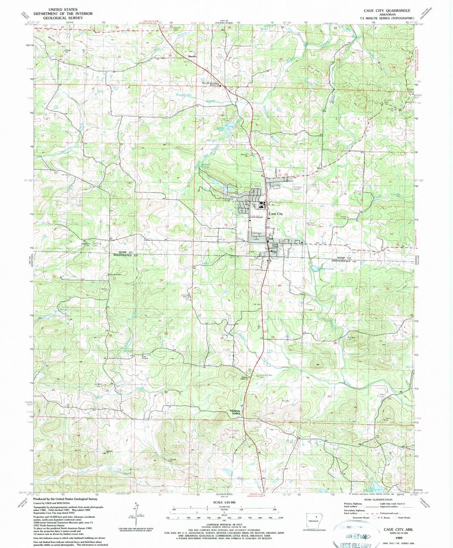
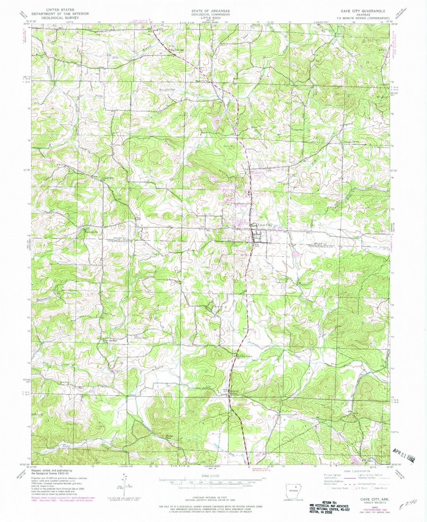
MyTopo
Classic USGS Cave City Arkansas 7.5'x7.5' Topo Map
Couldn't load pickup availability
Historical USGS topographic quad map of Cave City in the state of Arkansas. Map scale may vary for some years, but is generally around 1:24,000. Print size is approximately 24" x 27"
This quadrangle is in the following counties: Independence, Sharp.
The map contains contour lines, roads, rivers, towns, and lakes. Printed on high-quality waterproof paper with UV fade-resistant inks, and shipped rolled.
Contains the following named places: A G Gray Mine, Ball Cemetery, Ball Mine, Barnett Cemetery, Barnett Creek, Basket Creek, Bray Hill, Cave City, Cave City Cemetery, Cave City Elementary School, Cave City Fire Department, Cave City High School, Cave City Police Department, Cave City Post Office, Church of God, City of Cave City, Cochran Prospect, Cotton Hill Church, Doctor Toms Park, Dokken Hollow, E W Roach Prospect, Eliza Patterson Prospect, Goat Den, Gray Chapel, Gray Hill, Green Acres Estate Lake One Dam, Hawkins Hill, Hawkins Mine, Hickory Valley, Hickory Valley Cemetery, Hickory Valley Church, Hills Hill, Hodge School, Hunt Hollow, Jackson Creek, Jackson Prospect, Jackson Springs, Jeff Weaver Prospect, Jesse Pines, Johnson Branch, K D Aldridge Prospect, KZIG-FM (Cave City), Lake Cave City, Lake Cave City Dam, Lake Kimberly, Lick Fork, Lower Lake - Green Acres Estates, M D Aldridge Prospect, Matlock Mine, Maxville, Maxville Cemetery, Maxville Missionary Baptist Church, Maxville School, McGee Mine, McLeod Prospect, Milligan Prospect, Milligan-Perrin Prospect, Mount Tabor Cemetery, Palestine Cemetery, Palestine Church, Pine Springs School, Prosperity Church, Smith Hill, Smith Prospect, Spring River Paramedic Ambulance Service, Stanfield Branch, Story Mine, Three Dam, Township of Barren, Township of Cave, Township of East Sullivan, Upper Lake - Green Acres Estates, W T Gray Mine, White Hill, Willmuth Hill, Woodyard Prospect, Wooldridge Creek, ZIP Code: 72521