MyTopo
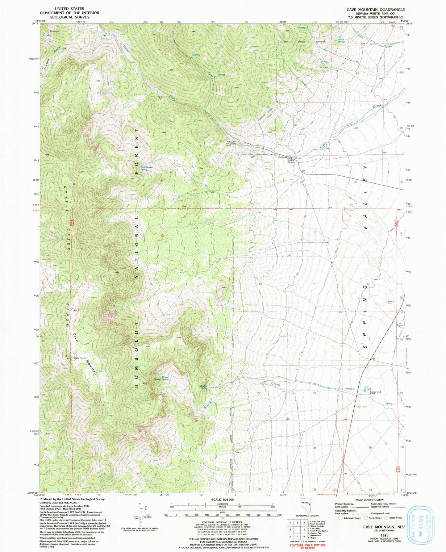
Classic USGS Cave Mountain Nevada 7.5'x7.5' Topo Map
Regular price
$16.95
Regular price
Sale price
$16.95
Unit price
per
Couldn't load pickup availability
Historical USGS topographic quad map of Cave Mountain in the state of Nevada. Map scale may vary for some years, but is generally around 1:24,000. Print size is approximately 24" x 27"
This quadrangle is in the following counties: White Pine.
The map contains contour lines, roads, rivers, towns, and lakes. Printed on high-quality waterproof paper with UV fade-resistant inks, and shipped rolled.
Contains the following named places: Bastian Creek, Bastian Creek Ranch, Bastian Spring, Cave Mountain, Cleve Creek Administrative Site, Cleve Creek Campground, Cleve Creek Mining District, Cottonwood Spring, Indian Springs, Kolcheck Basin, Kolcheck Springs, North Fork Cleve Creek, Upper Bastian Spring