MyTopo
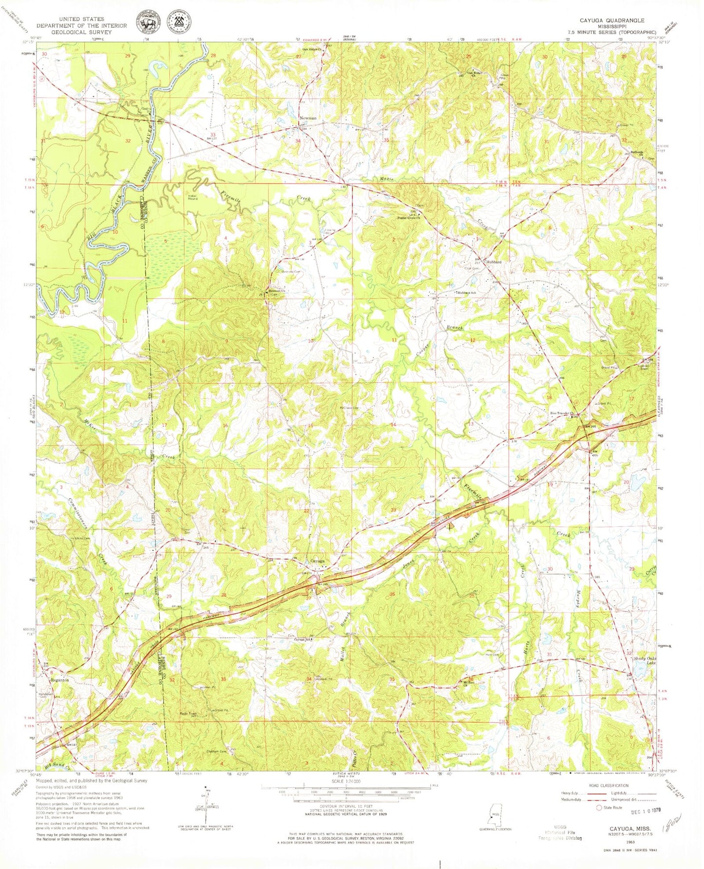
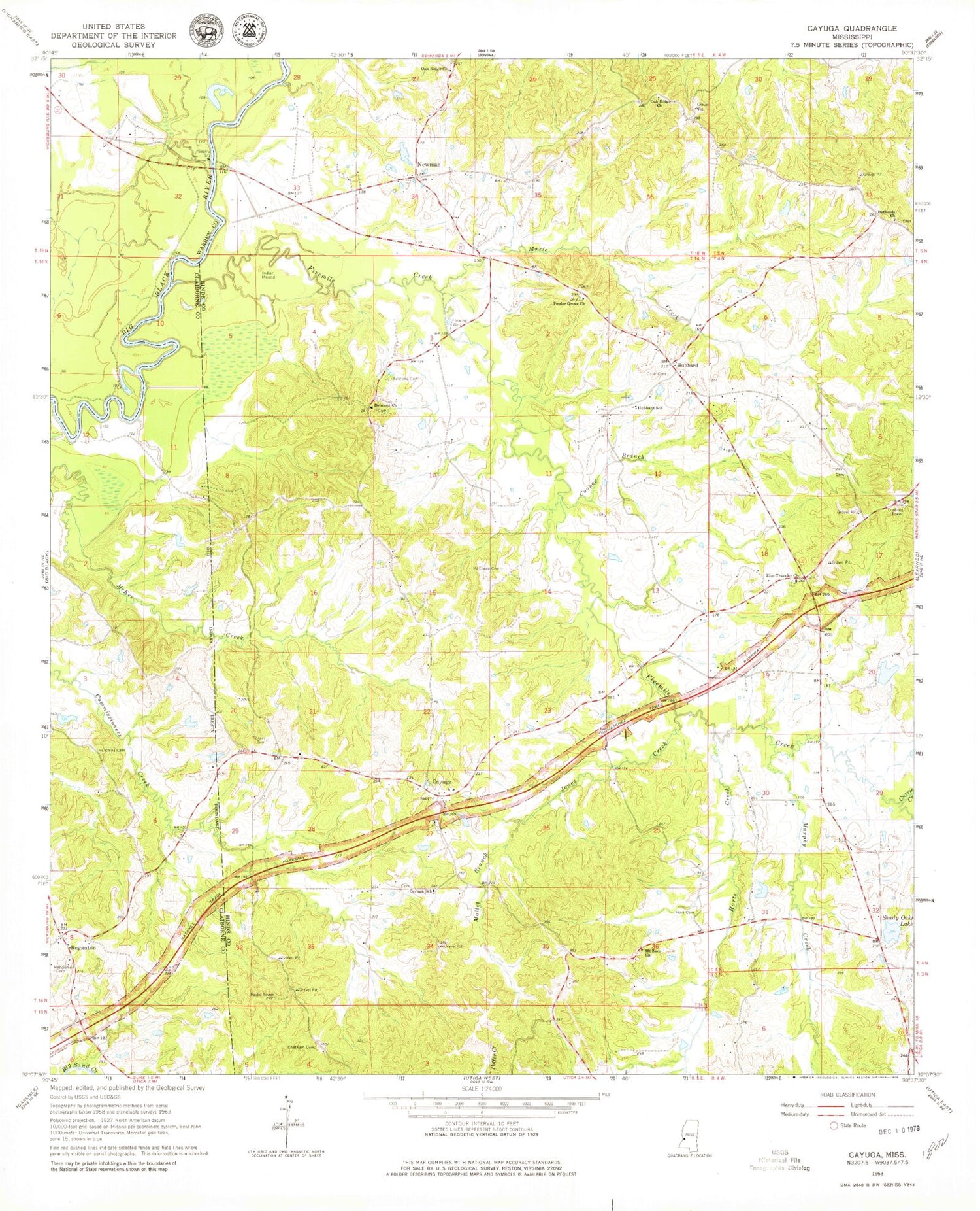
Classic USGS Cayuga Mississippi 7.5'x7.5' Topo Map
Couldn't load pickup availability
Historical USGS topographic quad map of Cayuga in the state of Mississippi. Typical map scale is 1:24,000, but may vary for certain years, if available. Print size: 24" x 27"
This quadrangle is in the following counties: Claiborne, Hinds, Warren.
The map contains contour lines, roads, rivers, towns, and lakes. Printed on high-quality waterproof paper with UV fade-resistant inks, and shipped rolled.
Contains the following named places: Belmont Cemetery, Belmont Church, Bethesda Church, Cayuga, Cayuga School, Chatham Cemetery, Cook Cemetery, Cooper Branch, Currie Creek, Fivemile Creek, Hart Cemetery, Harts Creek, Henderson Cemetery, Hubbard, Hubbard School, Hutchins Cemetery, Jones Creek, Mallet Branch, Maxie Creek, McElwee Cemetery, Mount Zion Church, Murphy Creek, Oak Ridge Church, Oak Ridge Church, Poplar Grove Church, Reganton, Shady Oaks Lake, Turner Cemetery, Zion Traveler Church, Barlows Pond Dam, Shady Oaks Lake Dam, Hubbard Pond Dam, Barnes Lake Dam, Mims Lake Dam, Hutchins Store (historical), Baldwin (historical), Beech Grove Church (historical), Childs Chapel (historical), Five Mile Lake, Goodrum School (historical), Mount Zion School (historical), Neil Branch, Oak Ridge School (historical), Old Oak Ridge School (historical), Rohelia Church, Skates (historical), Yates School (historical), Newman, Baldwins Ferry (historical), Oak Ridge Plantation (historical), Bench Volunteer Fire Department