MyTopo
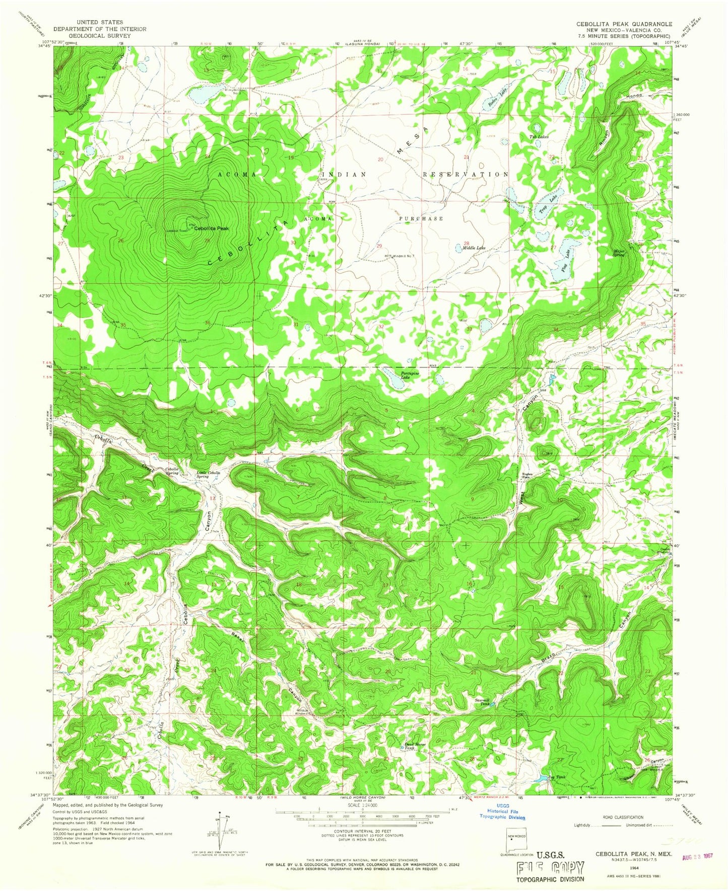
Classic USGS Cebollita Peak New Mexico 7.5'x7.5' Topo Map
Couldn't load pickup availability
Historical USGS topographic quad map of Cebollita Peak in the state of New Mexico. Map scale may vary for some years, but is generally around 1:24,000. Print size is approximately 24" x 27"
This quadrangle is in the following counties: Cibola.
The map contains contour lines, roads, rivers, towns, and lakes. Printed on high-quality waterproof paper with UV fade-resistant inks, and shipped rolled.
Contains the following named places: Baker Canyon, Cebolla Spring, Cebollita Mesa, Cebollita Peak, Dead Horse Tank, Flag Lake, Gibson Windmill, Gibson WML Water Well, Hughes Pl Water Well, Hughes Place, Jug Tank, Little Cebolla Spring, Major Spring, Middle Lake, Owsley Water Well, Owsley Windmill, Porcupine Lake, Rodeo Lake, Sawmill Tank, Trap Lake, Tub Lakes, Wildcat Windmill, Windmill Number 3, Windmill Number 7