MyTopo
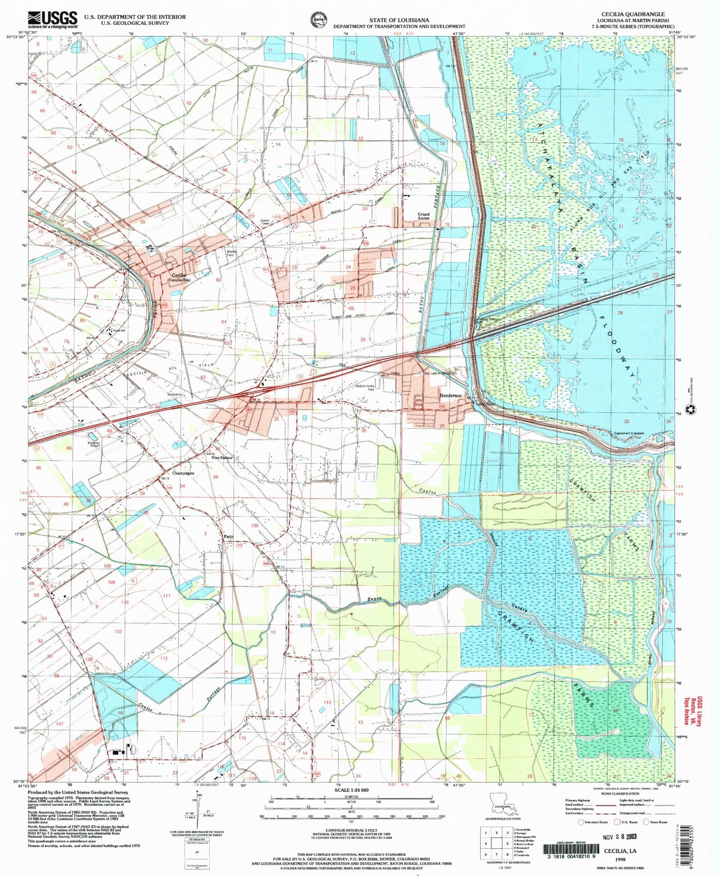
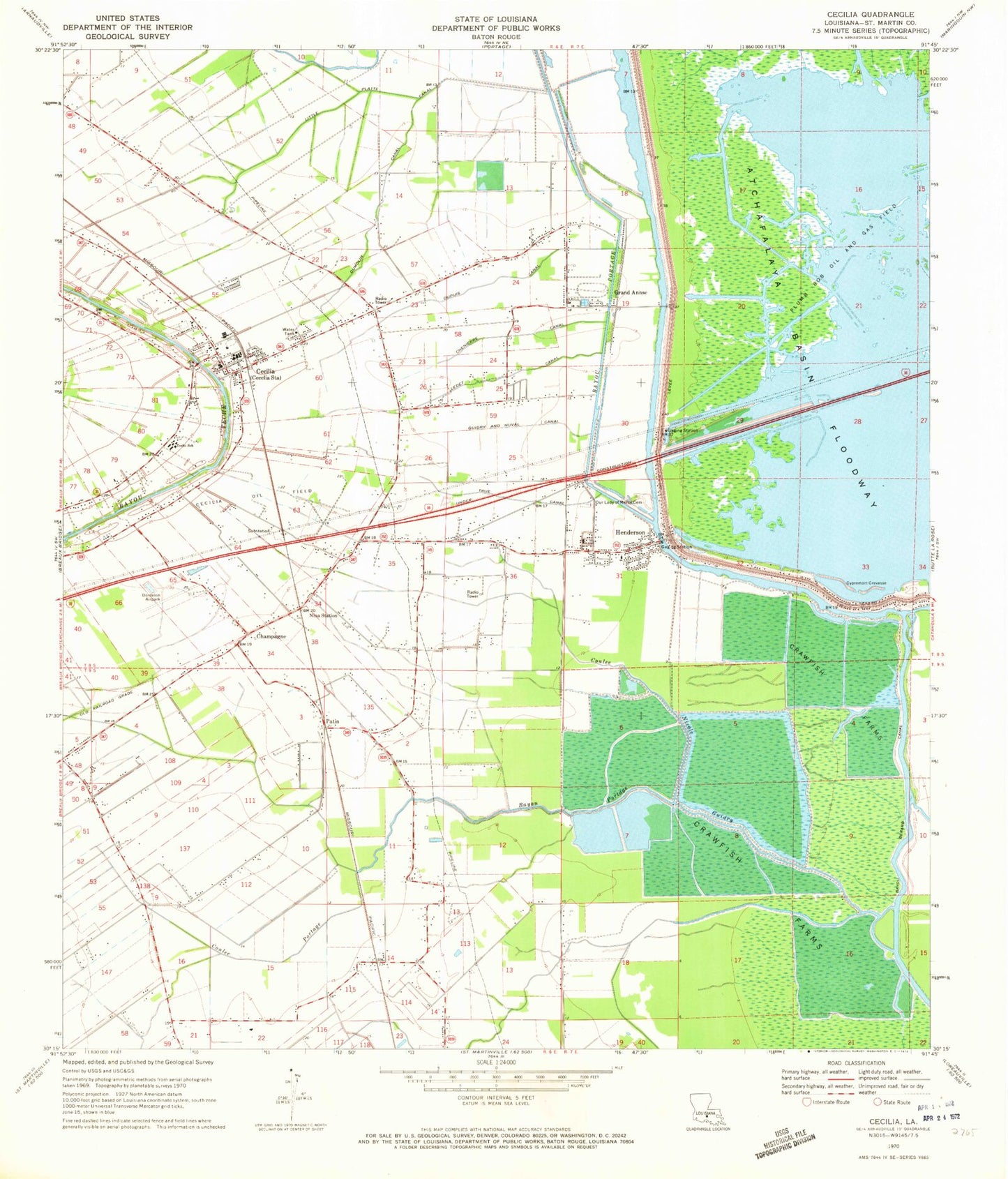
Classic USGS Cecilia Louisiana 7.5'x7.5' Topo Map
Couldn't load pickup availability
Historical USGS topographic quad map of Cecilia in the state of Louisiana. Map scale may vary for some years, but is generally around 1:24,000. Print size is approximately 24" x 27"
This quadrangle is in the following counties: St. Martin.
The map contains contour lines, roads, rivers, towns, and lakes. Printed on high-quality waterproof paper with UV fade-resistant inks, and shipped rolled.
Contains the following named places: Bayou Fusilier of the Swamps, Bayou Portage, Bordelon Airpark, Breaux Bridge High School, Cecilia, Cecilia Bridge, Cecilia Census Designated Place, Cecilia High School, Cecilia Junior High School, Cecilia Oil Field, Cecilia Post Office, Cecilia Primary School, Cecilia Volunteer Fire Department, Champagne, Chenierre Canal, Coulee Nicole Guidry, Coulee Portage, Cypremort Crevasse, Dumolin Canal, Dupuis Canal, Grand Annse, Guidry and Huval Canal, Henderson, Henderson Bible Church, Henderson Contract Postal Unit, Henderson Police Department, Henderson Volunteer Fire Department, Henderson Volunteer Fire Department Nina Substation, Henderson Wastewater Treatment Plant, Hope, Huron, Lake Bigeux, Ledet Canal, Little Platte Canal, Nina Station, Our Lady of Mercy Cemetery Saint Michael the Archangel Cemetery, Our Lady of Mercy Church, Patin, Plumb Bob Oil and Gas Field, Saint Joseph Church, Saint Martin Parish Library Cecilia Branch, Saint Martin Parish Police Jury, Saint Rose of Lima Church, Teche Elementary School, Town of Henderson, True Canal, Union Bayou School, Ward Five, ZIP Code: 70517