MyTopo
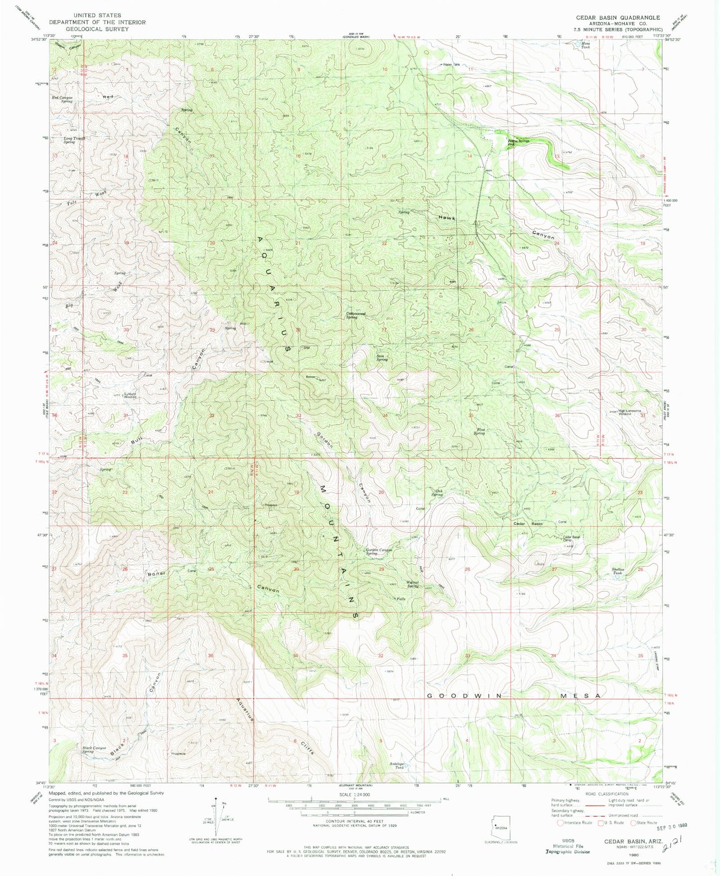
Classic USGS Cedar Basin Arizona 7.5'x7.5' Topo Map
Couldn't load pickup availability
Historical USGS topographic quad map of Cedar Basin in the state of Arizona. Map scale may vary for some years, but is generally around 1:24,000. Print size is approximately 24" x 27"
This quadrangle is in the following counties: Mohave.
The map contains contour lines, roads, rivers, towns, and lakes. Printed on high-quality waterproof paper with UV fade-resistant inks, and shipped rolled.
Contains the following named places: Antelope Tank, Aquarius Cliffs, Black Canyon, Black Canyon Spring, Blue Spring, Cedar Basin, Cedar Basin Camp, Cottonwood Spring, Gordon Canyon, Gordon Canyon Spring, High-Lonesome Windmill, Long Trough Spring, Mesa Tank, Oak Spring, Red Canyon Spring, Sam Spring, Shelton Tank, Sunburn Windmill, Walnut Spring, Williams Spring, Willow Springs Well