MyTopo
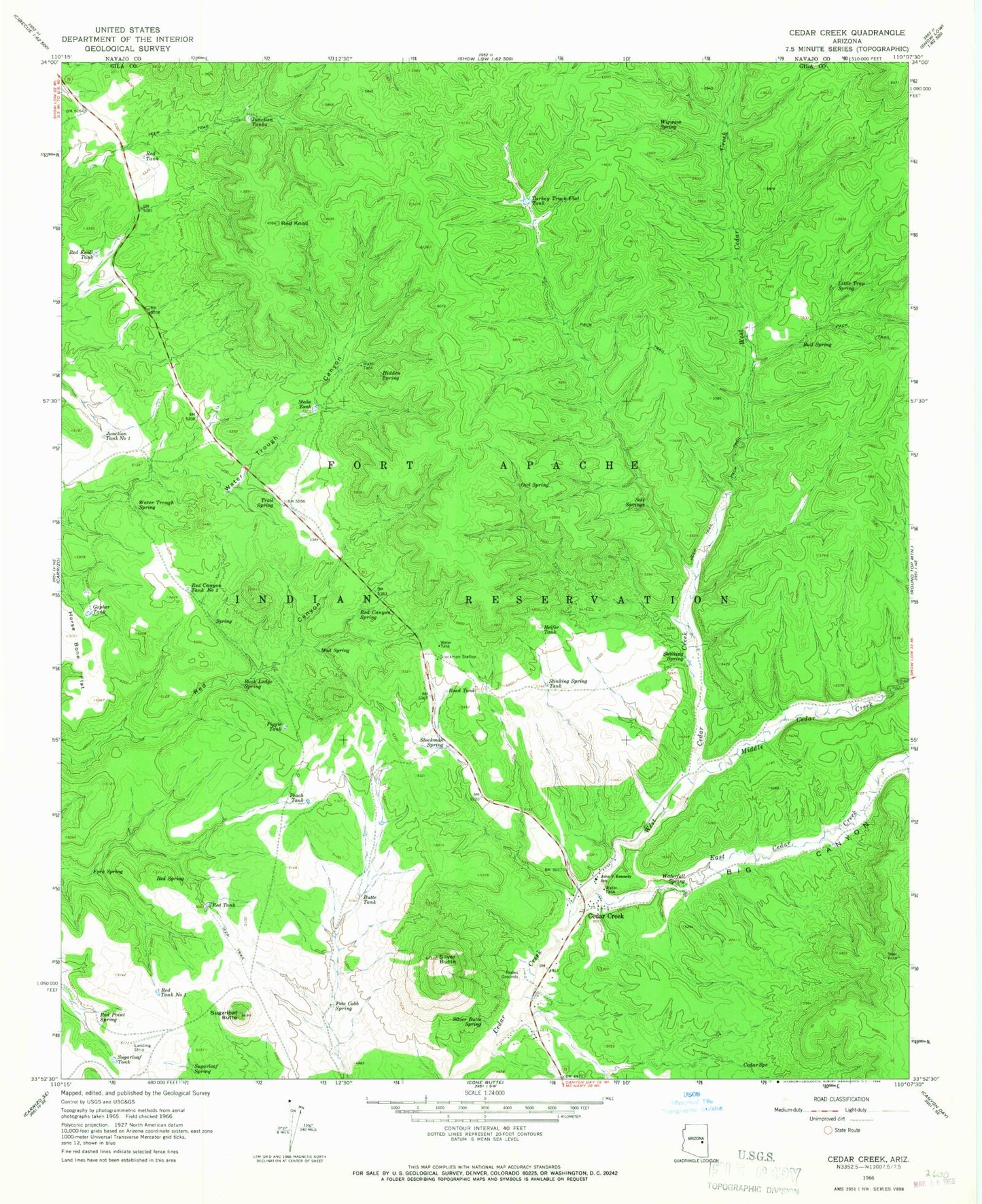
Classic USGS Cedar Creek Arizona 7.5'x7.5' Topo Map
Couldn't load pickup availability
Historical USGS topographic quad map of Cedar Creek in the state of Arizona. Map scale may vary for some years, but is generally around 1:24,000. Print size is approximately 24" x 27"
This quadrangle is in the following counties: Gila.
The map contains contour lines, roads, rivers, towns, and lakes. Printed on high-quality waterproof paper with UV fade-resistant inks, and shipped rolled.
Contains the following named places: Big Canyon, Bull Spring, Butte Tank, Cedar Creek, Cedar Creek Census Designated Place, Cedar Creek Rodeo Grounds, Cedar Spring, Corner Tank, East Cedar Creek, Fork Spring, Fort Apache Reservation, Gopher Tank, Heifer Tank, Hidden Spring, Horse Bone Flat, John F Kennedy Day School, Junction Tank Number One, Junction Tanks, Little Trap Spring, Lower Junction Tank Dam, Middle Cedar Creek, Mud Spring, Owl Spring, Pasture Tank, Pasture Tank Number One, Peach Tank, Pete Cobb Spring, Piggie Tank, Red Canyon Spring, Red Canyon Tank Number Two, Red Knoll, Red Knoll Tank, Red Point Spring, Red Spring, Red Tank, Red Tank Number One, Road Tank, Rock Ledge Spring, Salt Springs, Silver Butte, Silver Butte Spring, South Goodwin Tank, Stake Tank, Stinking Spring, Stinking Spring Tank, Stockman Spring, Stockman Station, Sugarloaf Butte, Sugarloaf Tank, Trail Spring, Turkey Track Flat Tank, Turkey Track Flat Tank Dam, Two Bit Tank, Water Trough Spring, Waterfall Spring, West Cedar Creek, Wigwam Spring