MyTopo
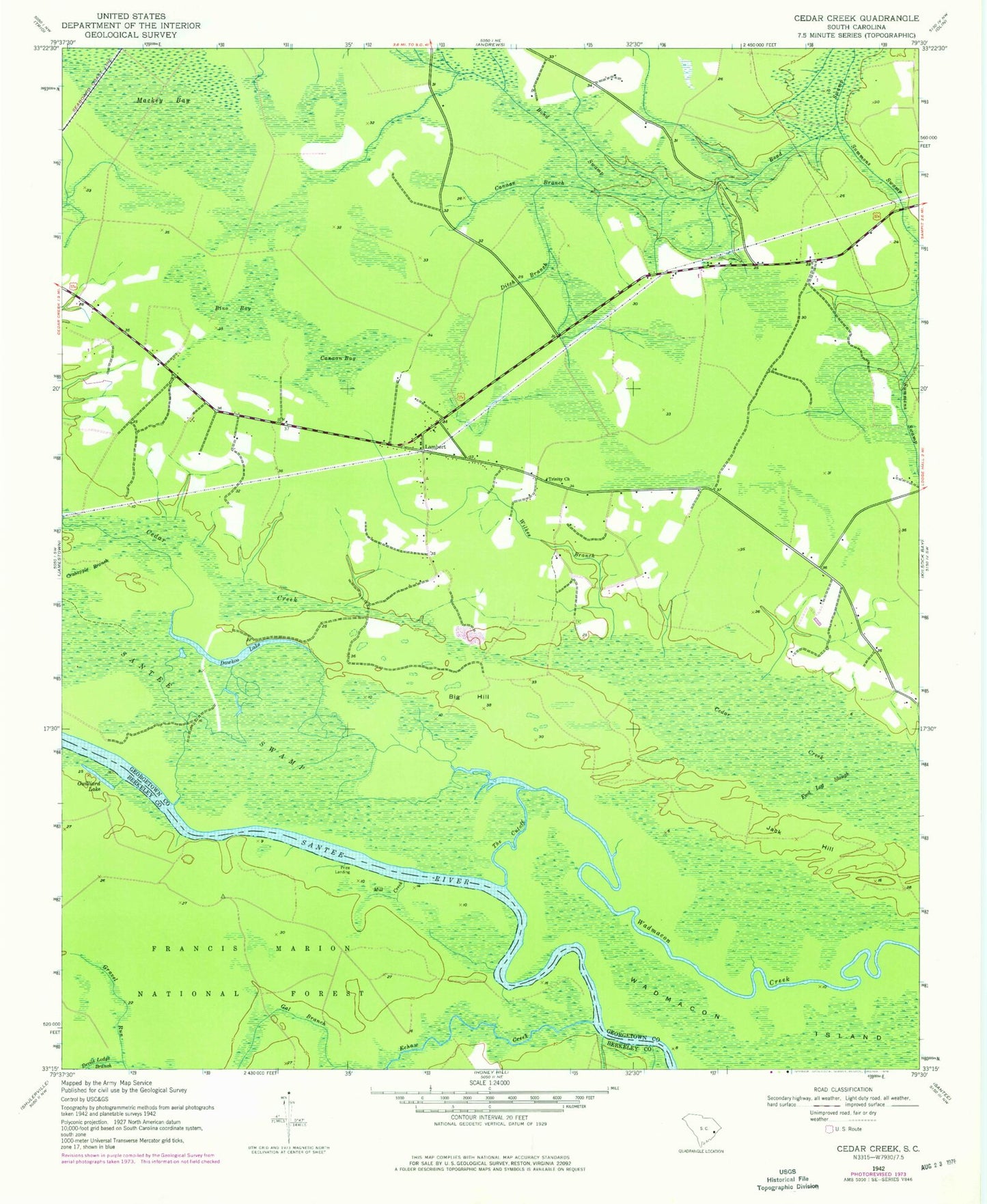
Classic USGS Cedar Creek South Carolina 7.5'x7.5' Topo Map
Couldn't load pickup availability
Historical USGS topographic quad map of Cedar Creek in the state of South Carolina. Map scale may vary for some years, but is generally around 1:24,000. Print size is approximately 24" x 27"
This quadrangle is in the following counties: Berkeley, Georgetown.
The map contains contour lines, roads, rivers, towns, and lakes. Printed on high-quality waterproof paper with UV fade-resistant inks, and shipped rolled.
Contains the following named places: Big Hill, Bino Bay, Canaan Bay, Canaan Branch, Cedar Creek School, Crabapple Branch, Dawhoo Lake, Ditch Branch, Doe Landing, Echaw Creek, Foot Log Slough, Fosters Landing, Gal Branch, Georgetown Fire Department Station 7, Guilliard Lake, Guilliard Lake Recreation Site, Jack Hill, Lambert, Mackey Bay, Mill Creek, Price Landing, Prices Landing, Put-on Branch, Saint Paul School, Saints Delight Church, Santee Swamp, Summons Swamp, The Cutoff, Trinity Lutheran Church, Wadmacon Island, Wilkes Branch