MyTopo
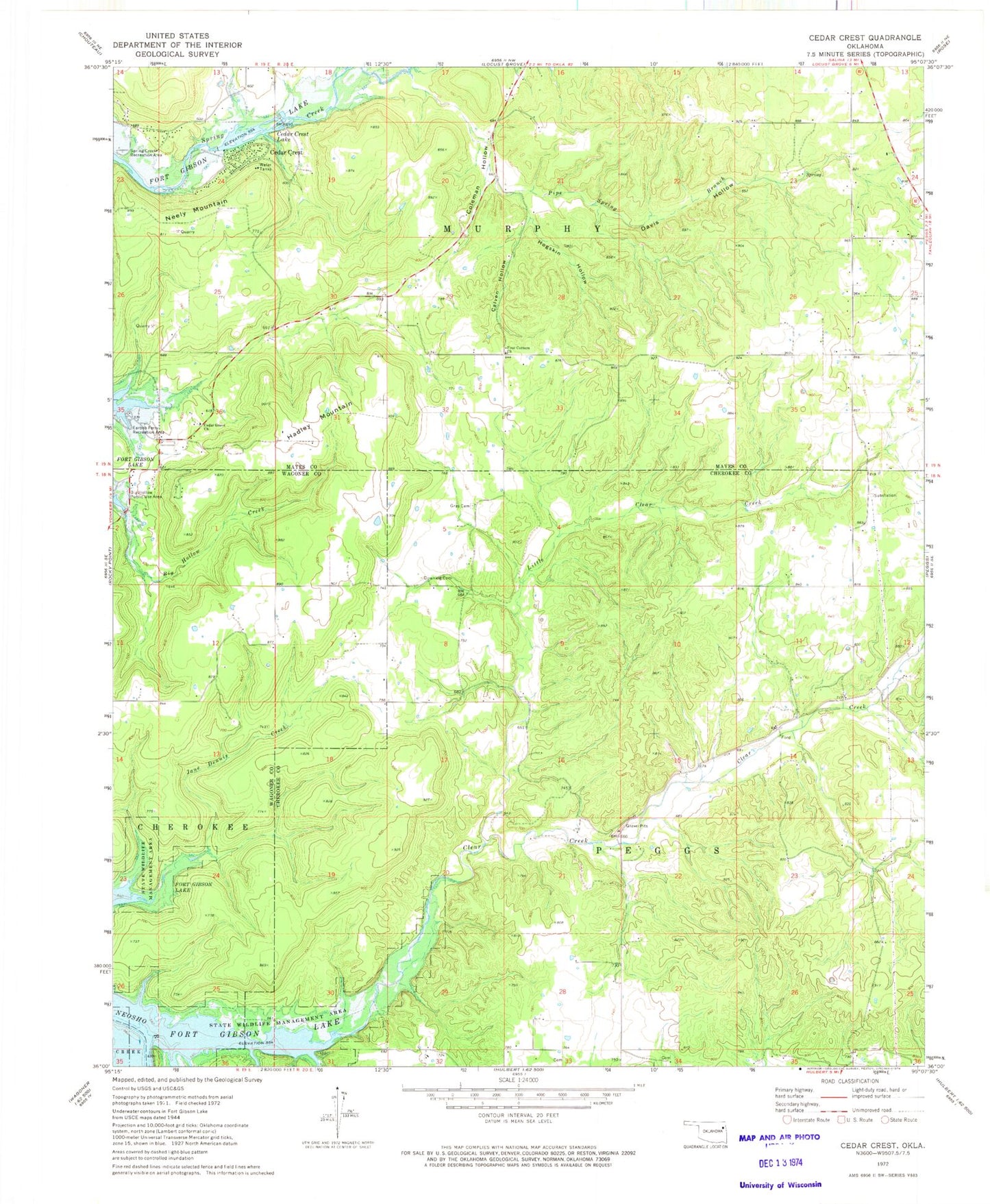
Classic USGS Cedar Crest Oklahoma 7.5'x7.5' Topo Map
Couldn't load pickup availability
Historical USGS topographic quad map of Cedar Crest in the state of Oklahoma. Typical map scale is 1:24,000, but may vary for certain years, if available. Print size: 24" x 27"
This quadrangle is in the following counties: Cherokee, Mayes, Wagoner.
The map contains contour lines, roads, rivers, towns, and lakes. Printed on high-quality waterproof paper with UV fade-resistant inks, and shipped rolled.
Contains the following named places: Spring Creek Recreation Area, Big Hollow Public Use Area, Calven Hollow, Cedar Crest, Cedar Crest Lake, Cedar Grove Church, Clear Creek, Coleman Hollow, Davis Hollow, Downing Cemetery, Earbob Ferry Recreation Area, Four Corners Church, Gray Cemetery, Hadley Mountain, Hare Branch, Hogskin Hollow, Little Clear Creek, Neely Mountain, Pipe Spring Branch, Wooded Hollow, Vo-Tech Heliport, Cedar Crest Heliport, Township of Murphy, Cedar Crest Census Designated Place, Cedar Crest