MyTopo
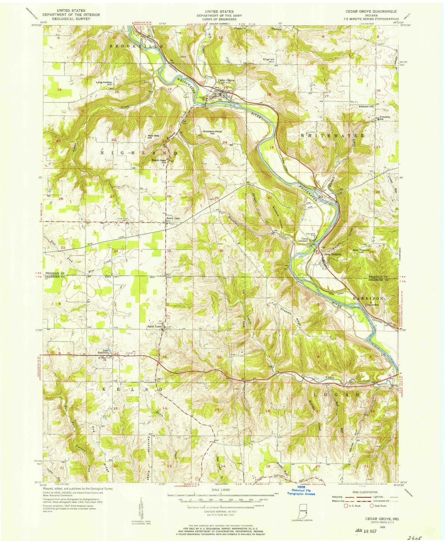
Classic USGS Cedar Grove Indiana 7.5'x7.5' Topo Map
Couldn't load pickup availability
Historical USGS topographic quad map of Cedar Grove in the state of Indiana. Map scale may vary for some years, but is generally around 1:24,000. Print size is approximately 24" x 27"
This quadrangle is in the following counties: Dearborn, Franklin.
The map contains contour lines, roads, rivers, towns, and lakes. Printed on high-quality waterproof paper with UV fade-resistant inks, and shipped rolled.
Contains the following named places: Ashby, Big Cedar Creek, Blackburn Creek, Bull Run, Buzzard Hollow, Camp Lenmary, Camp Olden, Cedar Grove, Cedar Grove Post Office, Cedar Grove Volunteer Fire Department, Chappelow Ridge, Dog Ridge, East Central High School, Elkhorn Creek, Elkhorn Hill, English Hill, Ennis Ridge, Faith Church, Franklin County Emergency Medical Services Station 4, Gaynor Ridge, Gobblers Knob Hill, Gobbles Creek, Holy Guardian Angels Cemetery, J Maxwell Pond, J Maxwell Pond Dam, Lake Roseanna, Logan Creek Church, Long Hollow Hill, McCann Creek, Minneman School, Mount Carmel School, New Trenton, New Trenton Census Designated Place, New Trenton Hill, New Trenton Volunteer Fire Department, Ramsey Creek, Richland Creek, Saint Johns Cemetery, Saint Joseph Cemetery, Saint Leon, Saint Leon Volunteer Fire Department, Shingle Creek, Smyrna Church, South Gate, South Gate Hill, Town of Cedar Grove, Town of Saint Leon, Township of Kelso, Township of Logan, Wee Wee Hill, Whistle Creek, Whites Hill, Whitewater School, ZIP Codes: 47016, 47035, 47060