MyTopo
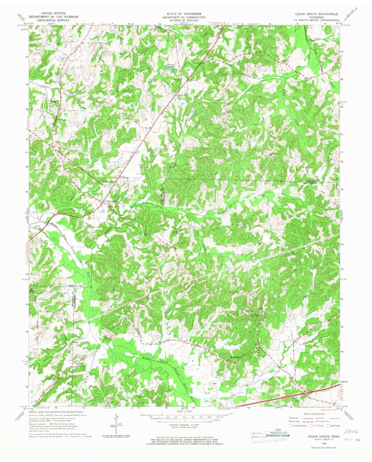
Classic USGS Cedar Grove Tennessee 7.5'x7.5' Topo Map
Couldn't load pickup availability
Historical USGS topographic quad map of Cedar Grove in the state of Tennessee. Map scale may vary for some years, but is generally around 1:24,000. Print size is approximately 24" x 27"
This quadrangle is in the following counties: Carroll, Henderson, Madison.
The map contains contour lines, roads, rivers, towns, and lakes. Printed on high-quality waterproof paper with UV fade-resistant inks, and shipped rolled.
Contains the following named places: Cane Creek, Carroll County Rural Fire Department District 5 Cedar Grove, Cedar Grove, Cedar Grove Church, Cedar Grove Division, Cedar Grove Post Office, Cedar Grove School, Christ Temple, Clark School, District 6, Duncans Store, Eubank Branch, Furgerson Cemetery, Griffin Creek, Gurley Creek, Hickory Flat, Hickory Flat Church, Hoopers Lake, Indian Creek, Indian Creek Lake Number 87-1, Indian Creek Number 87-1 Dam, Law, Lebanon Church, McHaney, McHayneys Mill, McHayneys Mill Creek, Morning Sun Cemetery, Morning Sun Church, Moss Creek, Moss Creek Lake, Moss Creek OFDBA 87-4 Dam, Moss Rest, Mount Gilead, Mount Gilead Baptist Church, Mount Gilead Lookout Tower, Munt Gilead School, New Bethel Baptist Church, Oak Grove Cemetery, OFDBA 87-3 Dam, OFDBA 87-3 Lake, Pleasant Hill Cemetery, Pleasant Hill Church, Providence Cemetery, Sharon, Sharon Church, Smith, Spain, Spain Cemetery, Stanford Farms, Susan Branch, Susan Branch 87-7 Dam, Susan Branch Lake, Utley, Wood Hill Cemetery, Woodard Cemetery, Woodhill, ZIP Code: 38321