MyTopo
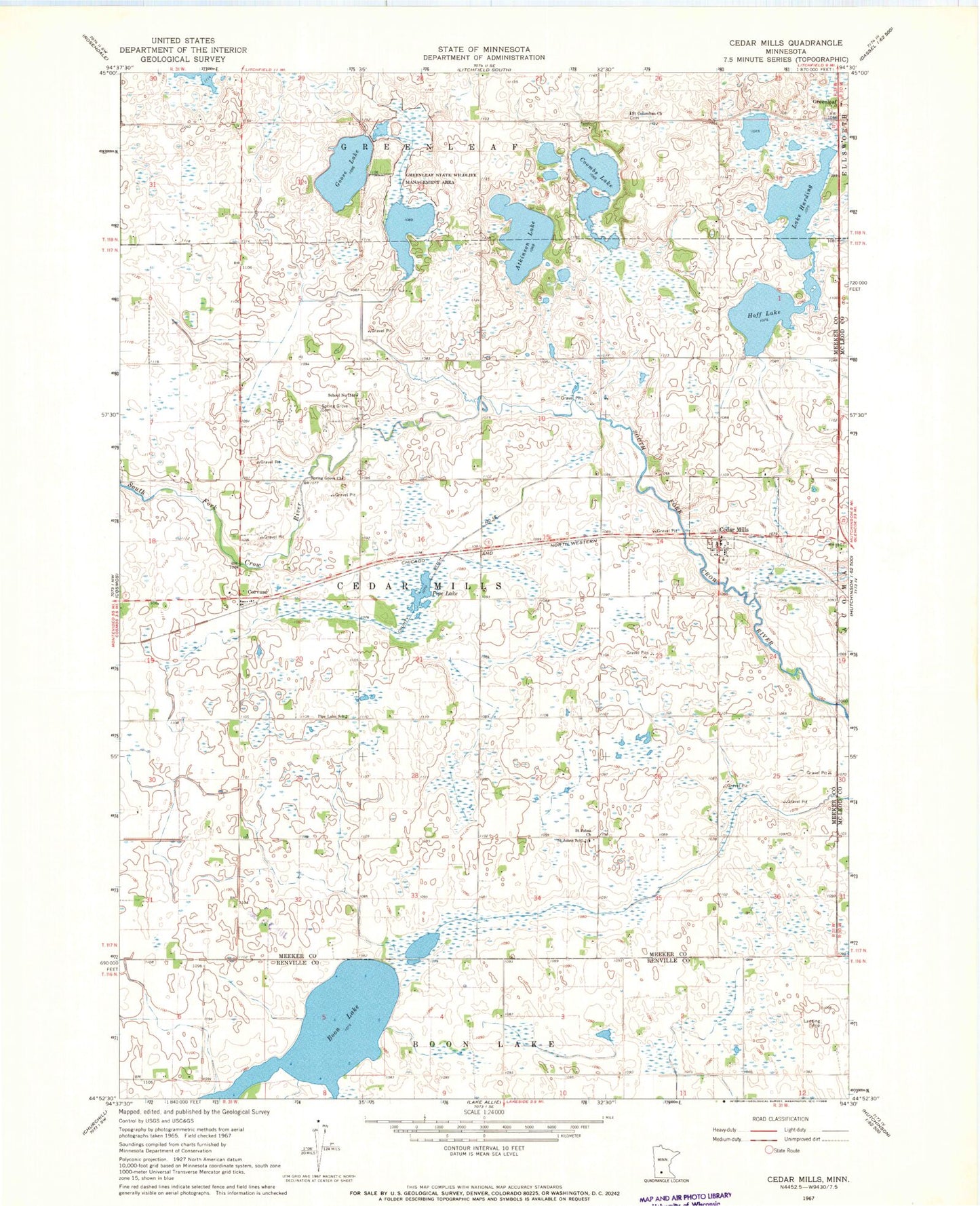
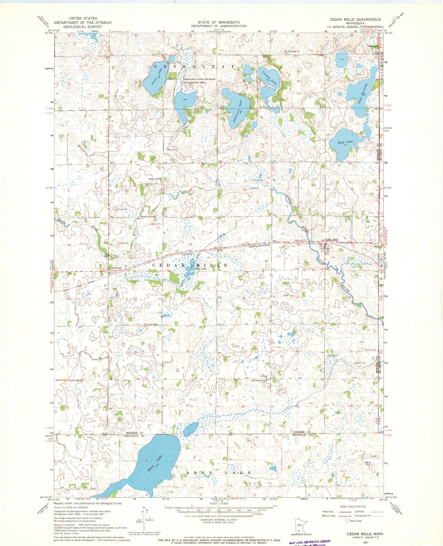
Classic USGS Cedar Mills Minnesota 7.5'x7.5' Topo Map
Couldn't load pickup availability
Historical USGS topographic quad map of Cedar Mills in the state of Minnesota. Map scale may vary for some years, but is generally around 1:24,000. Print size is approximately 24" x 27"
This quadrangle is in the following counties: McLeod, Meeker, Renville.
The map contains contour lines, roads, rivers, towns, and lakes. Printed on high-quality waterproof paper with UV fade-resistant inks, and shipped rolled.
Contains the following named places: Atkinson Lake, Boon Lake, Cedar Mills, Cedar Mills Post Office, City of Cedar Mills, Coombs Lake, Corvuso, Corvuso Post Office, County Ditch Number Eighteen, Goose Lake, Greenleaf State Wildlife Management Area, Hoff Lake, Kaping Farms, Lake Harding, Peterson Farms, Pipe Lake, Pipe Lake School, Runke's Field, Saint Columban Cemetery, Saint Columban Church, Saint John's Cemetery, Saint Johns Church, Saint Johns School, School Number 1118, Spring Grove Cemetery, Spring Grove Church, Township of Cedar Mills