MyTopo
Classic USGS Cedarville Michigan 7.5'x7.5' Topo Map
Couldn't load pickup availability
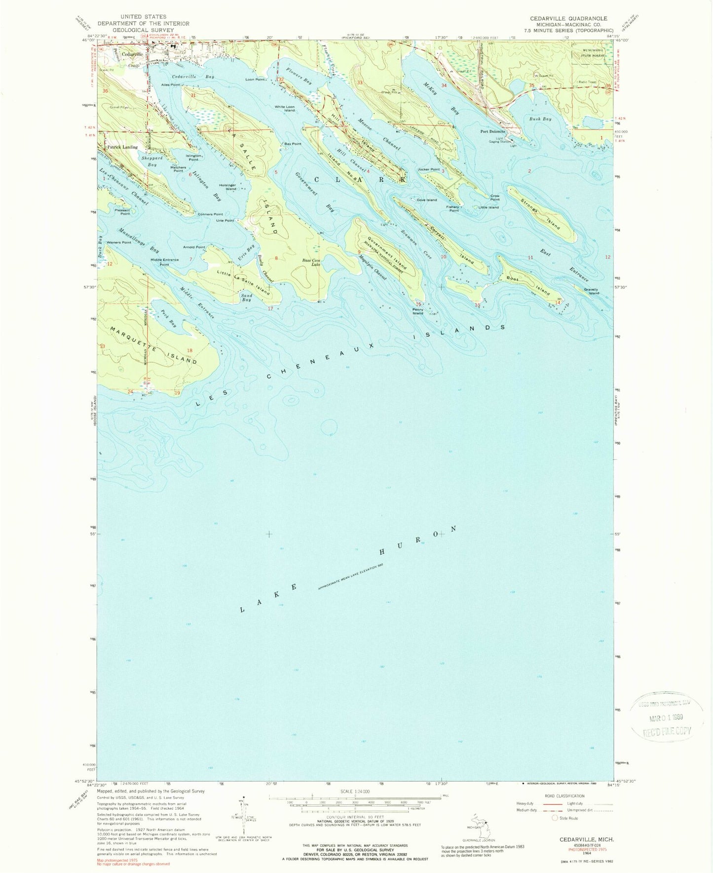
Historical USGS topographic quad map of Cedarville in the state of Michigan. Map scale may vary for some years, but is generally around 1:24,000. Print size is approximately 24" x 27"
This quadrangle is in the following counties: Mackinac.
The map contains contour lines, roads, rivers, towns, and lakes. Printed on high-quality waterproof paper with UV fade-resistant inks, and shipped rolled.
Contains the following named places: Ailes Point, Arnold Point, Bass Cove Lake, Bay Point, Beach Post Office, Boot Island, Bosely Channel, Bush Bay, Cedarville, Cedarville Bay, Cedarville Harbor Park, Cedarville Post Office, Cedarville RV Park and Campground, Clark Township Volunteer Fire Department, Connors Point, Coryell Island, Coryell Islands Post Office, Cove Island, Crow Point, East Entrance, First Union Church, Fishery Island Point, Flowers Bay, Flowers Creek, Government Bay, Government Island, Gravelly Island, Hill Channel, Hill Island, Holsinger Island, Hossack Memorial Park, Island Number Eight, Islington Bay, Islington Point, Islington Post Office, Jocker Point, La Salle Island, Lazy Days Campground, Les Cheneaux Community School, Les Cheneaux Historical Museum, Les Cheneaux Islands, Little Island, Little La Salle Island, Loon Point, Loons Point Campground, Magulpin Channel, Maritime Museum, McKay Bay, McKay Creek, Melchers Point, Middle Entrance, Middle Entrance Point, Moscoe Channel, Muscallonge Bay, Pearson Creek, Peck Bay, Penny Island, Pleasant Point, Point Piret, Point Shab-wa-way, Port Dolomite, Sand Bay, Scammon Cove, Sheppard Bay, Strongs Island, Urie Bay, Urie Point, White Loon Island, Wisner Point