MyTopo
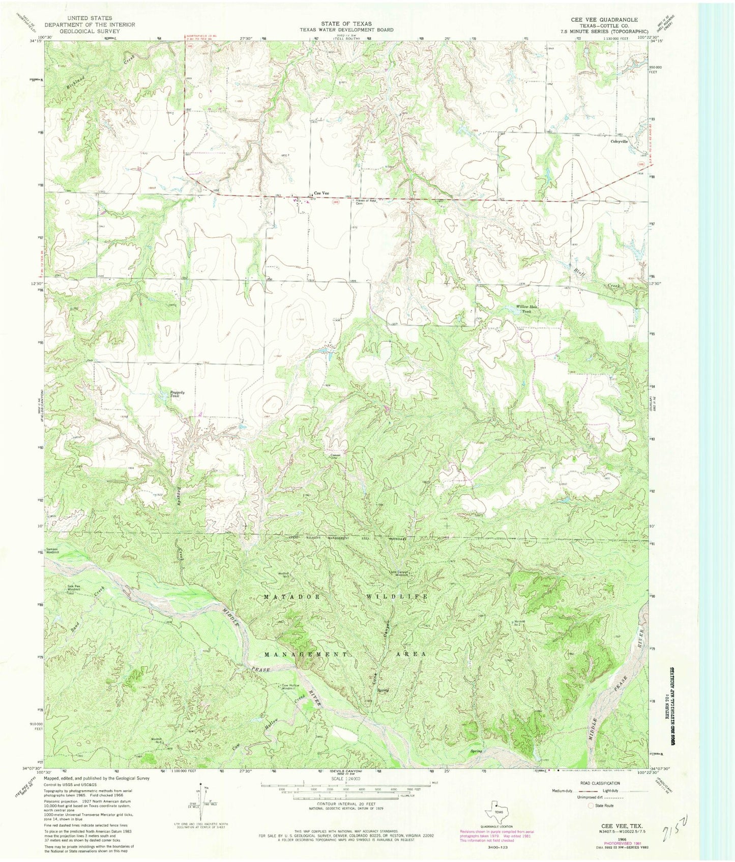
Classic USGS Cee Vee Texas 7.5'x7.5' Topo Map
Couldn't load pickup availability
Historical USGS topographic quad map of Cee Vee in the state of Texas. Typical map scale is 1:24,000, but may vary for certain years, if available. Print size: 24" x 27"
This quadrangle is in the following counties: Cottle.
The map contains contour lines, roads, rivers, towns, and lakes. Printed on high-quality waterproof paper with UV fade-resistant inks, and shipped rolled.
Contains the following named places: Cee Vee, Cow Hollow Creek, Cow Hollow Windmill, Haven of Rest Cemetery, Lone Canyon, Lone Canyon Windmill, Matador Wildlife Management Area, Raggedy Creek, Raggedy Tank, Sand Creek, Sisk Pen Windmill, Willow Hole Tank, Windmill Number Two, Windmill Number Three, Windmill Number Six, Tongue River, Coleyville