MyTopo
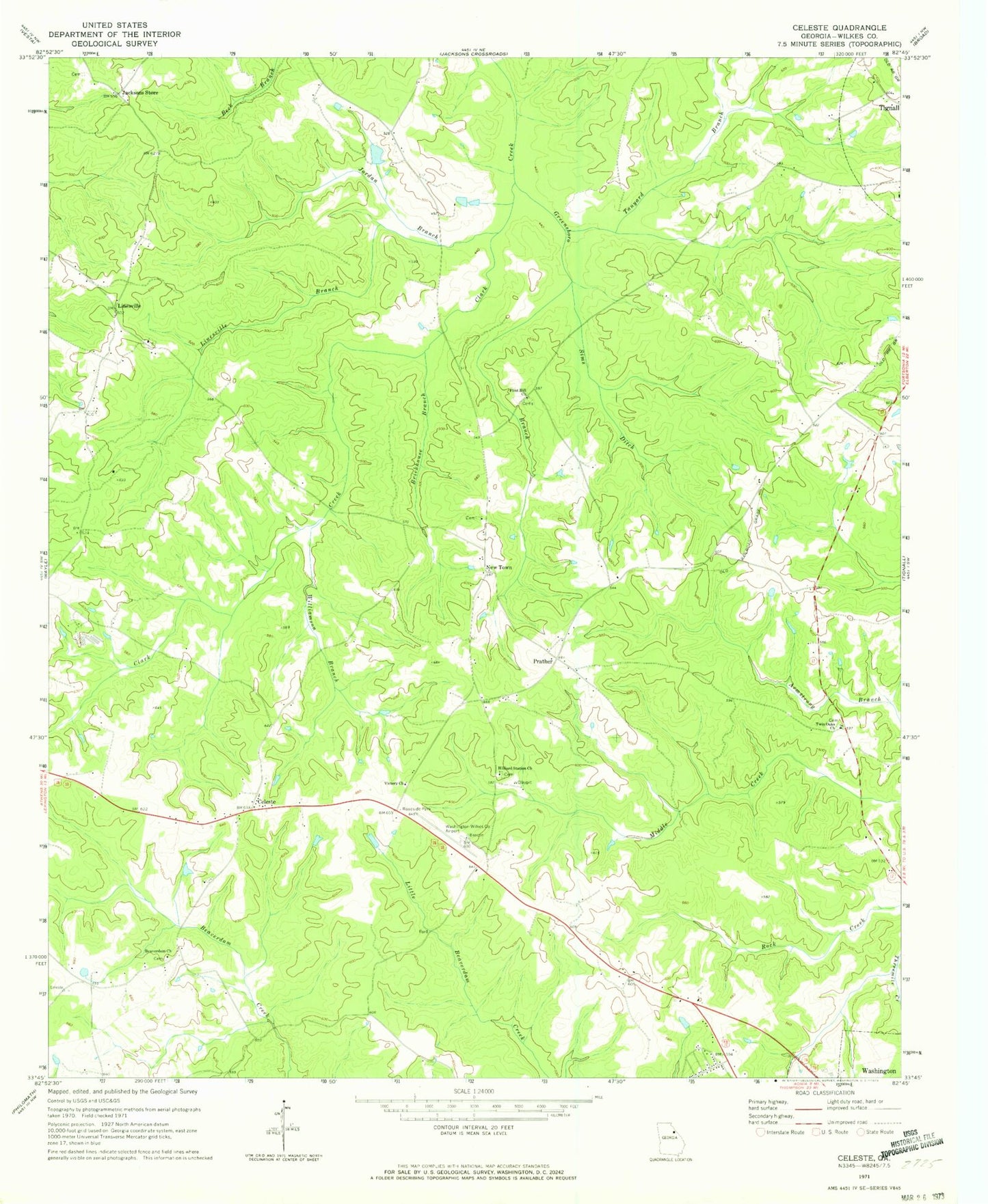
Classic USGS Celeste Georgia 7.5'x7.5' Topo Map
Couldn't load pickup availability
Historical USGS topographic quad map of Celeste in the state of Georgia. Map scale may vary for some years, but is generally around 1:24,000. Print size is approximately 24" x 27"
This quadrangle is in the following counties: Wilkes.
The map contains contour lines, roads, rivers, towns, and lakes. Printed on high-quality waterproof paper with UV fade-resistant inks, and shipped rolled.
Contains the following named places: Armstrong, Beaverdam Cemetery, Beaverdam Church, Bessie, Brickhouse, Brickhouse Branch, Celeste, Flint Hill Church, Greensboro Branch, Grimaude Lake, Grimaude Lake Dam, Hilliard Station Church, Jackson Heights, Jacksons Store, Jordan Branch, Kingdom Hall Church, Linesville, Linesville Branch, Lyonsville Church, New Town, New Town Church, Newtown Cemetery, Newtown Fire Department, Prather, Sims Ditch, Tanyard Branch, Twin Oaks Church, Victory Church, Washington-Wilkes County Airport, Washington-Wilkes Orchard Lake, Washinton-Wilkes Orchard Dam, White Rock Cemetery, White Rock Church, Wilkes County Church, Williamson Branch