MyTopo
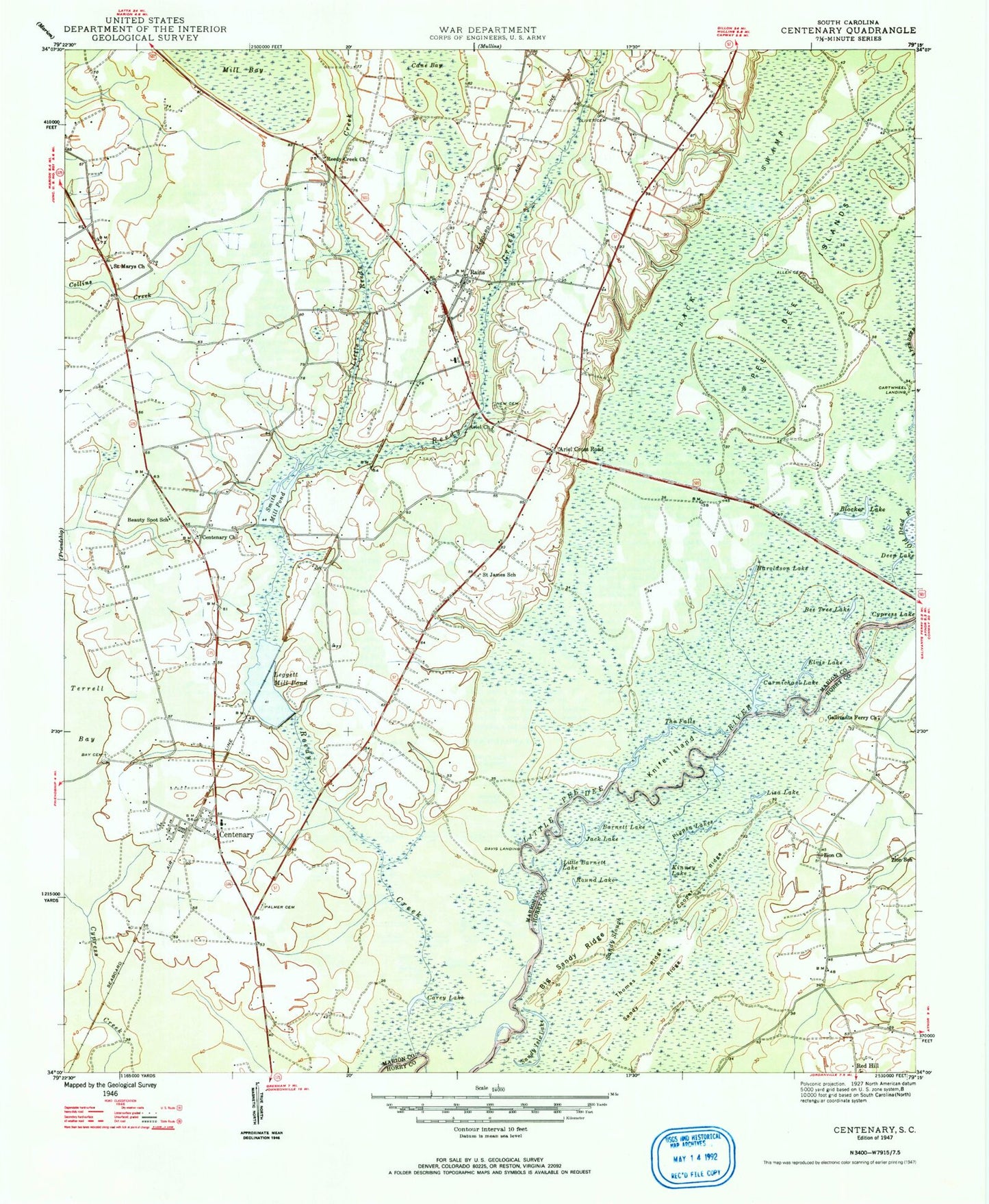
Classic USGS Centenary South Carolina 7.5'x7.5' Topo Map
Couldn't load pickup availability
Historical USGS topographic quad map of Centenary in the state of South Carolina. Typical map scale is 1:24,000, but may vary for certain years, if available. Print size: 24" x 27"
This quadrangle is in the following counties: Horry, Marion.
The map contains contour lines, roads, rivers, towns, and lakes. Printed on high-quality waterproof paper with UV fade-resistant inks, and shipped rolled.
Contains the following named places: Savannah Creek, Allen Cemetery, Back Swamp, Barnett Lake, Bay Cemetery, Bee Tree Lake, Big Sandy Ridge, Blocker Lake, Cane Bay, Carey Lake, Carmichael Lake, Centenary, Cooper Ridge, Cypress Lake, Deep Lake, Elvis Lake, Haroldson Lake, Jack Lake, Kinney Lake, Knife Island, Little Barnett Lake, Little Reedy Creek, Liza Lake, New Cemetery, Olivet Cemetery, Palmer Cemetery, Pee Dee Islands, Pigpen Lakes, Rains, Reedy Creek, Round Lake, Saint James School, Saint Marys Church, Sandy Isle Lake, Sandy Ridge, Sandy Slough, Smith Mill Pond, The Falls, Thomas Ridge, Zion School, Bethlehem Church, Centenary School (historical), Gurley Church, Knife Island Landing, Rains Centenary Early Childhood Center, Terrells Bay High School (historical), Cartwheel Landing, Davis Landing, Baxleys 501 Pond Dam D-0513, Baxley Farm Pond Dam D-0509, Leggett Millpond Dam D-0511, Rowell Pond Dam D-3239, Pages (historical), Ariel Church, Ariel Cross Road, Beauty Spot School, Leggett Mill Pond, Centenary Church, Gallivants Ferry Church, Marion County, Reedy Creek Church, Zion Church, Red Hill Church, Rains Volunteer Fire Department, Centenary Volunteer Fire Department, Creek Bridge High School, Centenary Post Office, Rains Post Office, Bethlehem African Methodist Episcopal Church, Centerville Baptist Church, New Faith Apostolic Church, Rain Freewill Baptist Church, Saint James African Methodist Episcopal Church, Baxley Farms, Rains Census Designated Place, Centenary Census Designated Place