
MyTopo
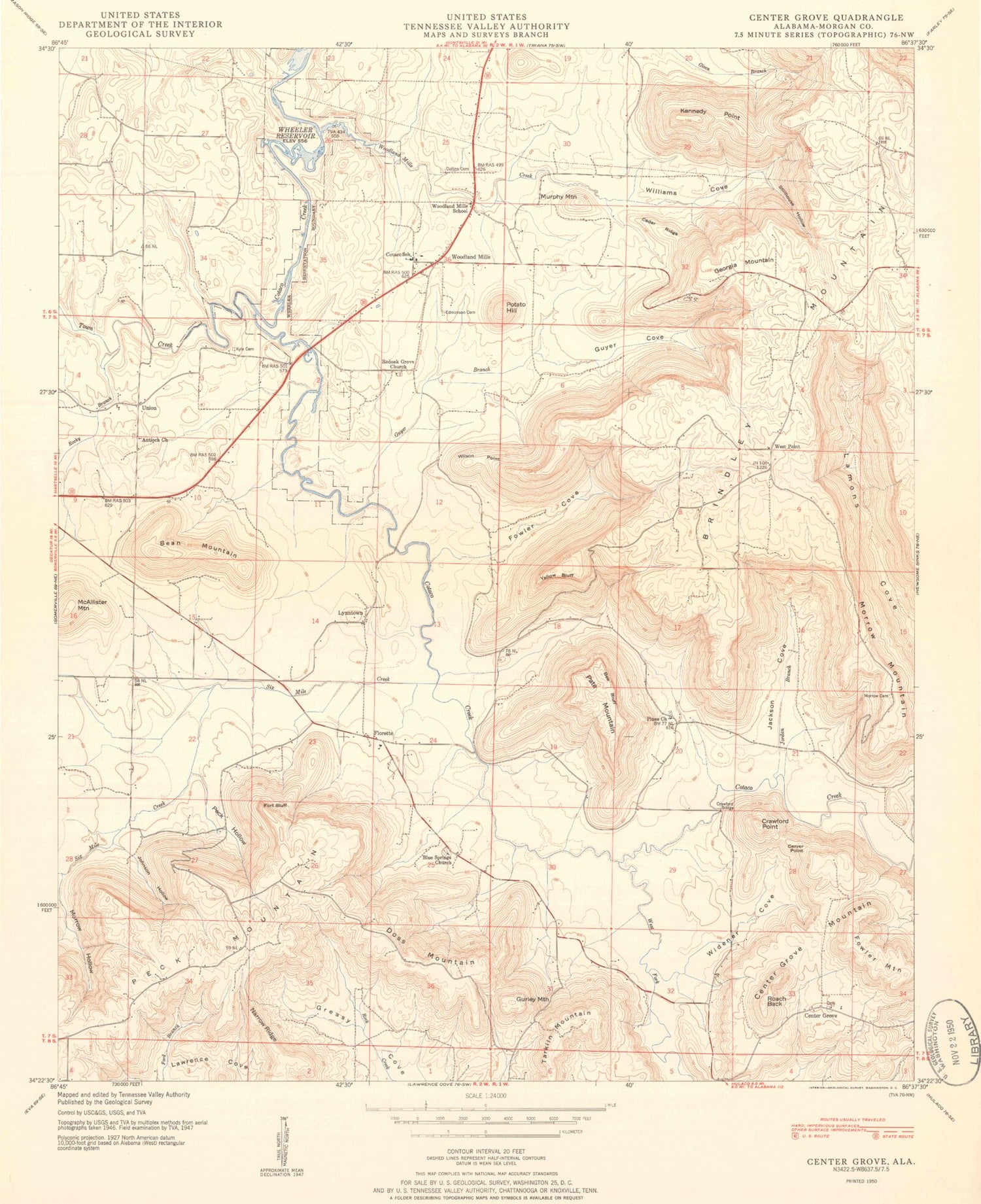
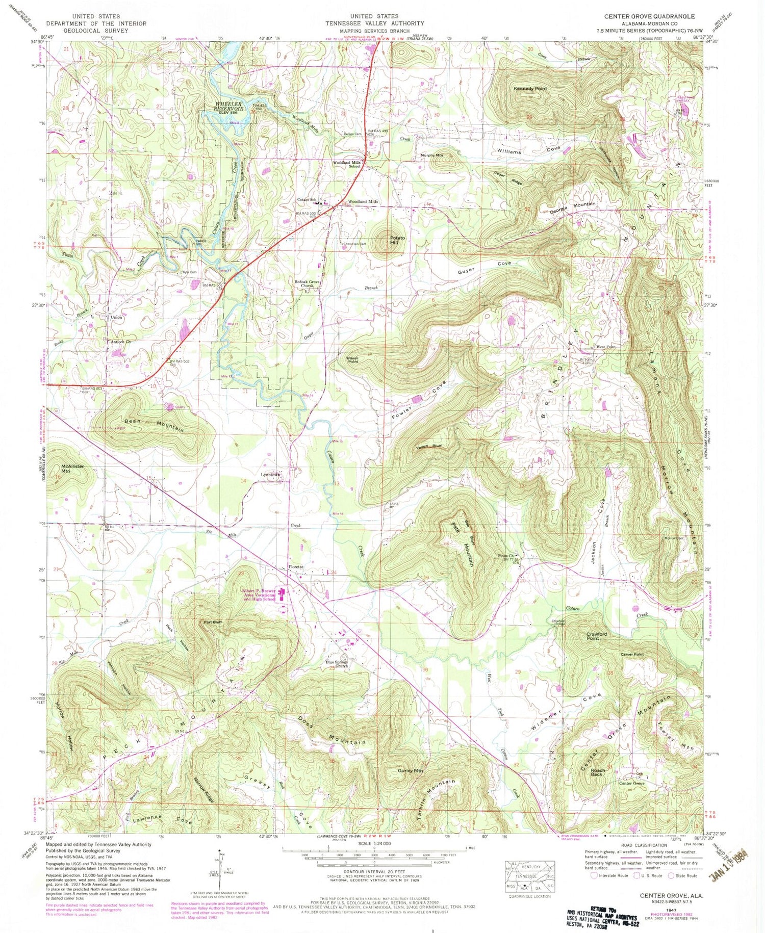
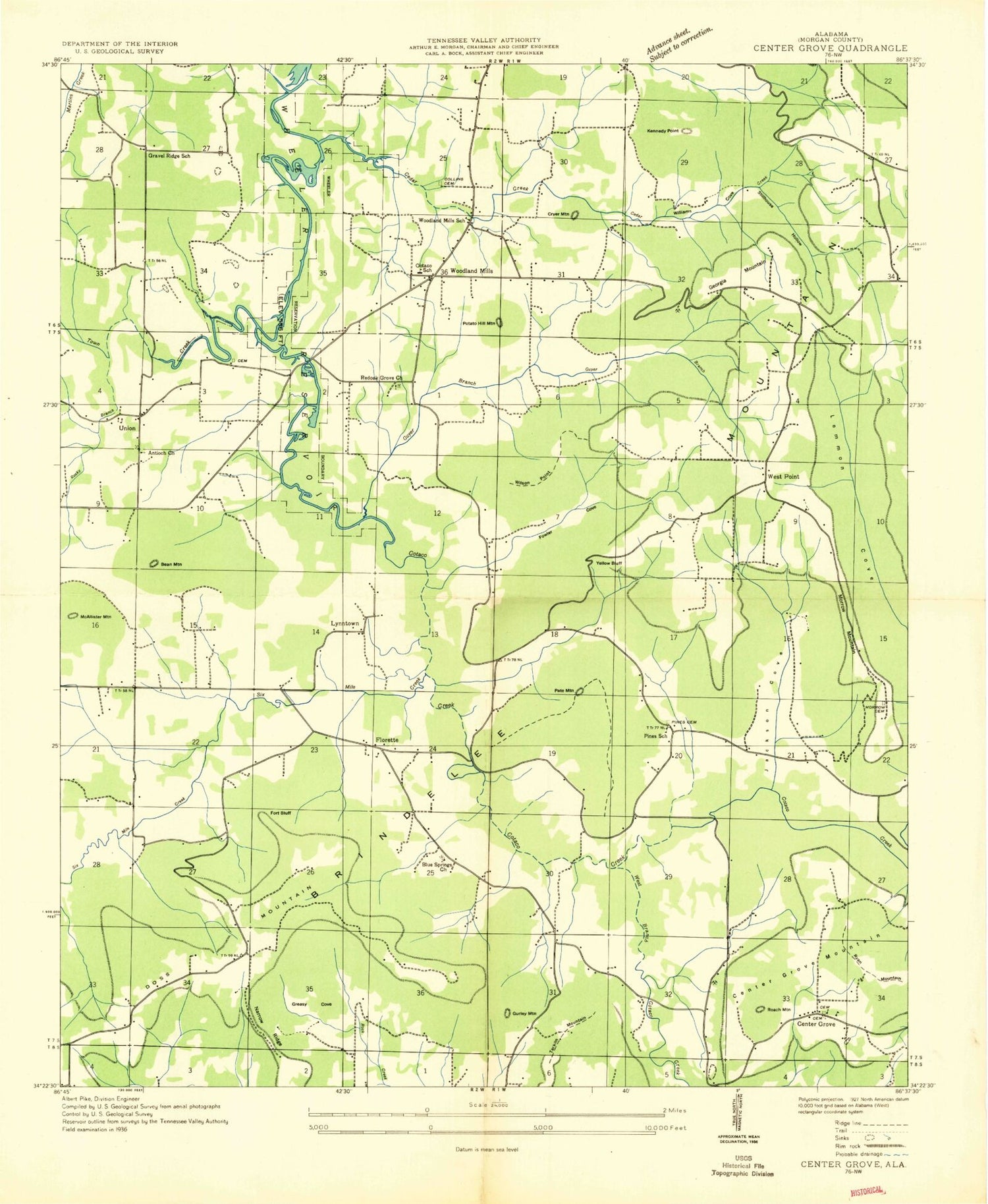
Classic USGS Center Grove Alabama 7.5'x7.5' Topo Map
Couldn't load pickup availability
Historical USGS topographic quad map of Center Grove in the state of Alabama. Map scale may vary for some years, but is generally around 1:24,000. Print size is approximately 24" x 27"
This quadrangle is in the following counties: Morgan.
The map contains contour lines, roads, rivers, towns, and lakes. Printed on high-quality waterproof paper with UV fade-resistant inks, and shipped rolled.
Contains the following named places: Albert P Brewer Area Vocational and High School, Antioch Cemetery West, Antioch United Methodist Church, Bean Mountain, Beaver Spring, Bee Bluff, Blowing Spring, Blue Springs Baptist Church, Blue Springs Cemetery, Brindley Mountain, Carver Point, Cedar Ridge, Center Grove, Center Grove Cemetery North, Center Grove Mountain, Collins Cemetery, Cotaco Fire Department, Cotaco High School, Cotaco United Methodist Church, Cove Spring Number 1, Cove Spring Number 2, Crawford Bridge, Crawford Point, Crawford Spring Number 1, Crawford Spring Number 2, Crawford Spring Number 3, Cryer Spring, Doss Mountain, Edmonson Cemetery, Flack Spring, Florette, Florette Church, Florette Volunteer Fire Department, Fort Bluff, Fort Bluff Post Office, Fowler Cove, Fowler Mountain, Fowler Spring, Georgia Mountain, Gravel Ridge School, Greasy Cove Spring, Gurley Mountain, Guyer Branch, Guyer Cove, Guyer Spring, Jackson Cove, Jaquess Spring, Johnson Hollow, Jordan Branch, Kennedy Point, Kyle Cemetery, Laceys Spring Division, Little Mountain, Lynntown, McAllister Mountain, Miller Spring, Milton Airport, Morrow Hollow, Morrow Mountain, Murphy Mountain, Narrow Ridge, New Salem Baptist Church, Pate Mountain, Peach Grove, Peck Hollow, Peck Mountain, Peck Mountain Spring, Peck Spring, Pines Church, Pines School, Potato Hill, Red Oak Grove, Red Oak Grove Cemetery, Red Oak Grove Methodist Church, Roach Back, Rocky Branch, Russell Cemetery, Russell Spring, Six Mile Creek, Stillhouse Hollow, Tarkiln Mountain, Town Creek, Turney Spring, Union, Union Church of Christ, Valhermoso Springs Post Office, Watson and Morrow Cemetery, West Fork Cotaco Creek, West Point, West Point Cemetery, West Point Church, West Point School, Widener Cove, Williams Cove, Williams Cove Spring, Wilson Point, Woodland Mills, Woodland Mills Creek, Woodland Mills School, Yellow Bluff, ZIP Code: 35670


