MyTopo
Classic USGS Center Point NE Arkansas 7.5'x7.5' Topo Map
Couldn't load pickup availability
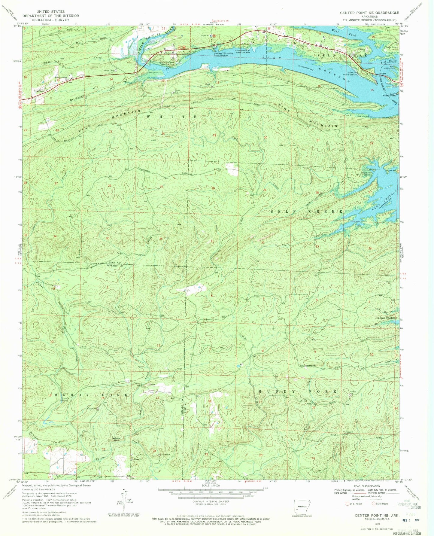
Historical USGS topographic quad map of Center Point NE in the state of Arkansas. Map scale may vary for some years, but is generally around 1:24,000. Print size is approximately 24" x 27"
This quadrangle is in the following counties: Howard, Pike.
The map contains contour lines, roads, rivers, towns, and lakes. Printed on high-quality waterproof paper with UV fade-resistant inks, and shipped rolled.
Contains the following named places: Arrowhead Point Public Use Area, Blue Creek, Brickyard Creek, Camp Tula, Crawford, Eden Landmark Church, Highway 70 Landing Public Use Area, Jacobs Creek, Lake Greeson, Little Creek, Mount Joy Church, Panther Creek, Pine Mountain, Polk Cemetery, Polk Church, Rock Creek, Rock Creek Public Use Area, Self Creek Public Use Area, Shiloh Cemetery, Star of the West, Star of the West Public Use Area, Township of Muddy Fork, Township of White, West Fork, West Fork Lake Greeson, White Oak Creek, Wildcat Bluff, Wylie Picnic Area