MyTopo
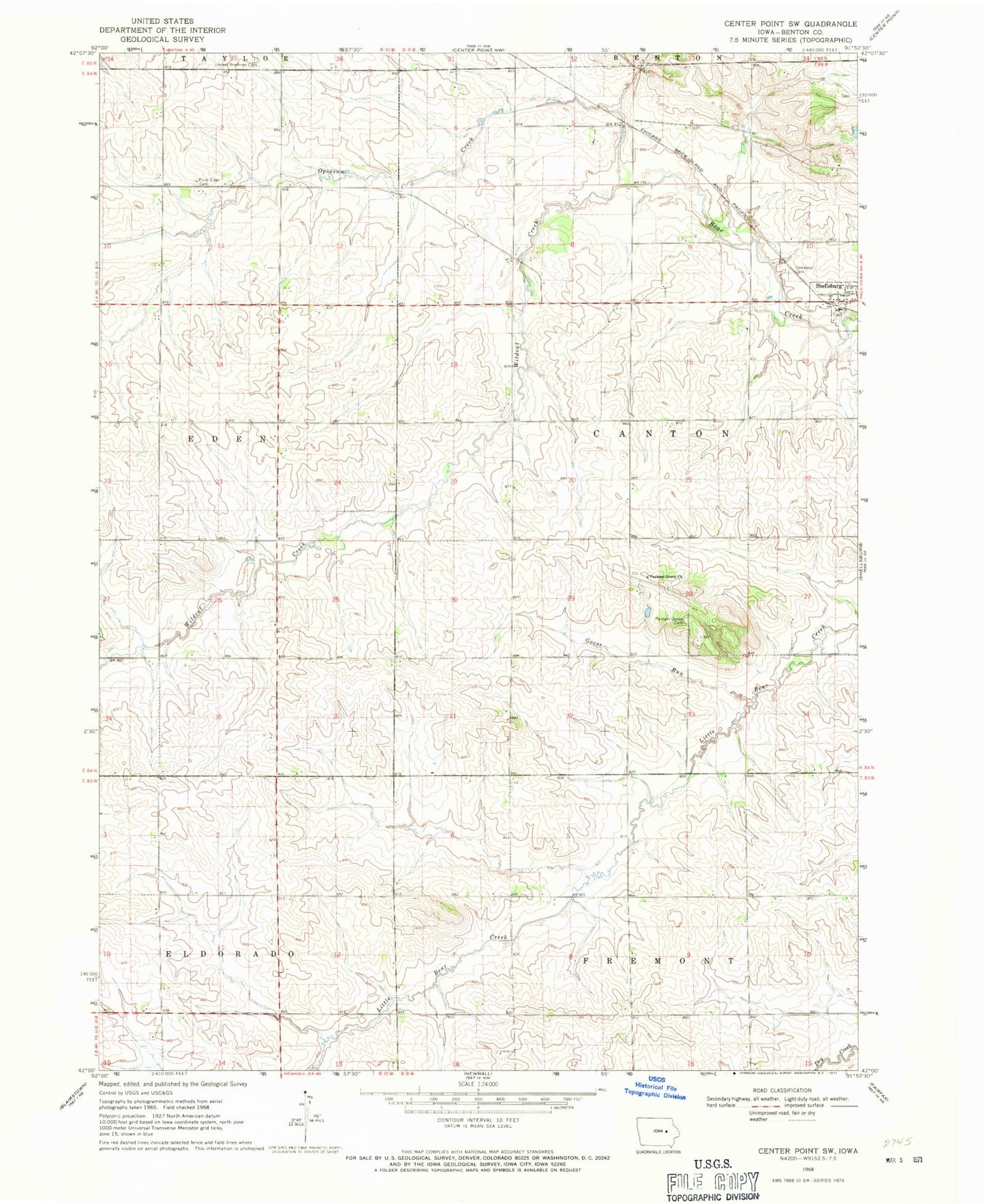
Classic USGS Center Point SW Iowa 7.5'x7.5' Topo Map
Couldn't load pickup availability
Historical USGS topographic quad map of Center Point SW in the state of Iowa. Map scale may vary for some years, but is generally around 1:24,000. Print size is approximately 24" x 27"
This quadrangle is in the following counties: Benton.
The map contains contour lines, roads, rivers, towns, and lakes. Printed on high-quality waterproof paper with UV fade-resistant inks, and shipped rolled.
Contains the following named places: East - Eden Cemetery, Eden, Fix Cemetery, Goose Run, Oakwood Cemetery, Opossum Creek, Parkers Grove Cemetery, Parkers Grove Church, Shellsburg Cemetery, Summers Post Office, Township of Canton, United Brethren Cemetery, Warren H Pangborn Wildlife Area, Wildcat Creek, ZIP Codes: 52315, 52332