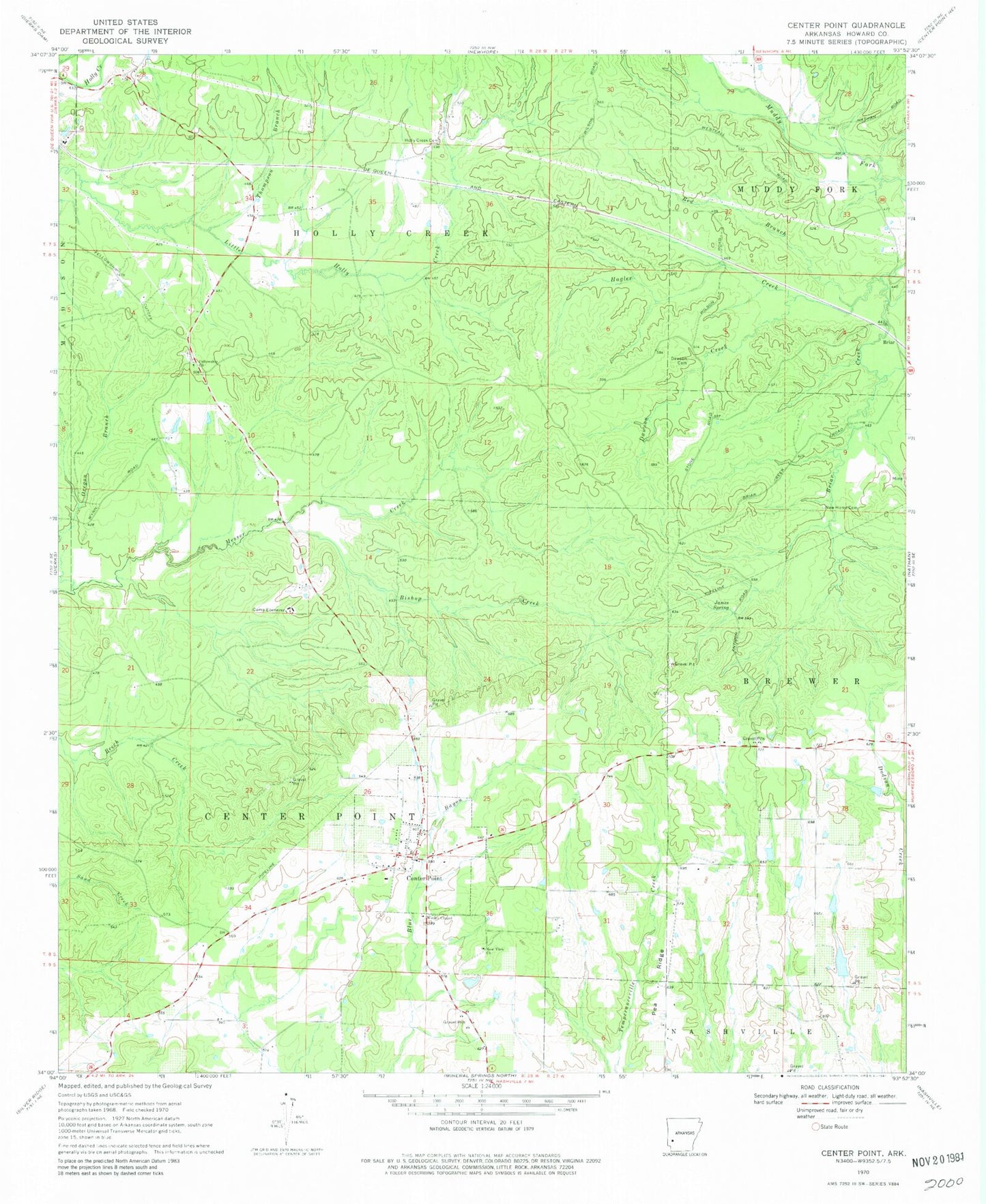
MyTopo
Classic USGS Center Point Arkansas 7.5'x7.5' Topo Map
Couldn't load pickup availability
Historical USGS topographic quad map of Center Point in the state of Arkansas. Map scale may vary for some years, but is generally around 1:24,000. Print size is approximately 24" x 27"
This quadrangle is in the following counties: Howard.
The map contains contour lines, roads, rivers, towns, and lakes. Printed on high-quality waterproof paper with UV fade-resistant inks, and shipped rolled.
Contains the following named places: Antioch Church, Barnes Lake, Barnes Lake Dam, Bishop Creek, Boles Cemetery, Camp Ebenezer, Center Point, Center Point Census Designated Place, Center Point Volunteer Fire Department, Dawson Cemetery, Dawson Creek, Ebenezer Cemetery, Fellowship Cemetery, Fellowship Church, Hagler Creek, Hester Cemetery, Holly Creek Cemetery, Howard County, Independence Hall School, James Spring, McAdams Lake, McAdams Lake Dam, Mount Olive Church, New Bethel Church, New Home Cemetery, New View Church, Old Salem Cemetery, Oregon Branch, Pea Ridge, Red Branch, Salem School, Shaws Store, Thompson Branch, Township of Center Point, Township of Holly Creek, Wesley Chapel