MyTopo
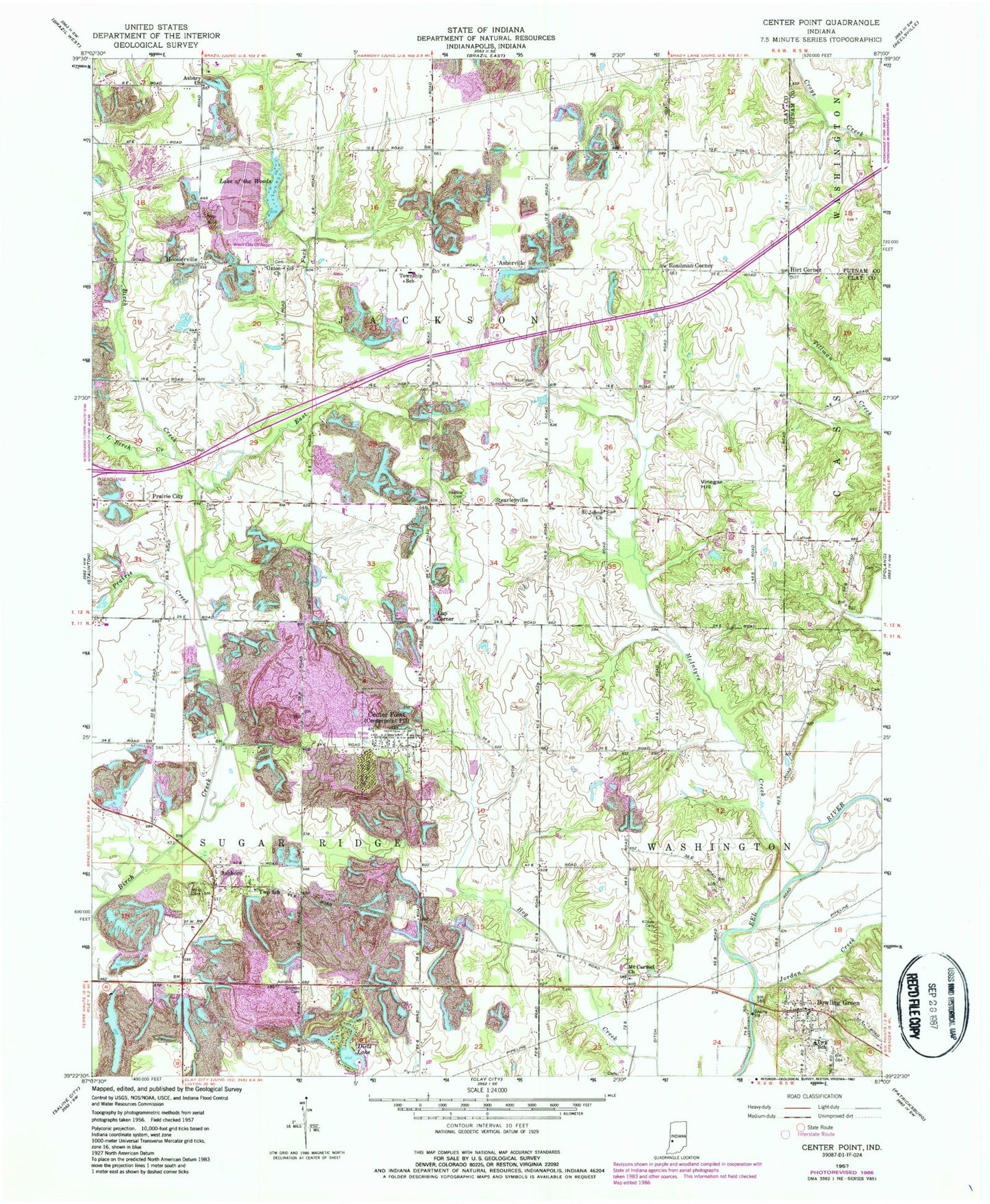
Classic USGS Center Point Indiana 7.5'x7.5' Topo Map
Couldn't load pickup availability
Historical USGS topographic quad map of Center Point in the state of Indiana. Map scale may vary for some years, but is generally around 1:24,000. Print size is approximately 24" x 27"
This quadrangle is in the following counties: Clay, Putnam.
The map contains contour lines, roads, rivers, towns, and lakes. Printed on high-quality waterproof paper with UV fade-resistant inks, and shipped rolled.
Contains the following named places: Air Evacuation Lifeteam 39, Asbury Church, Ashboro, Ashboro - Moss Cemetery, Ashboro North Pit, Asherville, Bowling Green, Bowling Green Post Office, Bowling Green Volunteer Fire Department, Brazil Clay County Airport, Center Point, Center Point and Community Volunteer Fire Department, Center Point Cemetery, Church Creek, Clay County, Dietz Lake, East Fork Birch Creek, Gremes Cemetery, Hirt Corner, Hoosierville, Jackson Township Elementary School, Jackson Township Volunteer Fire Department Brazil Station, Jordan Creek, Kealber Cemetery, Killion Cemetery, Lake of the Woods, Lap Corner, Little Birch Creek, McIntyre Creek, Miller Cemetery, Miller Creek, Mount Carmel Church, Neidlinger Cemetery, Prairie City, Prairie Creek, Roadman Corner, Saint Johns Church, Son Run, Stearleyville, Town of Center Point, Township of Jackson, Township of Sugar Ridge, Union Church, Vinegar Hill, Walker Cemetery, Zenor Cemetery, ZIP Code: 47840