MyTopo
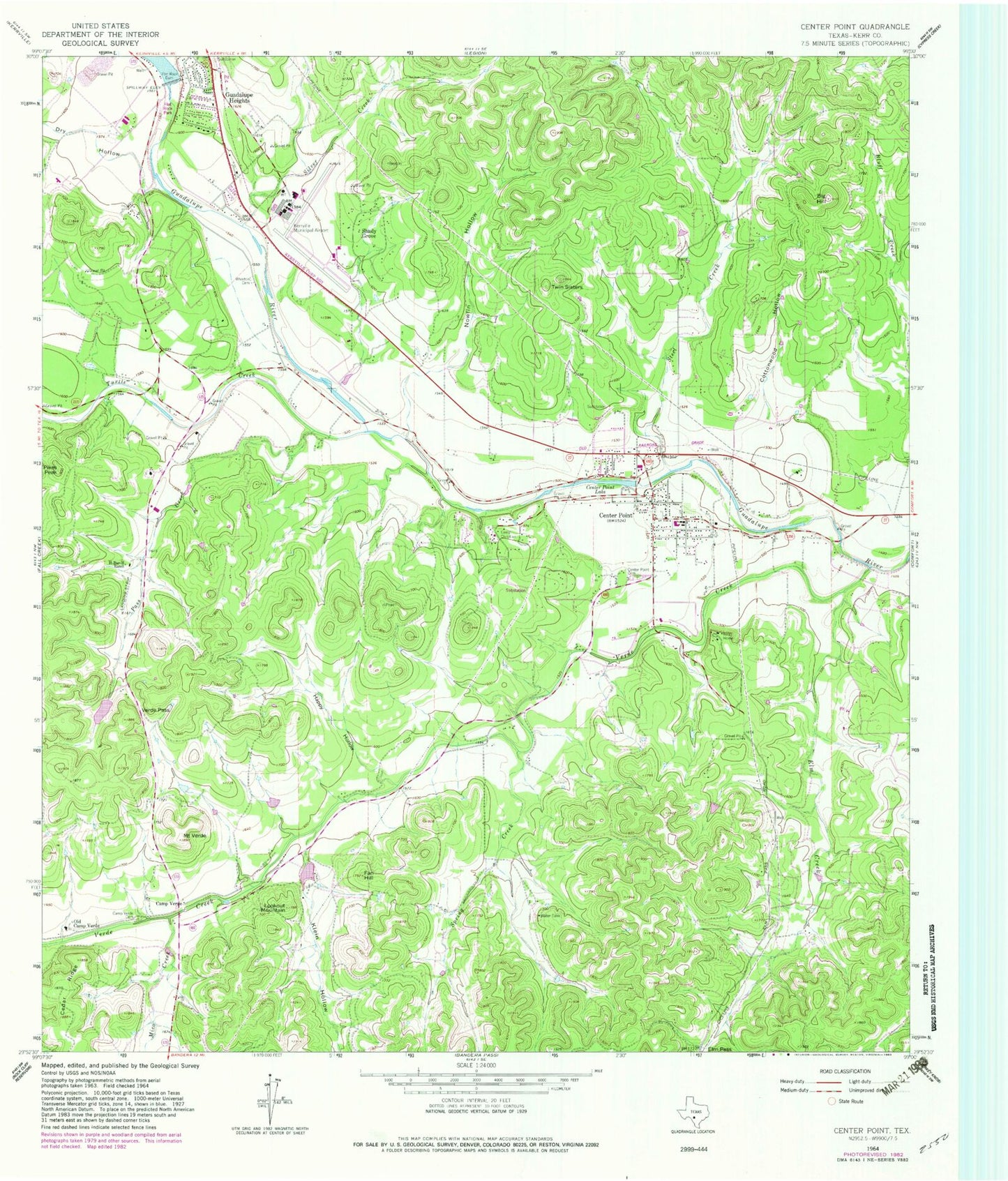
Classic USGS Center Point Texas 7.5'x7.5' Topo Map
Couldn't load pickup availability
Historical USGS topographic quad map of Center Point in the state of Texas. Map scale may vary for some years, but is generally around 1:24,000. Print size is approximately 24" x 27"
This quadrangle is in the following counties: Kerr.
The map contains contour lines, roads, rivers, towns, and lakes. Printed on high-quality waterproof paper with UV fade-resistant inks, and shipped rolled.
Contains the following named places: Big Hill, Bolin Family Cemetery, Camp Christian, Camp Verde, Camp Verde Cemetery, Center Point, Center Point Cemetery, Center Point Census Designated Place, Center Point Lake, Center Point Lake Dam, Center Point Post Office, Center Point Volunteer Fire Department, Cottonwood Hollow, Dam C Lake, Dry Hollow, Elm Creek, Fall Hill, Flat Rock Dam, Flatrock Park, Guadalupe Heights, Happy Hollow, H-Bar-H Ranch, Kerrville Lake Dam, Kerrville Municipal Airport/Louis Schreiner Field, Klein Hollow, Lookout Mountain, Mico Creek, Mount Verde, Nowlin Hollow, Old Camp Verde, Pass Creek, Pikes Peak, Shady Grove, Silver Creek, Spring Creek, Starlite Recovery Center, Steel Creek, Tuck Lake, Tuck Lake Dam, Turtle Creek, Twin Sisters, Verde Creek, Verde Pass, Wharton Cemetery, ZIP Code: 78010