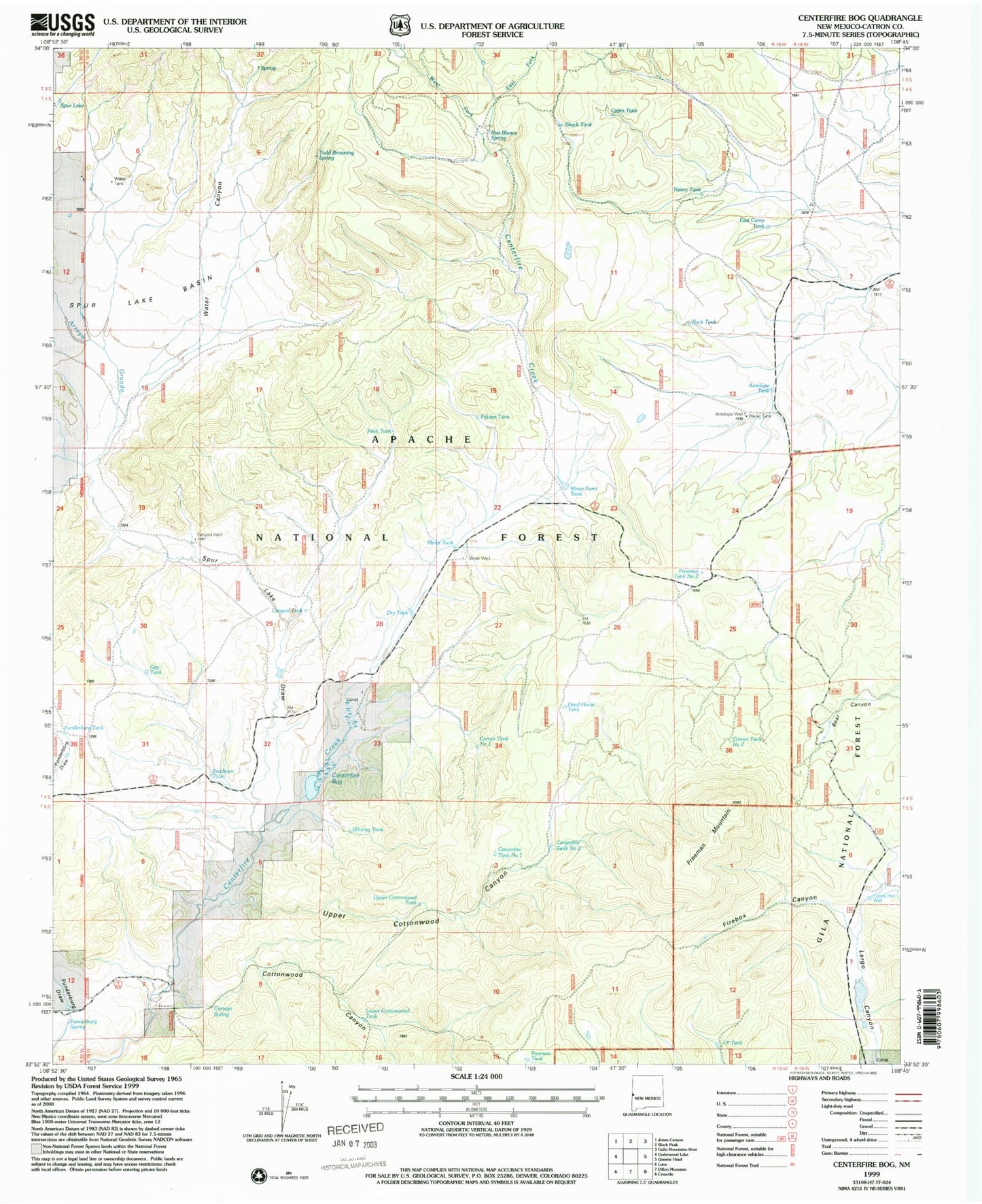
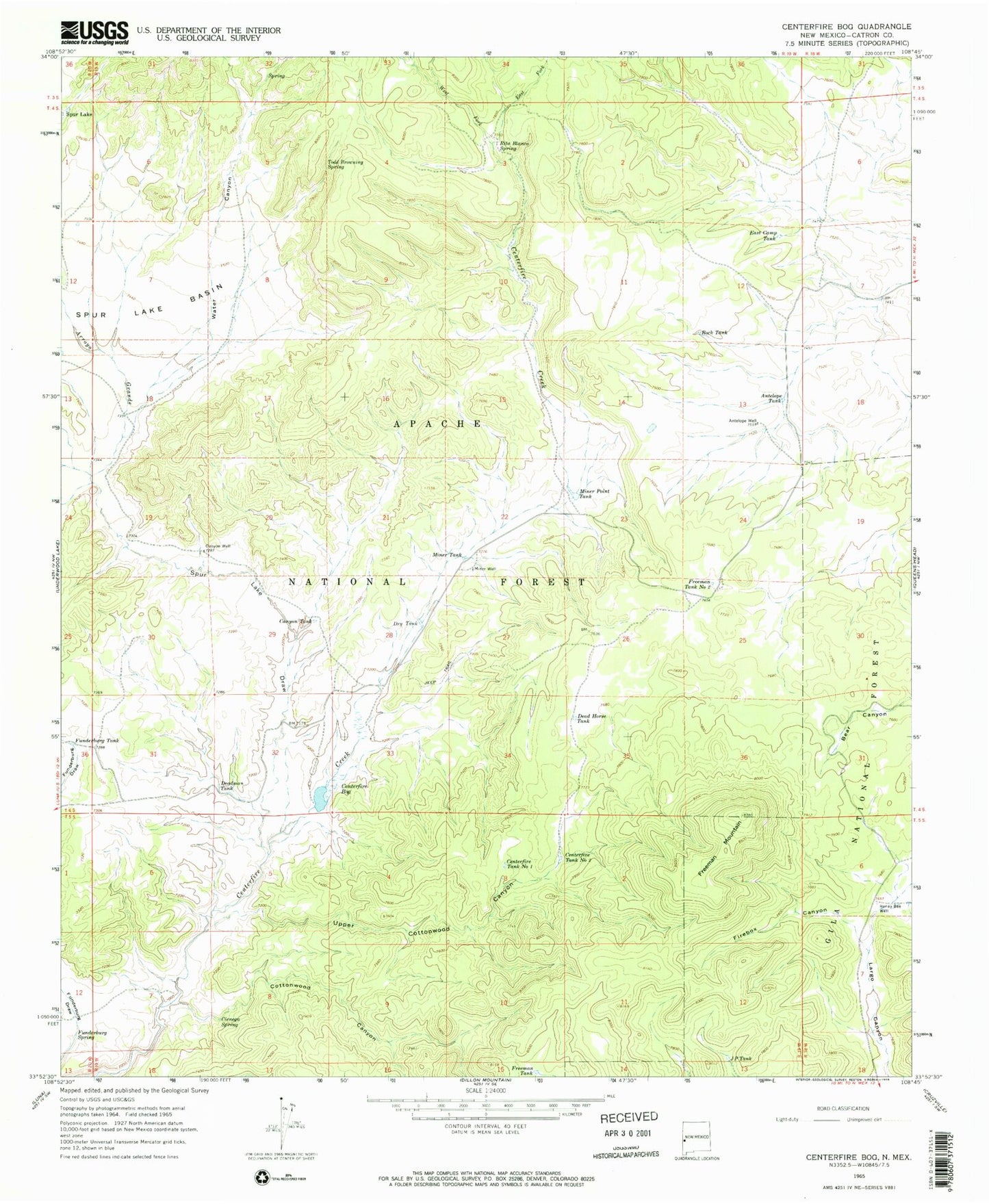
MyTopo
Classic USGS Centerfire Bog New Mexico 7.5'x7.5' Topo Map
Couldn't load pickup availability
Historical USGS topographic quad map of Centerfire Bog in the state of New Mexico. Typical map scale is 1:24,000, but may vary for certain years, if available. Print size: 24" x 27"
This quadrangle is in the following counties: Catron.
The map contains contour lines, roads, rivers, towns, and lakes. Printed on high-quality waterproof paper with UV fade-resistant inks, and shipped rolled.
Contains the following named places: Antelope Tank, Antelope Well, Arroyo Grande, Canyon Tank, Canyon Well, Centerfire Tank Number 1, Centerfire Tank Number 2, Cienega Spring, Cottonwood Canyon, Dead Horse Tank, Deadman Tank, Dry Tank, East Camp Tank, East Fork Centerfire Creek, Firebox Canyon, Freeman Mountain, Freeman Tank, Freeman Tank Number 2, Funderburg Spring, Funderburg Tank, Honey Bee Well, J P Tank, Miner Point Tank, Miner Tank, Miner Well, Rita Blanca Spring, Rock Tank, Spur Lake Basin, Spur Lake Draw, Todd Browning Spring, Upper Cottonwood Canyon, Water Canyon, West Fork Centerfire Creek, Draw Tank, Shack Tank, Nancy Tank, Fifteen Tank, Peak Tank, Hay Tank, Lower Cottonwood Tank, Whiting Tank, Black Gap Tank Number Two, Corner Tank Number One, Corner Tank Number Two, Gap Tank, Centerfire Bog, Cabin Tank, Upper Cottonwood Tank, Arroyo Grande