MyTopo
Classic USGS Centerville NE Louisiana 7.5'x7.5' Topo Map
Couldn't load pickup availability
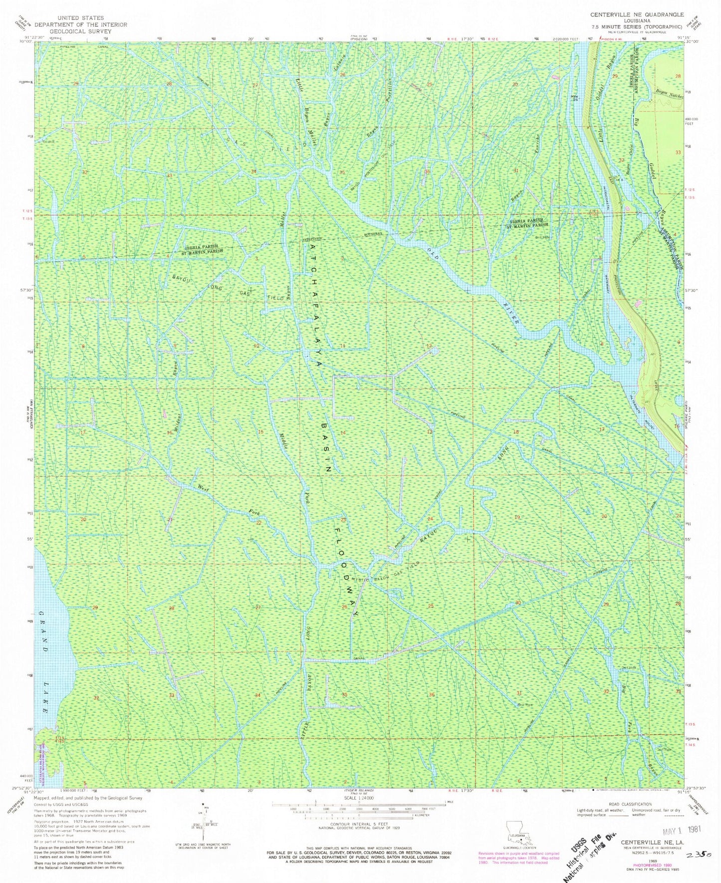
Historical USGS topographic quad map of Centerville NE in the state of Louisiana. Typical map scale is 1:24,000, but may vary for certain years, if available. Print size: 24" x 27"
This quadrangle is in the following counties: Assumption, Iberia, St. Martin.
The map contains contour lines, roads, rivers, towns, and lakes. Printed on high-quality waterproof paper with UV fade-resistant inks, and shipped rolled.
Contains the following named places: Bayou Calist, Bayou Latania, Bayou Postillion, Little Bayou Mallet, Little Goddel Bayou, Bayou Postillion Oil Field, Bayou Fourche, Bayou Long, Bayou Long Gas Field, Bayou Mallet, Big Goddel Bayou, Middle Fork Bayou Long, Mystic Bayou Gas Field, Old River, West Fork Bayou Long, Wildcat Bayou