
MyTopo
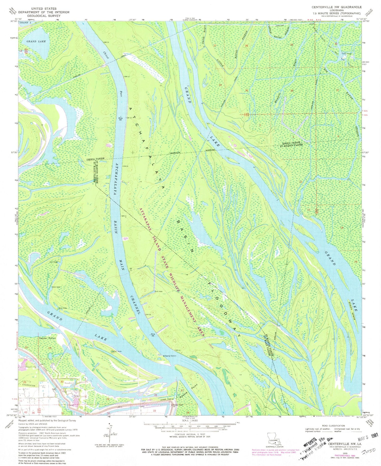
Classic USGS Centerville NW Louisiana 7.5'x7.5' Topo Map
Couldn't load pickup availability
Historical USGS topographic quad map of Centerville NW in the state of Louisiana. Map scale may vary for some years, but is generally around 1:24,000. Print size is approximately 24" x 27"
This quadrangle is in the following counties: Iberia, St. Martin, St. Mary.
The map contains contour lines, roads, rivers, towns, and lakes. Printed on high-quality waterproof paper with UV fade-resistant inks, and shipped rolled.
Contains the following named places: Attakapas Island State Wildlife Managment Area, Bayou Grue, Big Bayou Pigeon, Charenton Oil and Gas Field, Grand Lake, Hooppole Bayou, Keelboat Pass, Little Bayou Pigeon, Mecom Cut, Millet Point, Myette Point Church, Myette Point Oil and Gas Field, Parish Governing Authority District 11, Shaws Island, Smith Bayou, Taylor Point


