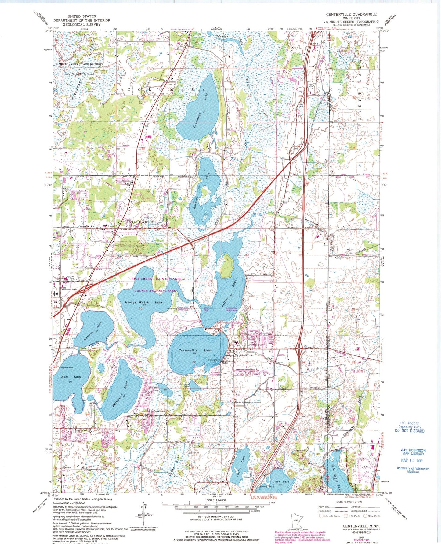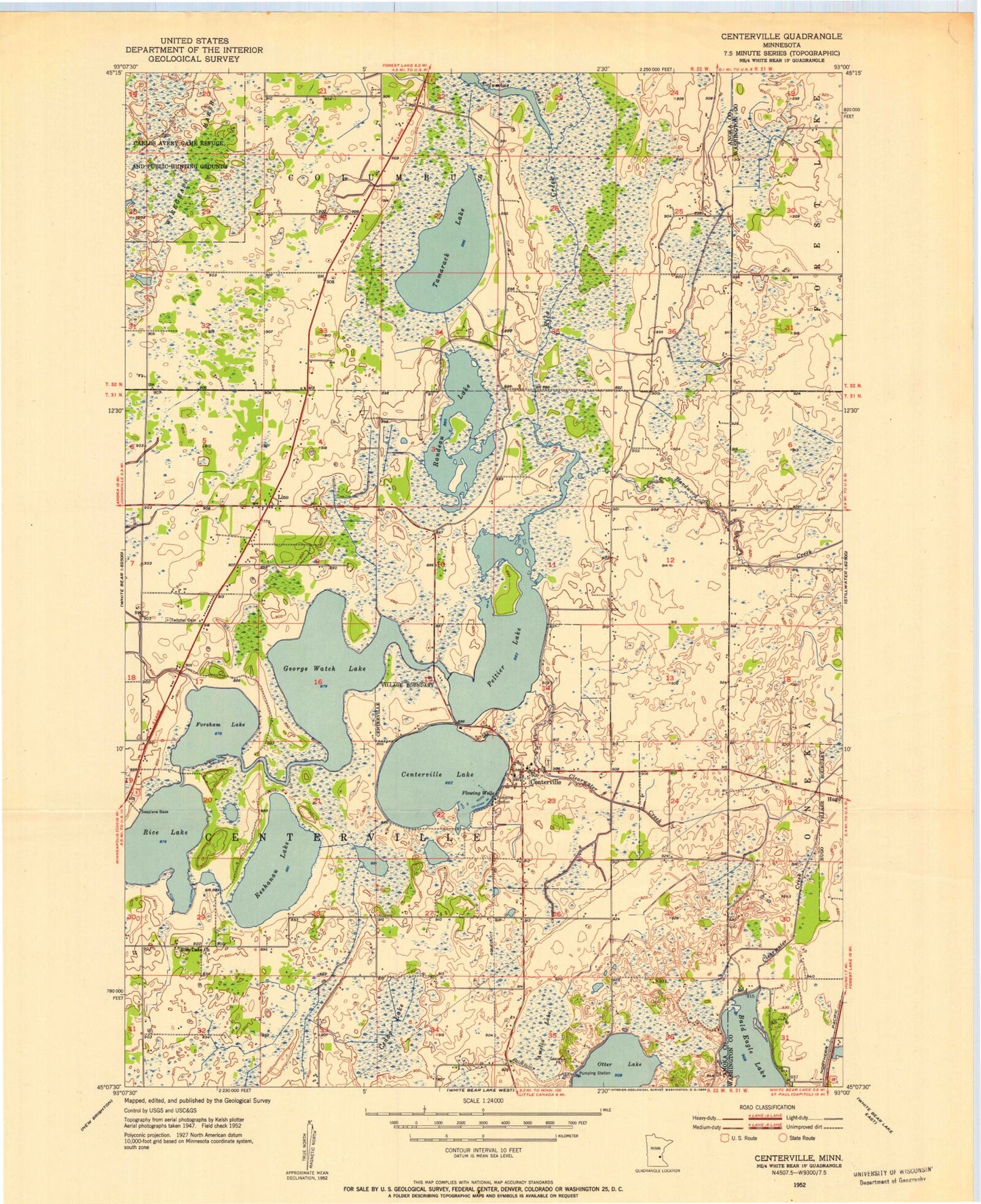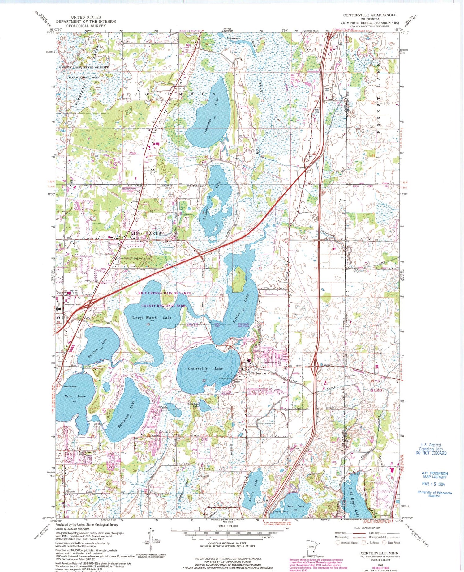

MyTopo
Classic USGS Centerville Minnesota 7.5'x7.5' Topo Map
Couldn't load pickup availability
Historical USGS topographic quad map of Centerville in the state of Minnesota. Map scale may vary for some years, but is generally around 1:24,000. Print size is approximately 24" x 27"
This quadrangle is in the following counties: Anoka, Washington.
The map contains contour lines, roads, rivers, towns, and lakes. Printed on high-quality waterproof paper with UV fade-resistant inks, and shipped rolled.
Contains the following named places: Amelia Lake, Applecrest Orchards, Birchwood Acres Park, Blue Heron Elementary School, Browns Base South-Reshanau Lake Seaplane Base, Cedar Lake, Centennial Fire District Station 3, Centerville, Centerville City Hall, Centerville Elementary School, Centerville Lake, Centerville Post Office, Chomonix Golf Course, City of Centerville, City of Lino Lakes, Clearwater Creek, Columbus Lake, Country Lakes Park, Crossways Lake, Du Fresne Airport, George Watch Lake, Grove Park, Hardwood Creek, Lino Lakes, Lino Lakes Elementary School, Lino Lakes Fire Station Number 1, Lino Lakes Police Department, Lino Park, Lino Post Office, Marshan Lake, Marshan Park, Minnesota Correctional Facility Lino Lakes, Oneka Elementary School, Peltier Lake, Peltier Lake Dam, Reshanau Lake, Rice Creek Campgrounds, Rice Creek-Chain of Lakes County Regional Park, Rice Lake, Rice Lake Elementary School, Rice Lake Methodist Cemetery, Rondeau Lake, Saint Genevieve Cemetery, Shenandoah Park, Sherman Lake, South Reshanau Lake Estates Park, Surfside Airport, Surfside Seaplane Base, Township of Centerville, Twitchell Cemetery, Wards Lake, Wiregrass Marsh