MyTopo
Classic USGS Centrahoma Oklahoma 7.5'x7.5' Topo Map
Couldn't load pickup availability
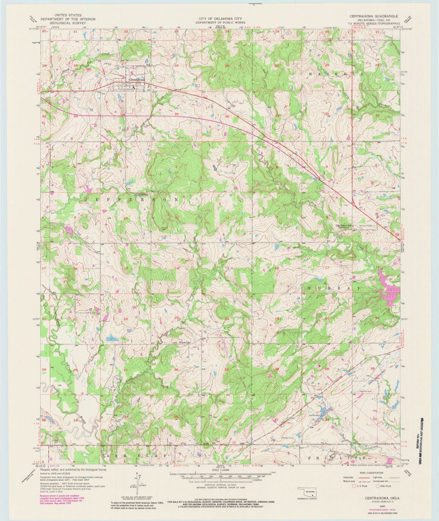
Historical USGS topographic quad map of Centrahoma in the state of Oklahoma. Map scale may vary for some years, but is generally around 1:24,000. Print size is approximately 24" x 27"
This quadrangle is in the following counties: Coal.
The map contains contour lines, roads, rivers, towns, and lakes. Printed on high-quality waterproof paper with UV fade-resistant inks, and shipped rolled.
Contains the following named places: Caney-Coon Creek Site 1 Dam, Caney-Coon Creek Site 1 Reservoir, Centrahoma, Centrahoma Cemetery, City of Centrahoma, Coal County, Hazilton Mine, Keel Cemetery, Keystone Mine, Leader Creek, Leader Middle Clear Boggy Creek 34 Dam, Leader Middle Clear Boggy Creek 34 Reservoir, Leader Middle Clear Boggy Creek 35 Dam, Leader Middle Clear Boggy Creek 35 Reservoir, Leader Middle Clear Boggy Creek 36 Dam, Leader Middle Clear Boggy Creek 6 Reservoir, Little Caney Boggy Creek, Nixon Cemetery, Nixon Church, Oak Grove School, Oconee Oil Field, Phillips Mine, Round Lake Cemetery, Township of Jefferson, Township of Murray, Tupelo Fire Department Centrahoma Station, ZIP Codes: 74534, 74538