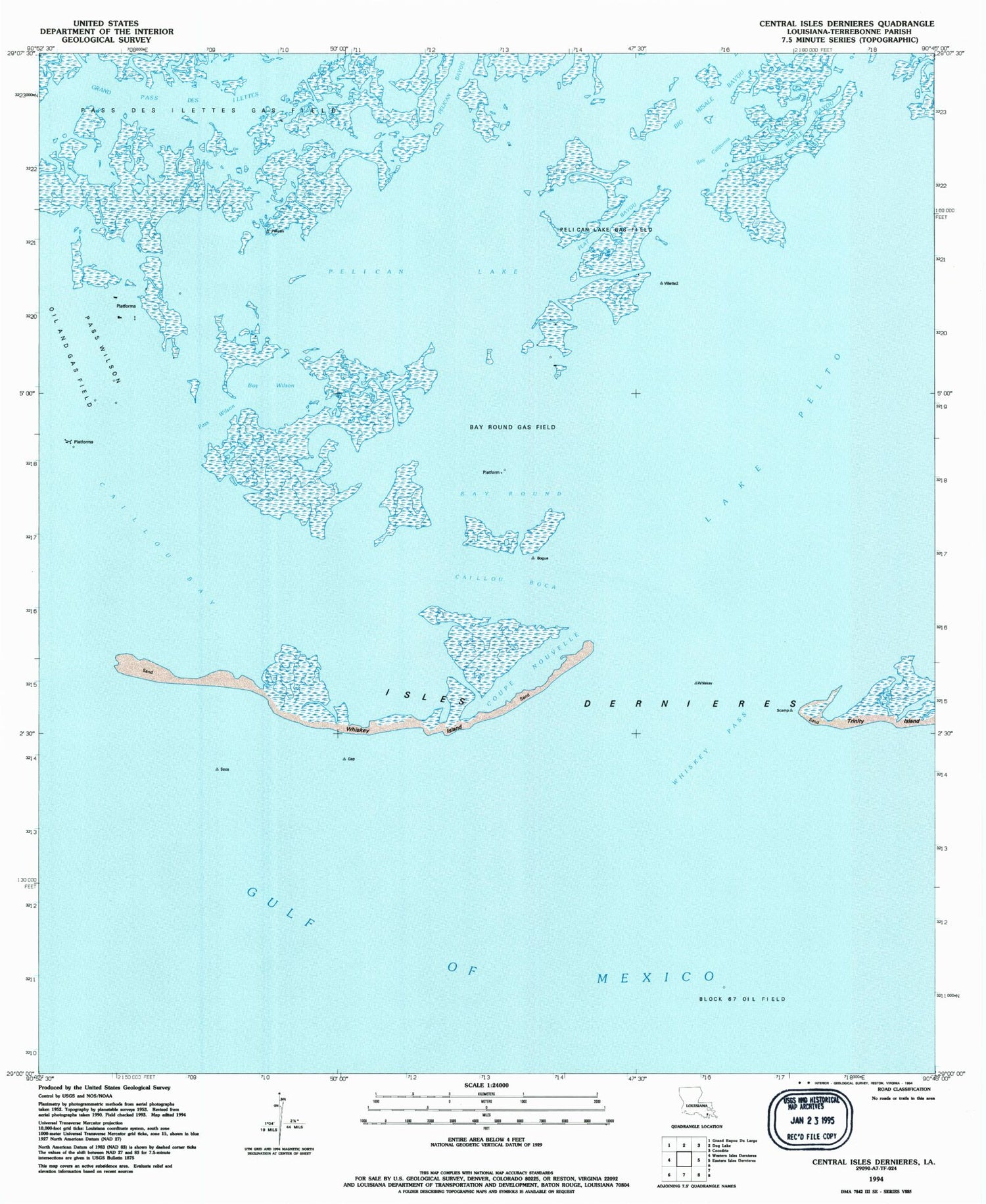
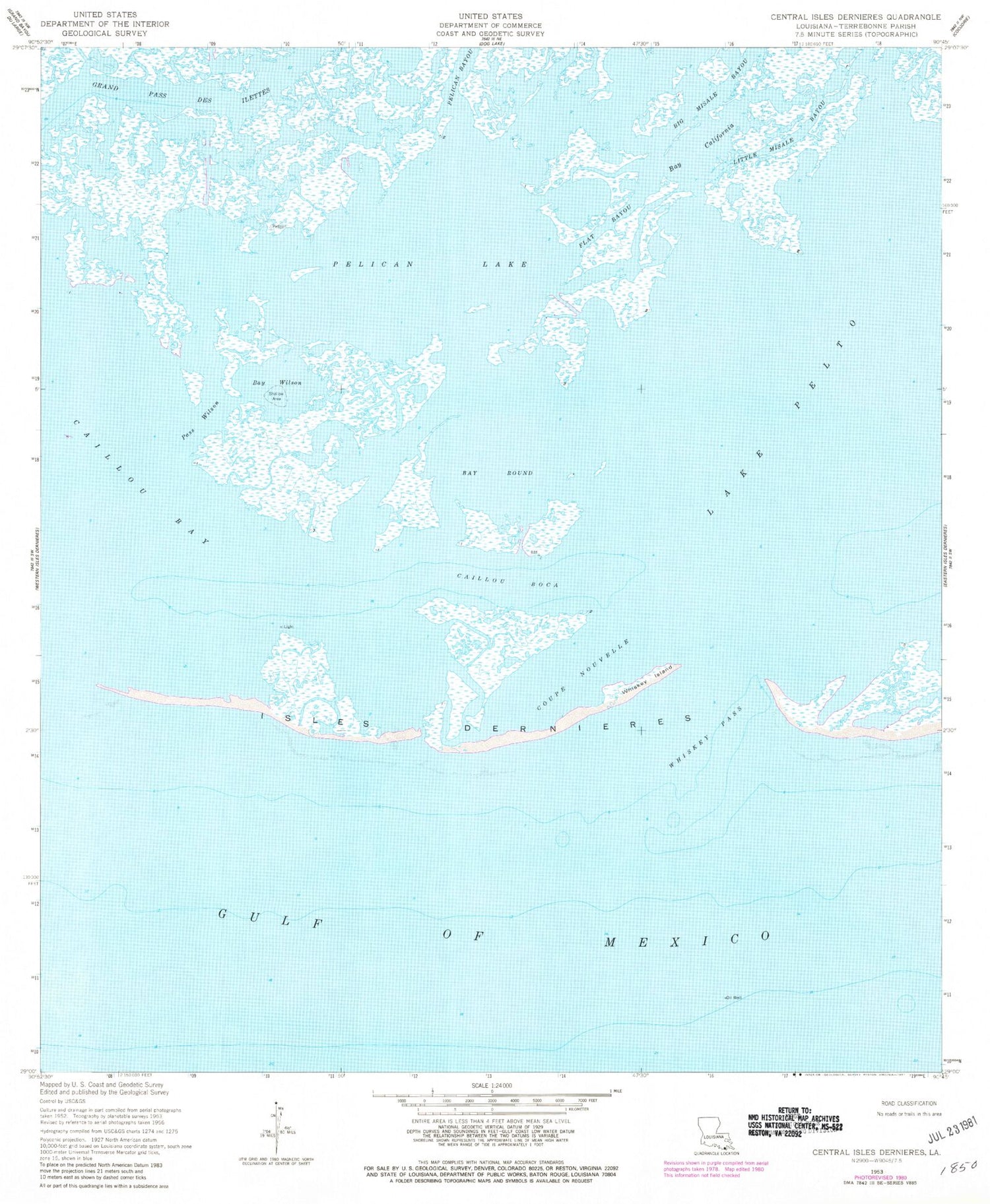
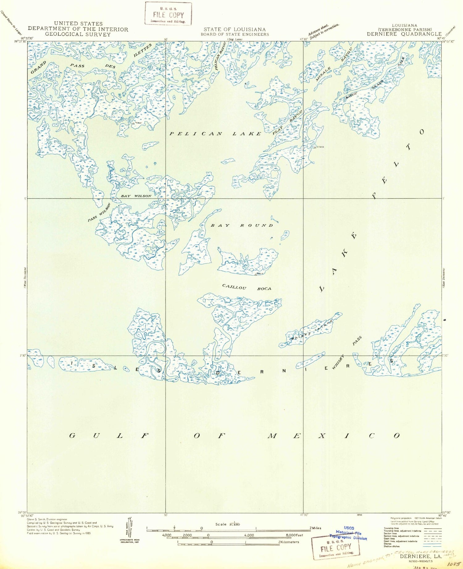
MyTopo
Classic USGS Central Isles Dernieres Louisiana 7.5'x7.5' Topo Map
Regular price
$16.95
Regular price
Sale price
$16.95
Unit price
per
Couldn't load pickup availability
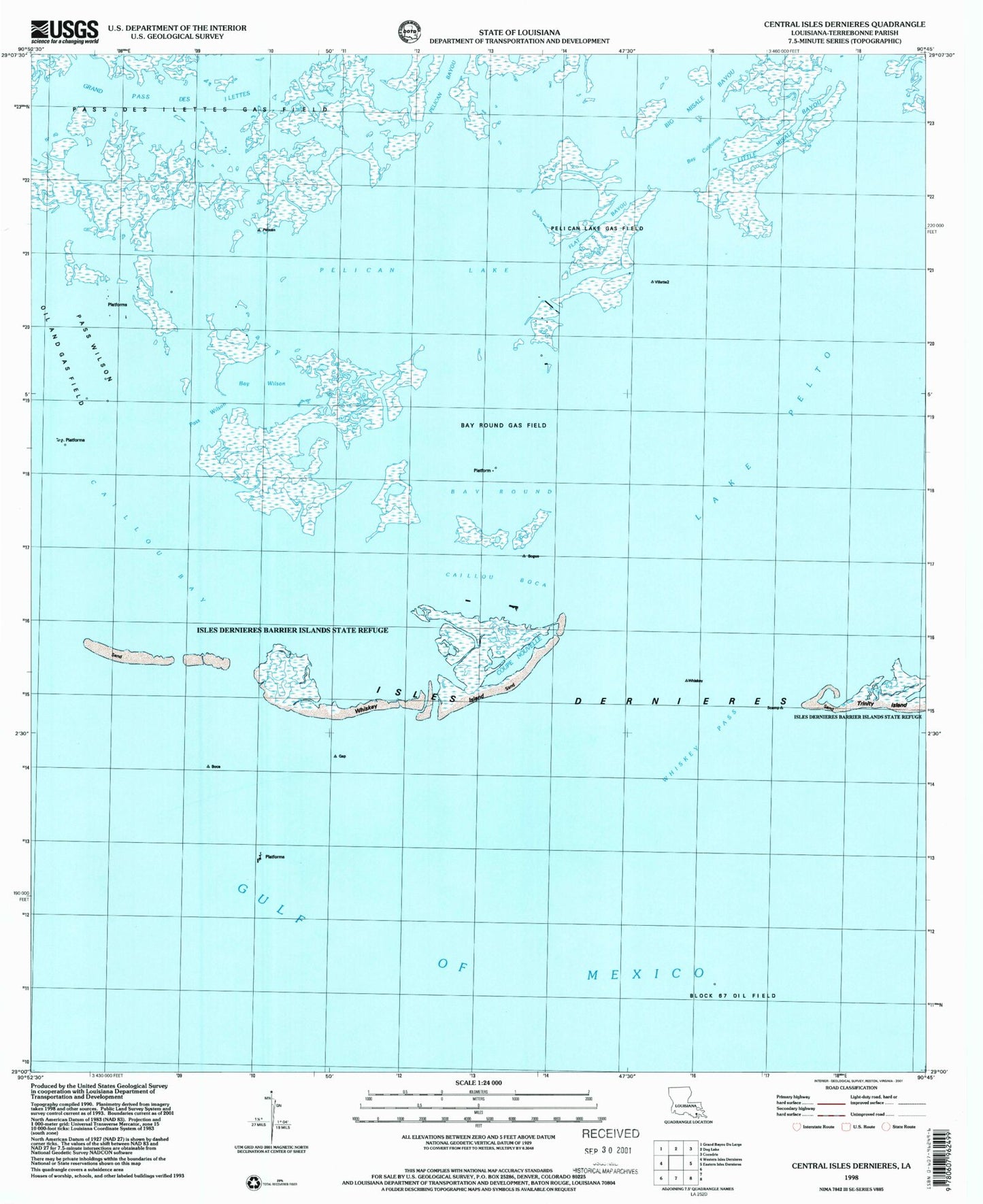
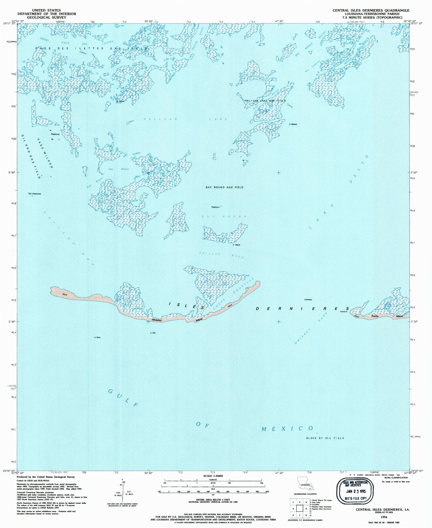
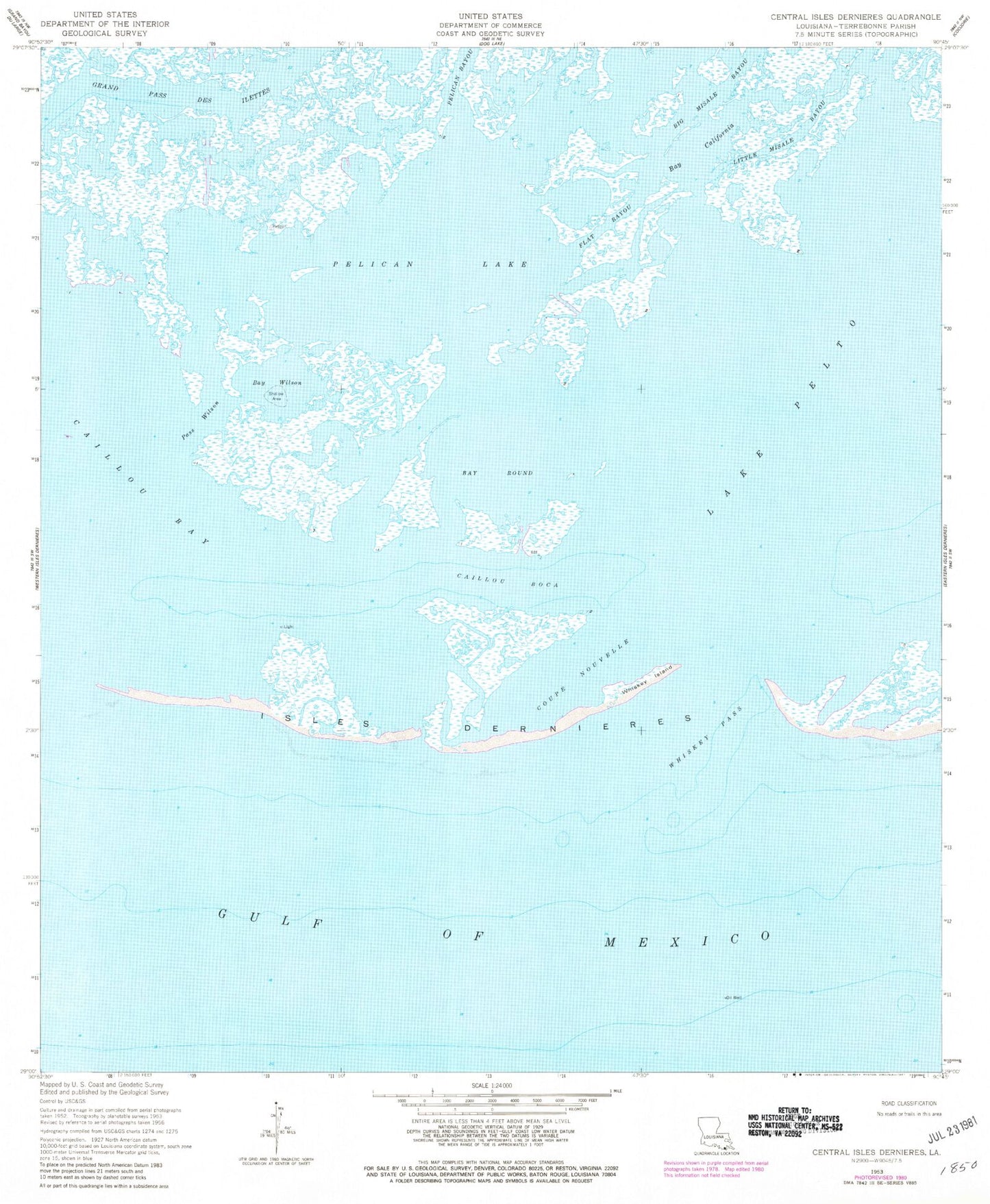
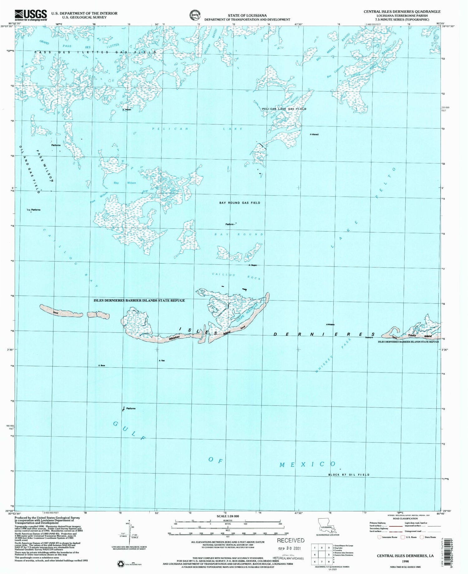
Historical USGS topographic quad map of Central Isles Dernieres in the state of Louisiana. Map scale may vary for some years, but is generally around 1:24,000. Print size is approximately 24" x 27"
This quadrangle is in the following counties: Terrebonne.
The map contains contour lines, roads, rivers, towns, and lakes. Printed on high-quality waterproof paper with UV fade-resistant inks, and shipped rolled.
Contains the following named places: Bay California, Bay Round, Bay Wilson, Caillou Boca, Coupe Nouvelle, Flat Bayou, Isles Dernieres, Pass Wilson, Pelican Bayou, Pelican Lake, Pelican Lake Gas Field, Whiskey Island, Whiskey Pass