
MyTopo
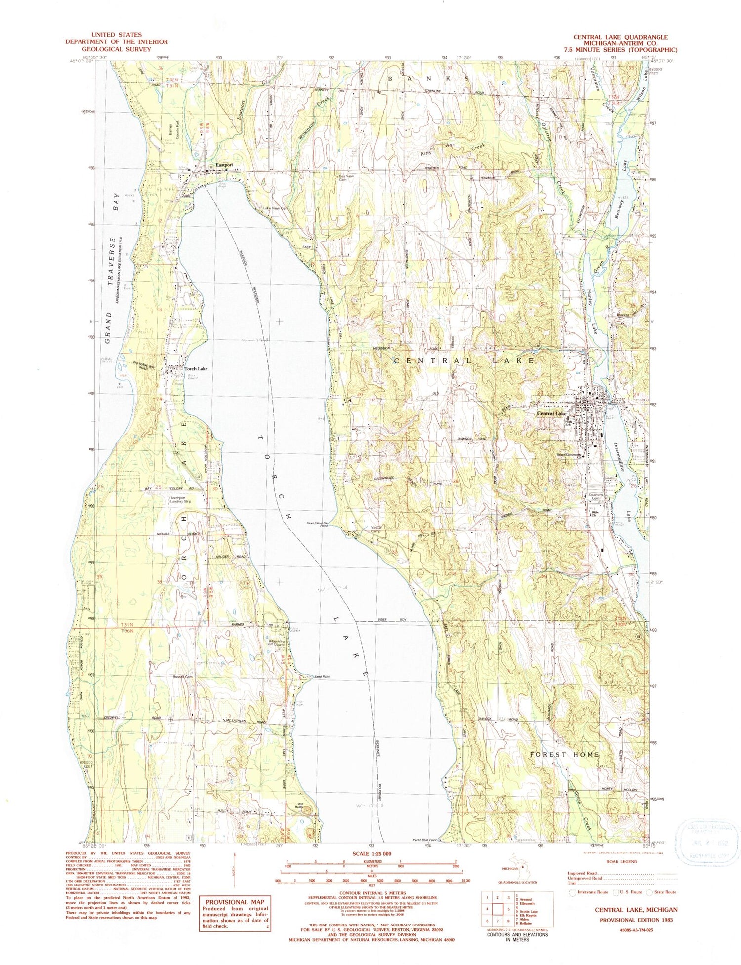
Classic USGS Central Lake Michigan 7.5'x7.5' Topo Map
Couldn't load pickup availability
Historical USGS topographic quad map of Central Lake in the state of Michigan. Map scale may vary for some years, but is generally around 1:24,000. Print size is approximately 24" x 27"
This quadrangle is in the following counties: Antrim.
The map contains contour lines, roads, rivers, towns, and lakes. Printed on high-quality waterproof paper with UV fade-resistant inks, and shipped rolled.
Contains the following named places: A-Ga-Ming Golf Course, Barnes County Park, Bay View Cemetery, Ben-way Lake, Bible Church, Central Lake, Central Lake District Library, Central Lake Elementary School, Central Lake Family Health Center, Central Lake High School, Central Lake Police Department, Central Lake Post Office, Central Lake Station, Central Lake Township Fire Department, Central Lake Township Hall, Central Lakes Seventh Day Adventist Church, Cherry View Orchards, Coulter Creek, Creswell, Creswell Post Office, Eastport, Eastport Baptist Church, Eastport Census Designated Place, Eastport Creek, Eastport Post Office, Eastport Village Care Home, Factoryville Post Office, Grace Community Church, Green River, Greenwood Grange School, Hanley Lake, Hayo-Went-Ha Point, Kitty Ann Creek, Knowles Creek, Lake View Cemetery, Ogletree Creek, Old Baldy, Russell Cemetery, Sand Point, Southern Cemetery, Thurston Park, Torch Lake, Torch Lake Post Office, Torch Lake Township Emergency Medical Services, Torch Lake Township Fire Department, Torch Lake Township Fire Department North Station, Torch Lake Township Hall, Torchport Airport, Township of Central Lake, Township of Torch Lake, Village of Central Lake, Vonstraten Creek, Wilkinson Creek, Yacht Club Point, YMCA Camp, ZIP Codes: 49622, 49627


