MyTopo
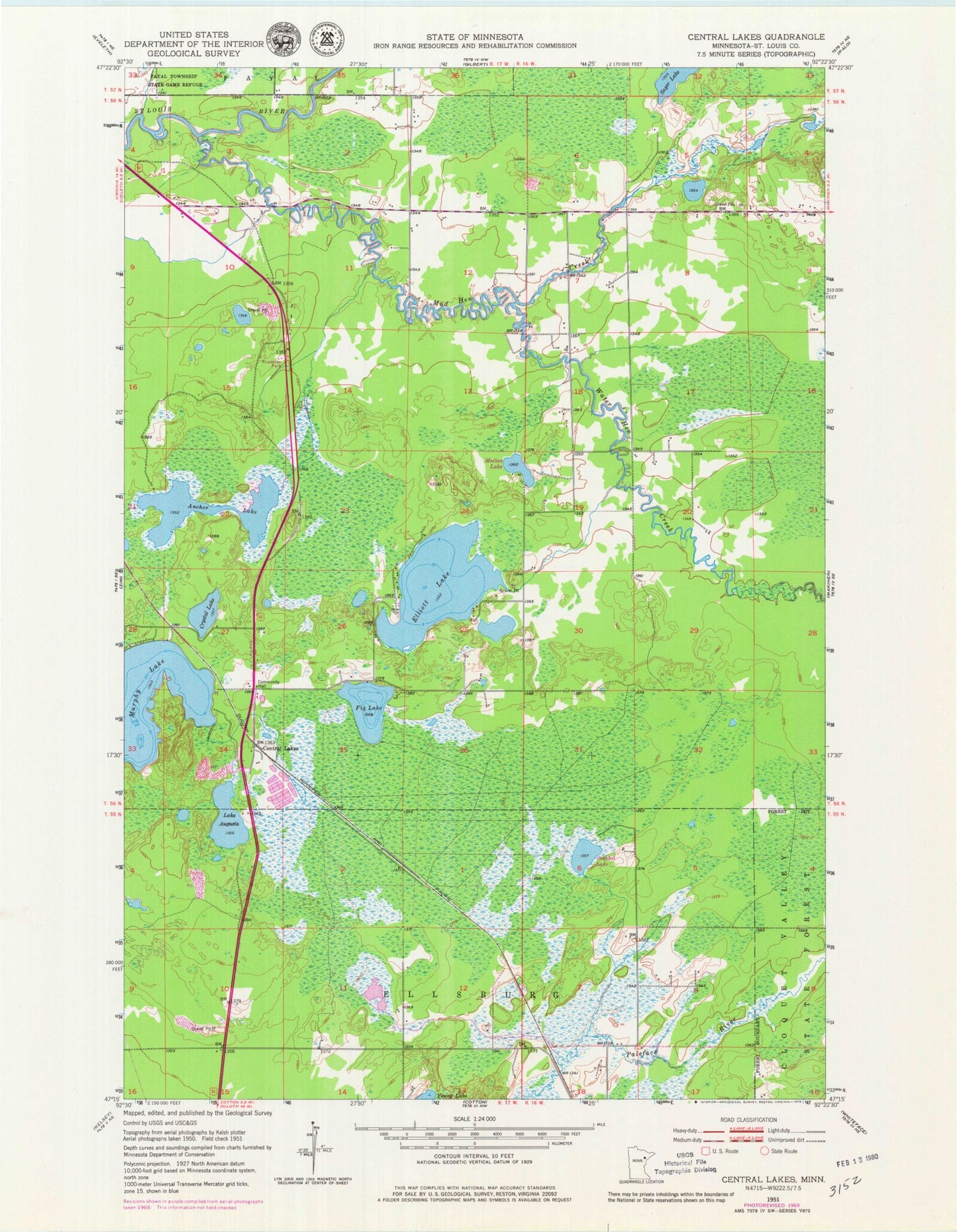
Classic USGS Central Lakes Minnesota 7.5'x7.5' Topo Map
Couldn't load pickup availability
Historical USGS topographic quad map of Central Lakes in the state of Minnesota. Map scale may vary for some years, but is generally around 1:24,000. Print size is approximately 24" x 27"
This quadrangle is in the following counties: St. Louis.
The map contains contour lines, roads, rivers, towns, and lakes. Printed on high-quality waterproof paper with UV fade-resistant inks, and shipped rolled.
Contains the following named places: Anchor Lake, Anchor Lake Travel Information Center, Central Lakes, Central Lakes Fire Department and Community Organization Station 1, Central Lakes Fire Department and Community Organization Station 2, Central Lakes Post Office, Central Lakes Station, Crystal Lake, Elliott Lake, Fig Lake, Lake Augusta, Makinen Fire Department, Moilan Lake, Mud Hen Creek, Murphy Lake, Paleface Creek, Sayer Lake, Seasted Lake, Three-Way Continental Divide Historical Marker, Unorganized Territory of Heikkala Lake, Unorganized Territory of Makinen, Water Hen Creek, ZIP Codes: 55734, 55766