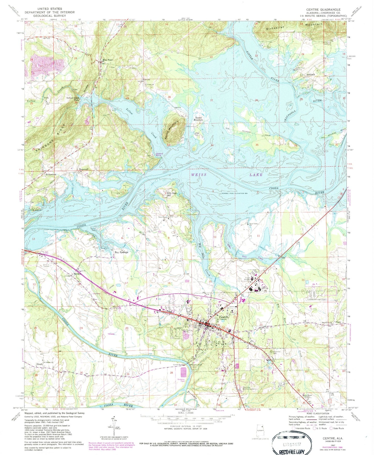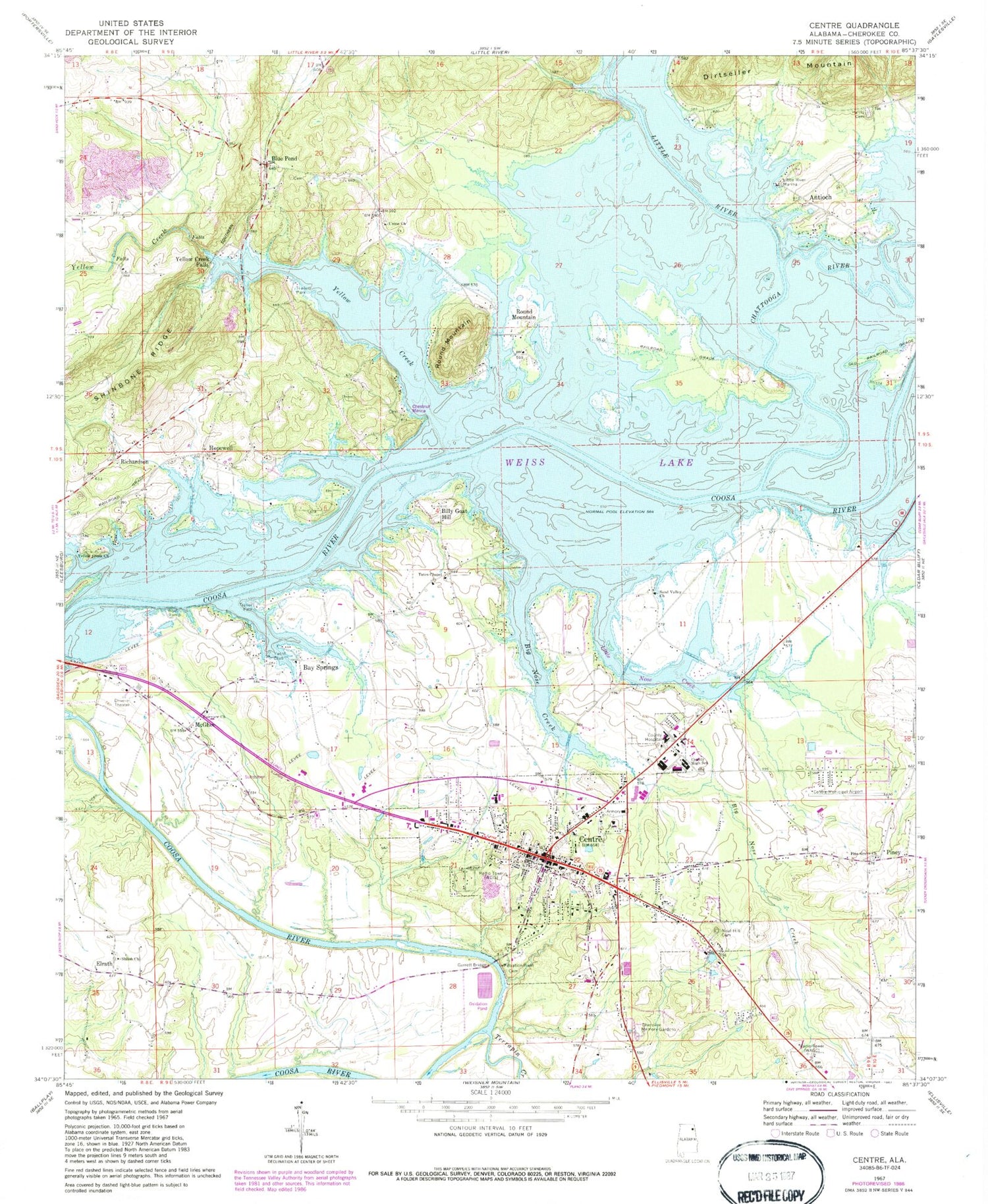
MyTopo
Classic USGS Centre Alabama 7.5'x7.5' Topo Map
Couldn't load pickup availability
Historical USGS topographic quad map of Centre in the state of Alabama. Typical map scale is 1:24,000, but may vary for certain years, if available. Print size: 24" x 27"
This quadrangle is in the following counties: Cherokee.
The map contains contour lines, roads, rivers, towns, and lakes. Printed on high-quality waterproof paper with UV fade-resistant inks, and shipped rolled.
Contains the following named places: Antioch, Bay Springs, Big Nose Creek, Billy Goat Hill, Centre, Cherokee Memory Gardens Cemetery, Fairview Methodist Church, Garrett Bridge, Harris Cemetery, Hatcher High School, Hopewell, Little River Marina, McGhee, Neal Hill Cemetery, Piney, Richardson, Round Mountain, Round Mountain, Weiss Lake, Yellow Creek Falls, Centre Municipal Airport (historical), Anderson Cove, Antioch Estates, Cherokee Medical Center, Bay View Estates, Black Mallard Cove, Bradford Ferry (historical), Brooks Estates, Buffingtons Island, Centre Cemetery, Centre Church, Centre City Park, Centre Elementary School, Centre Middle School, Cherokee County Courthouse, Cherokee County High School, Cherokee County Health and Rehabilitation Center, Cherokee Plaza Shopping Center, Chesnut Cemetery, Chestnut Cove, Edwards Ferry (historical), Ethel Morrison Memorial Park, Ewing Ferry (historical), Fairview United Methodist Church Cemetery, Garrett Cemetery, Garrett Ferry (historical), Graveyard Hill, Griffin, Hawthorn Cove, Hog Island, Kingdom Hall Church, Muddy Branch, Northwood Estates, Piney Grove Church Cemetery, Pratt Cemetery, Round Mountain Ironworks (historical), Sand Valley Cemetery, Sewell Cemetery, Shangrila, Shiloh Cemetery, Tates Chapel Baptist Church Cemetery, Turkey Town (historical), Union Church Cemetery, Weiss Dam, Windom Ball Field, Yellow Creek Baptist Church Cemetery, Bay Springs Marina, Centre City Hall, Westmoreland Ferry (historical), Little River, Yellow Creek, Sand Valley Baptist Church, Shiloh Baptist Church, Tates Chapel Baptist Church, Union Methodist Church, Yellow Creek Baptist Church, First Baptist Church of Centre, Round Mountain Baptist Church, Pine Grove Baptist Church, Bothwell Methodist Church, Blue Pond, Elrath, Terrapin Creek, WAGC-AM (Centre), WEIS-AM (Centre), Anderson, Centre Post Office, City of Centre, Davis Fish Farm, Centre Fire Department, Cherokee County Sheriff's Office