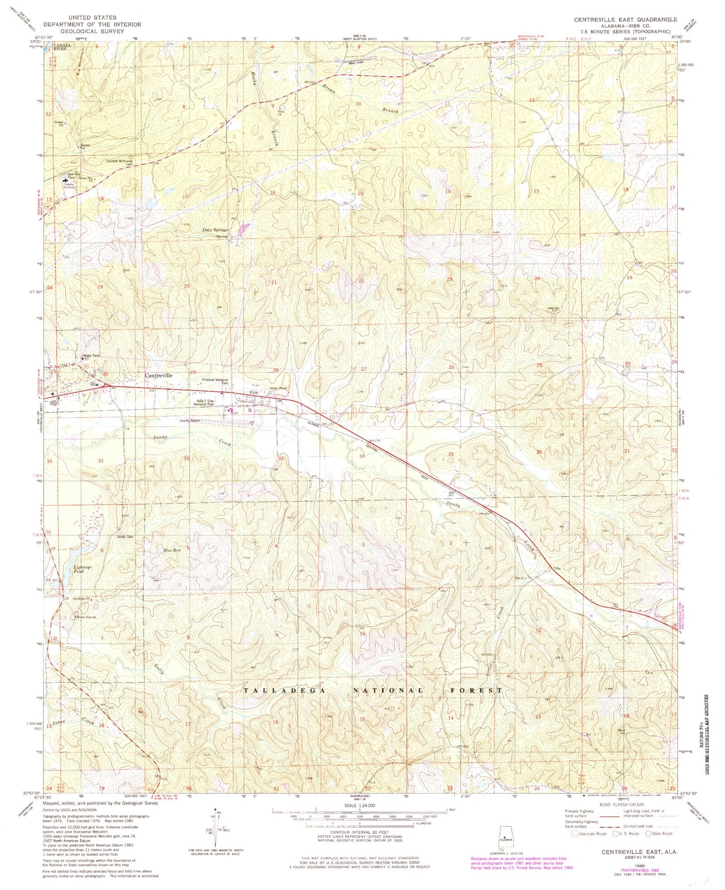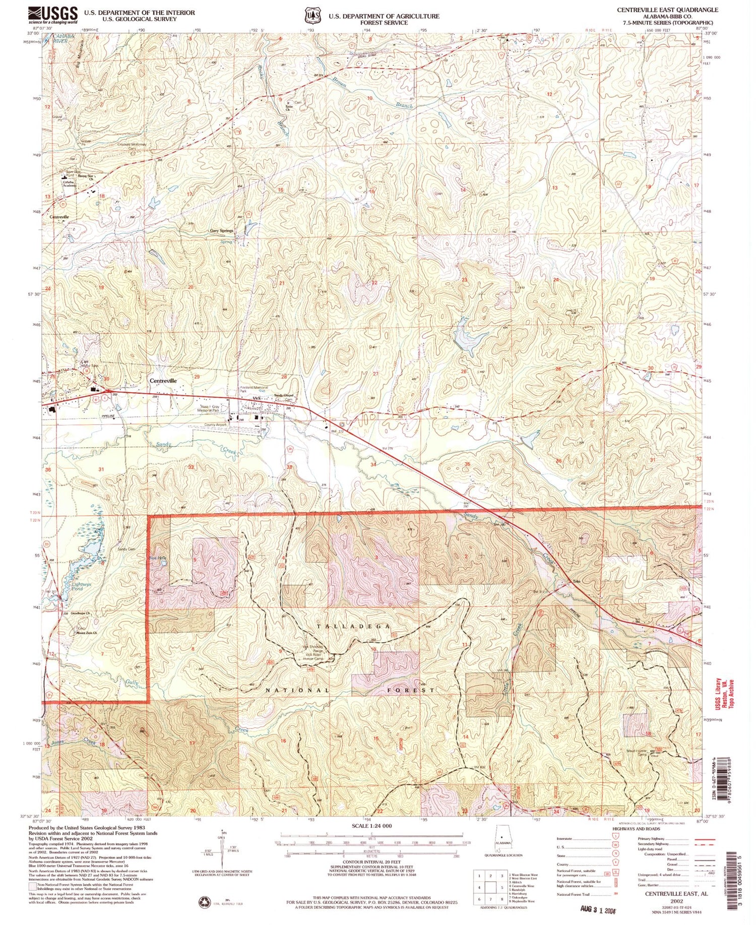
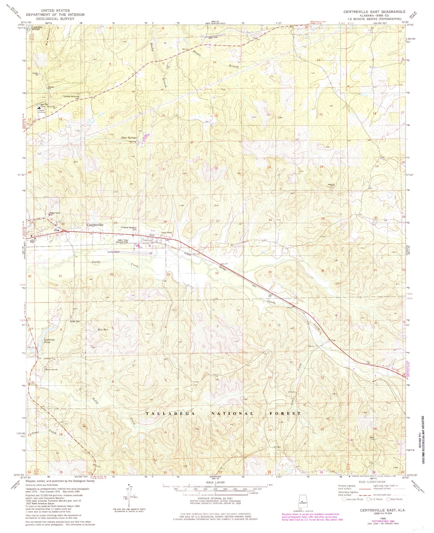
MyTopo
Classic USGS Centreville East Alabama 7.5'x7.5' Topo Map
Couldn't load pickup availability
Historical USGS topographic quad map of Centreville East in the state of Alabama. Map scale may vary for some years, but is generally around 1:24,000. Print size is approximately 24" x 27"
This quadrangle is in the following counties: Bibb.
The map contains contour lines, roads, rivers, towns, and lakes. Printed on high-quality waterproof paper with UV fade-resistant inks, and shipped rolled.
Contains the following named places: Bibb County Airport, Bibb County Training School, Big Branch, Blue Hole, Cahaba Academy, Centreville Elementary School, Centreville Work Center, Crockett McKinney Cemetery, Enon Cemetery, Enon Missionary Baptist Church, Gary Springs, Goodhope Baptist Church, Lightseys Mill Pond Dam, Lightseys Pond, Little Creek, Mount Zion Cemetery, Mount Zion Missionary Baptist Church, Pineland Memorial Park, Rising Star Baptist Church, Ross F Gray Memorial Park, Sandy Cemetery, Sandy Chapel Cemetery, Sandy Chapel United Methodist Church, Soap Hill, Southern Methodist Church, Trio, Vick, Wheeler Mountain, ZIP Code: 35042