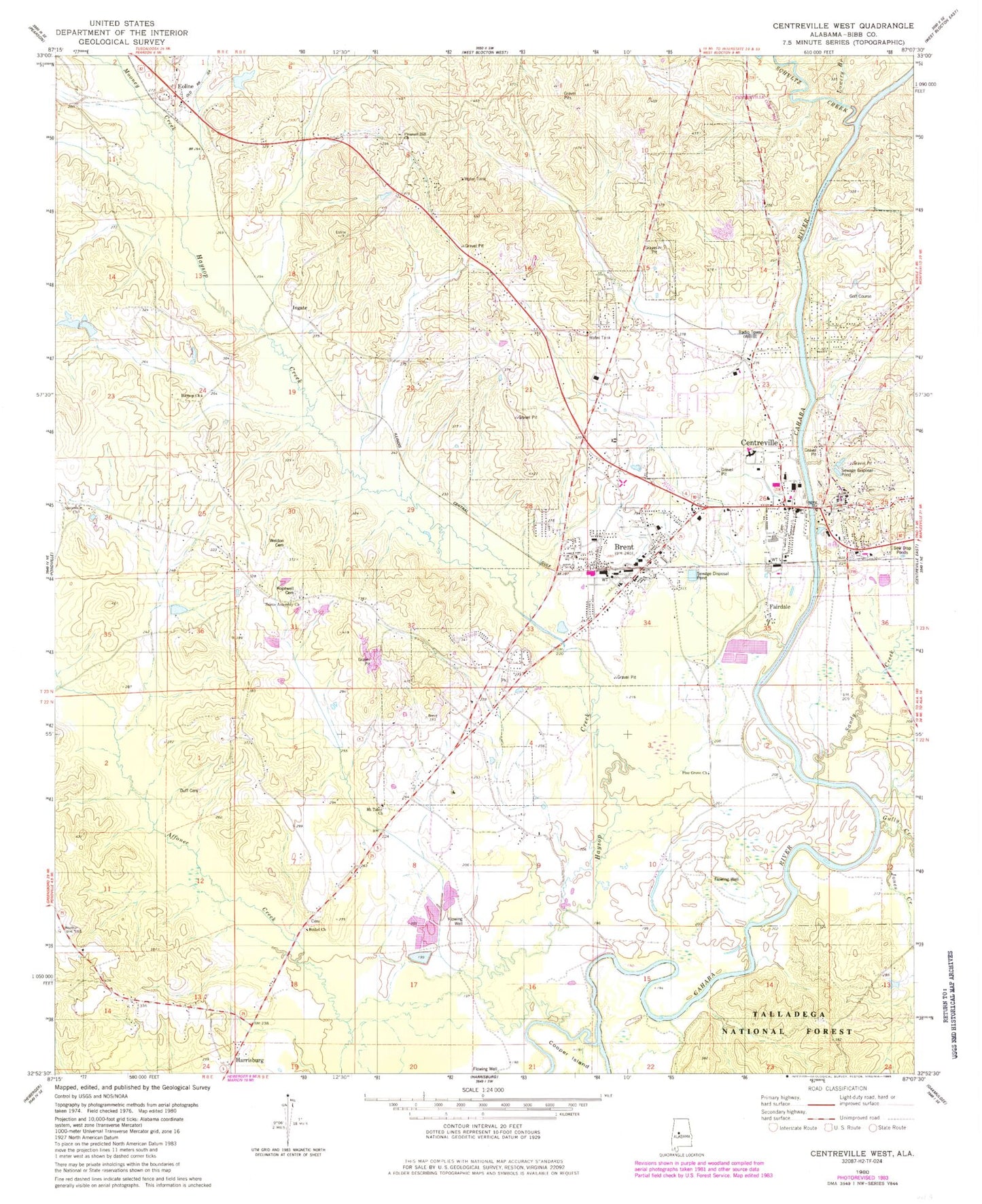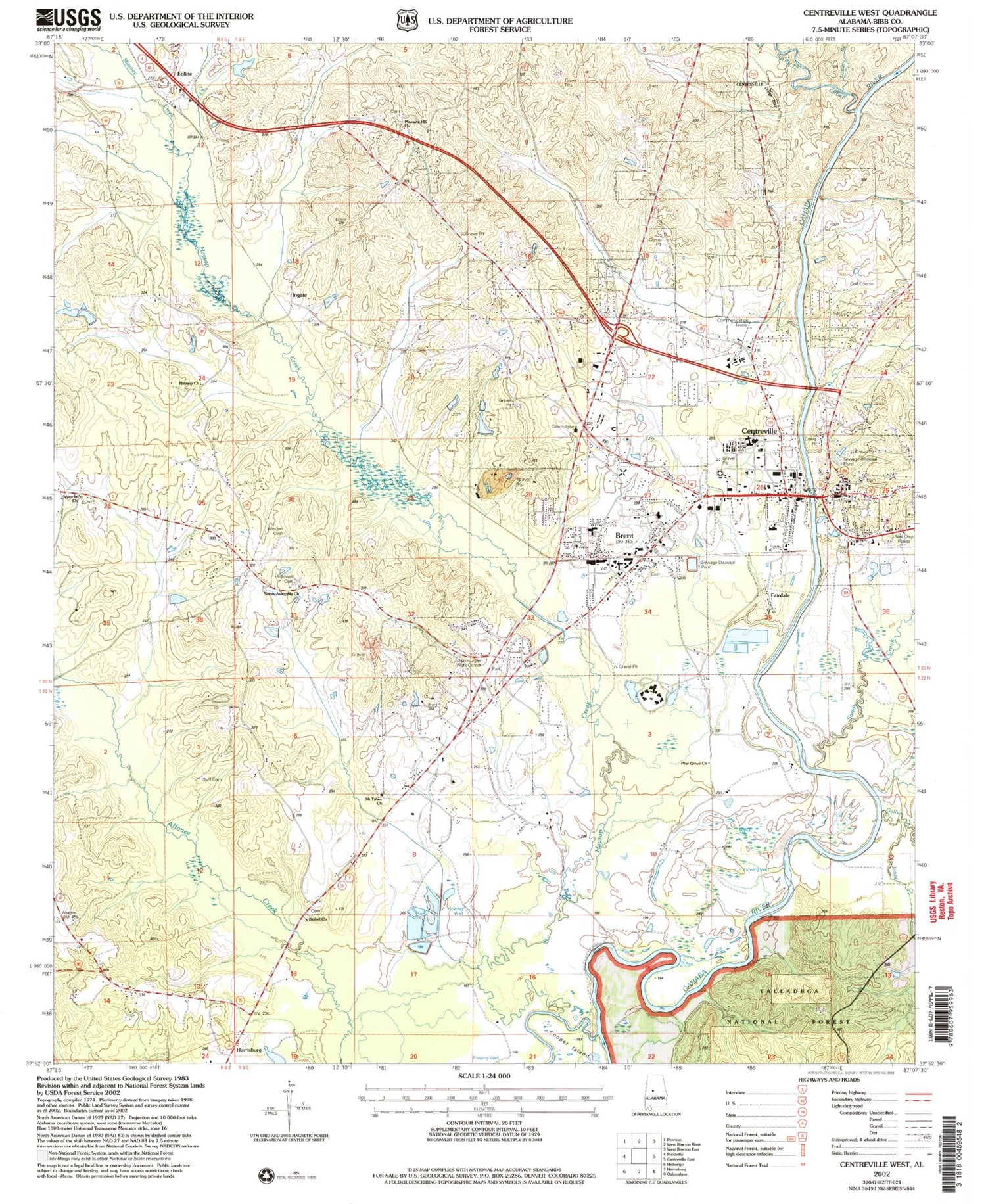
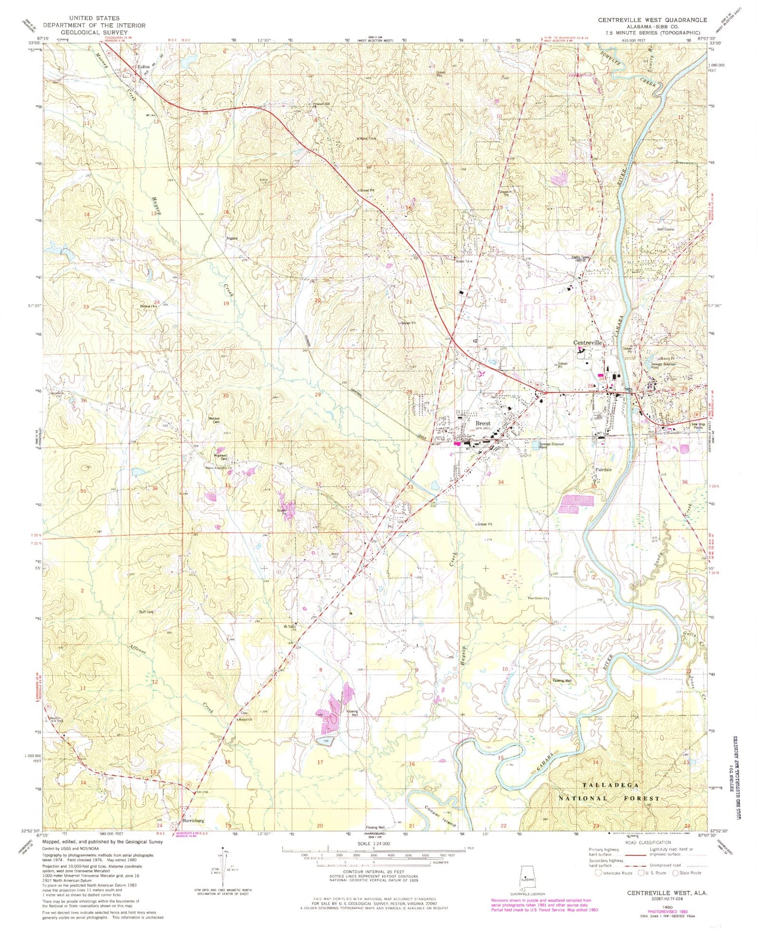
MyTopo
Classic USGS Centreville West Alabama 7.5'x7.5' Topo Map
Couldn't load pickup availability
Historical USGS topographic quad map of Centreville West in the state of Alabama. Map scale may vary for some years, but is generally around 1:24,000. Print size is approximately 24" x 27"
This quadrangle is in the following counties: Bibb.
The map contains contour lines, roads, rivers, towns, and lakes. Printed on high-quality waterproof paper with UV fade-resistant inks, and shipped rolled.
Contains the following named places: Avery Pond, Bethel Baptist Church, Bethel Cemetery, Bibb Correctional Facility, Bibb County, Bibb County Courthouse, Bibb County High School, Bibb County Junior High School, Bibb County Sheriff's Office, Bibb Medical Center, Bill Branch, Brent, Brent Baptist Church, Brent Cemetery, Brent Church of God, Brent Elementary School, Brent Police Department, Brent Post Office, Brent Presbyterian Church, Brent Volunteer Fire Department, Brent-Centreville Public Library, Calvary Baptist Church, Centreville, Centreville Baptist Church, Centreville Ferry, Centreville First Presbyterian Church, Centreville Memorial Cemetery, Centreville Police Department, Centreville Post Office, Centreville United Methodist Church, Centreville Volunteer Fire Department, Centreville Weather Station, Centreville-Brent Division, Choctaw Hills, City of Brent, City of Centreville, Congo Creek, Cooper Island, Cooper Pasture Branch, Dry Hollow Branch, Duff Cemetery, Duff Settlement, East Centreville, East Town, Eoline, Eoline Baptist Church, Eoline Church, Eoline Elementary School, Eoline Volunteer Fire Department Station 1, Fairdale, Four Points Baptist Church, Goodson, Goodson Bottoms, Gully Creek, Harrisburg, Haysop Church, Haysop Creek, Hopewell African Methodist Episcopal Church, Hopewell Cemetery, Horse Branch, Howard Cooper Bridge, Ingate, James Cemetery, Jamesville, Jones Creek, Lowery Branch, Mooney Creek, Mount Tabor Baptist Church, Mount Tabor Elementary School, Oakmulgee District Ranger Office, Penootaw, Pine Grove Church, Pineview Baptist Church, Pleasant Hill, Pleasant Hill Cemetery, Pleasant Hill Presbyterian Church, Pleasant Valley Baptist Church, Saints Assembly Church, Sandy Creek, Schultz Creek, Shiloh Baptist Church, Smith Creek, Spencer, Spencer Nazarene Church, WBIB-AM (Centreville), Weldon Cemetery, West Centreville, Youngbloods Ferry, Zulu