MyTopo
Classic USGS Cerbat Arizona 7.5'x7.5' Topo Map
Couldn't load pickup availability
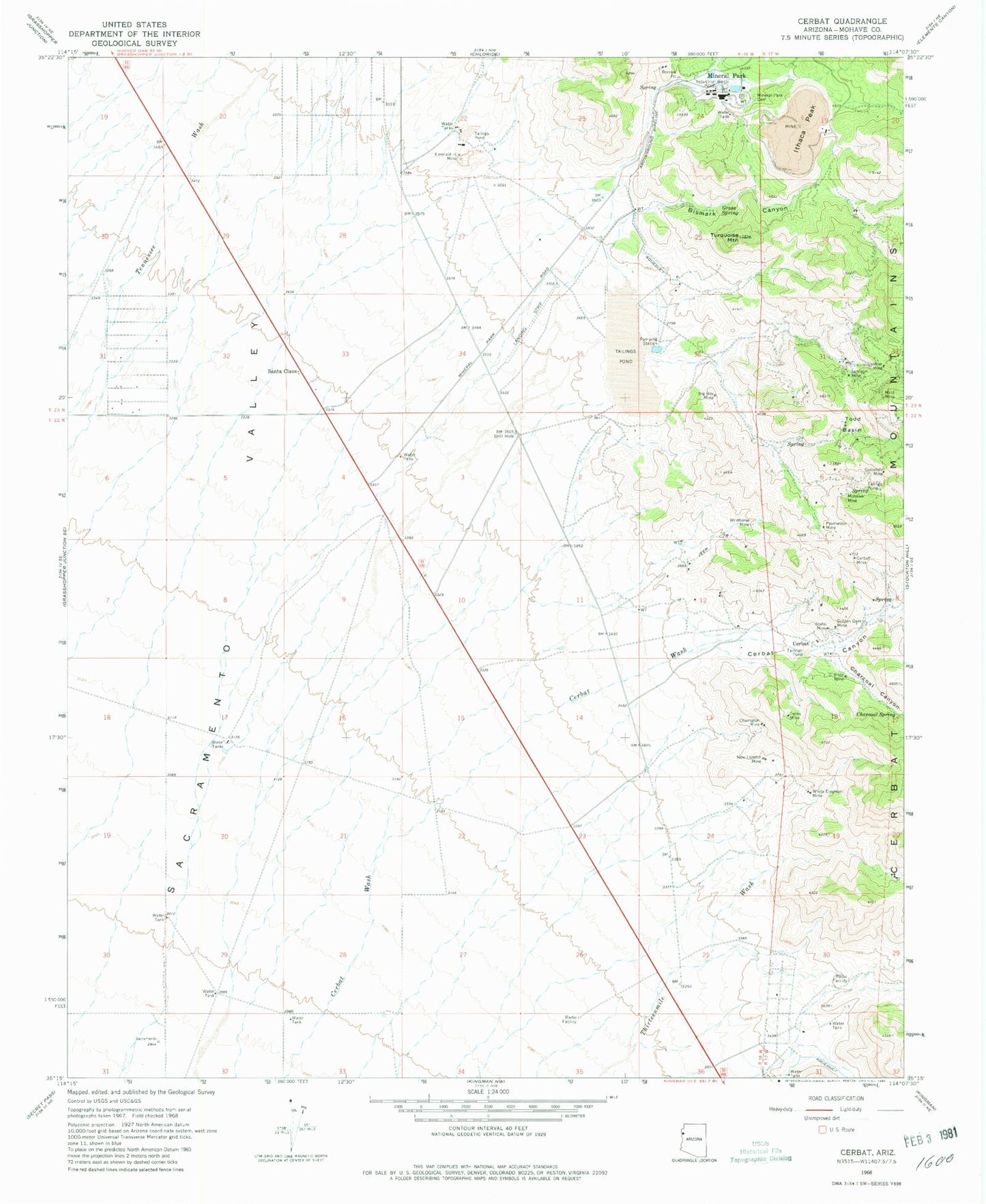
Historical USGS topographic quad map of Cerbat in the state of Arizona. Map scale may vary for some years, but is generally around 1:24,000. Print size is approximately 24" x 27"
This quadrangle is in the following counties: Mohave.
The map contains contour lines, roads, rivers, towns, and lakes. Printed on high-quality waterproof paper with UV fade-resistant inks, and shipped rolled.
Contains the following named places: Big Boy Mine, Bismark Canyon, Cashier Mine, Cerbat, Cerbat Canyon, Cerbat Mine, Champion Mine, Charcoal Canyon, Charcoal Spring, Emerald Isle Mine, Golconda Mine, Golden Gem Mine, Gross Spring, Idaho Mine, Ithaca Peak, Jamison Mine, Mineral Park, Mineral Park Cemetery, Mint Mine, Mohawk Mine, New London Mine, O'Brien Mine, Paymaster Mine, Santa Claus, So-Hi Census Designated Place, Todd Basin, Turquoise Mountain, Twins Mine, White Elephant Mine, Wildhorse Mine