
MyTopo
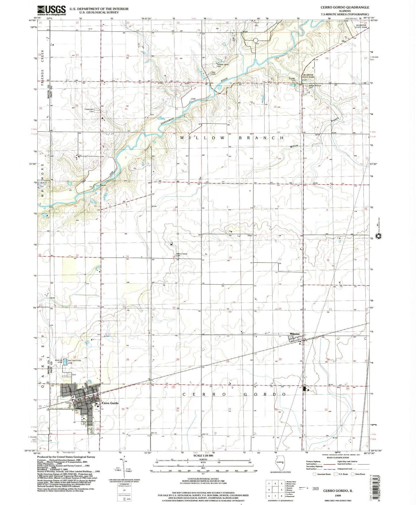
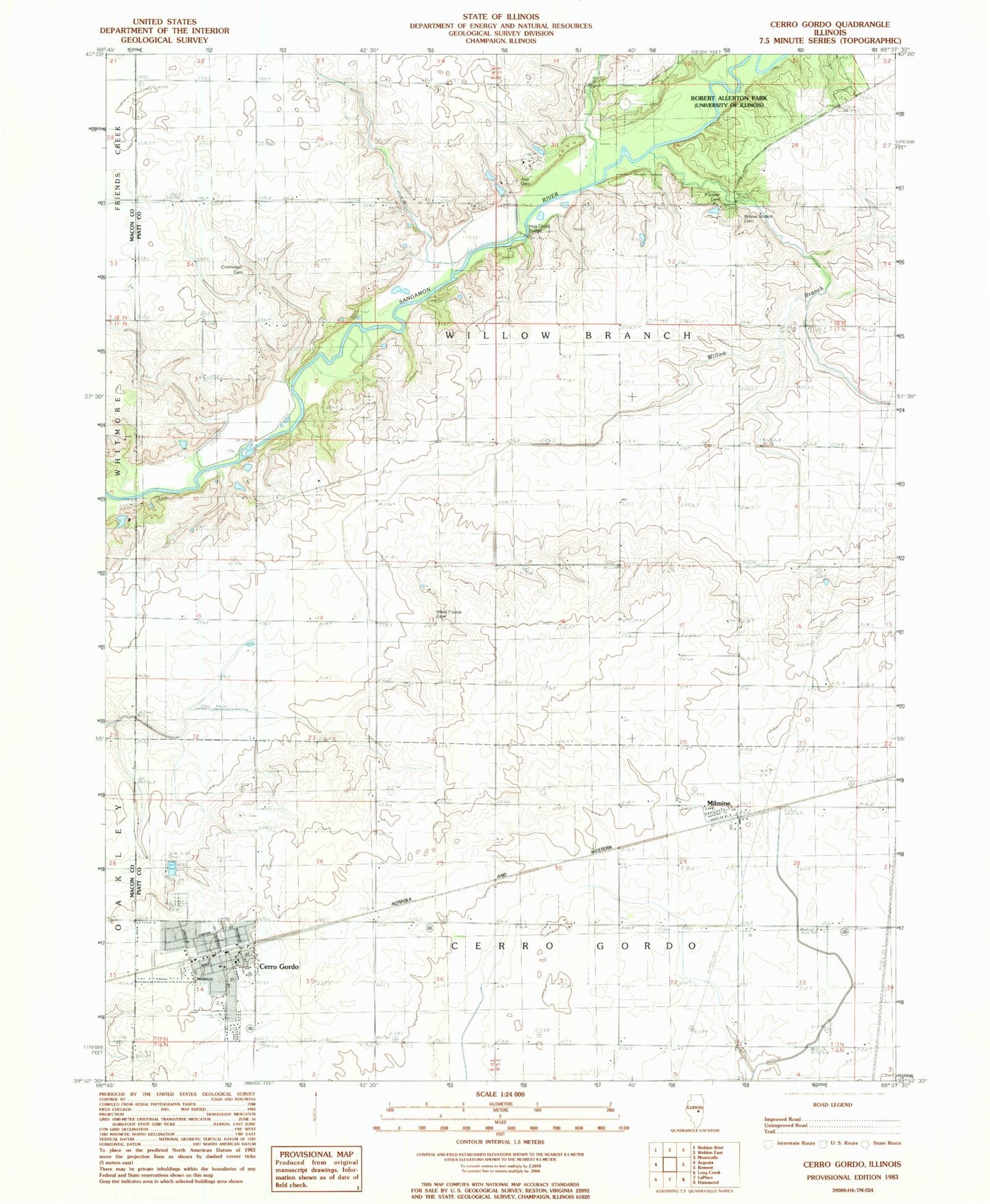
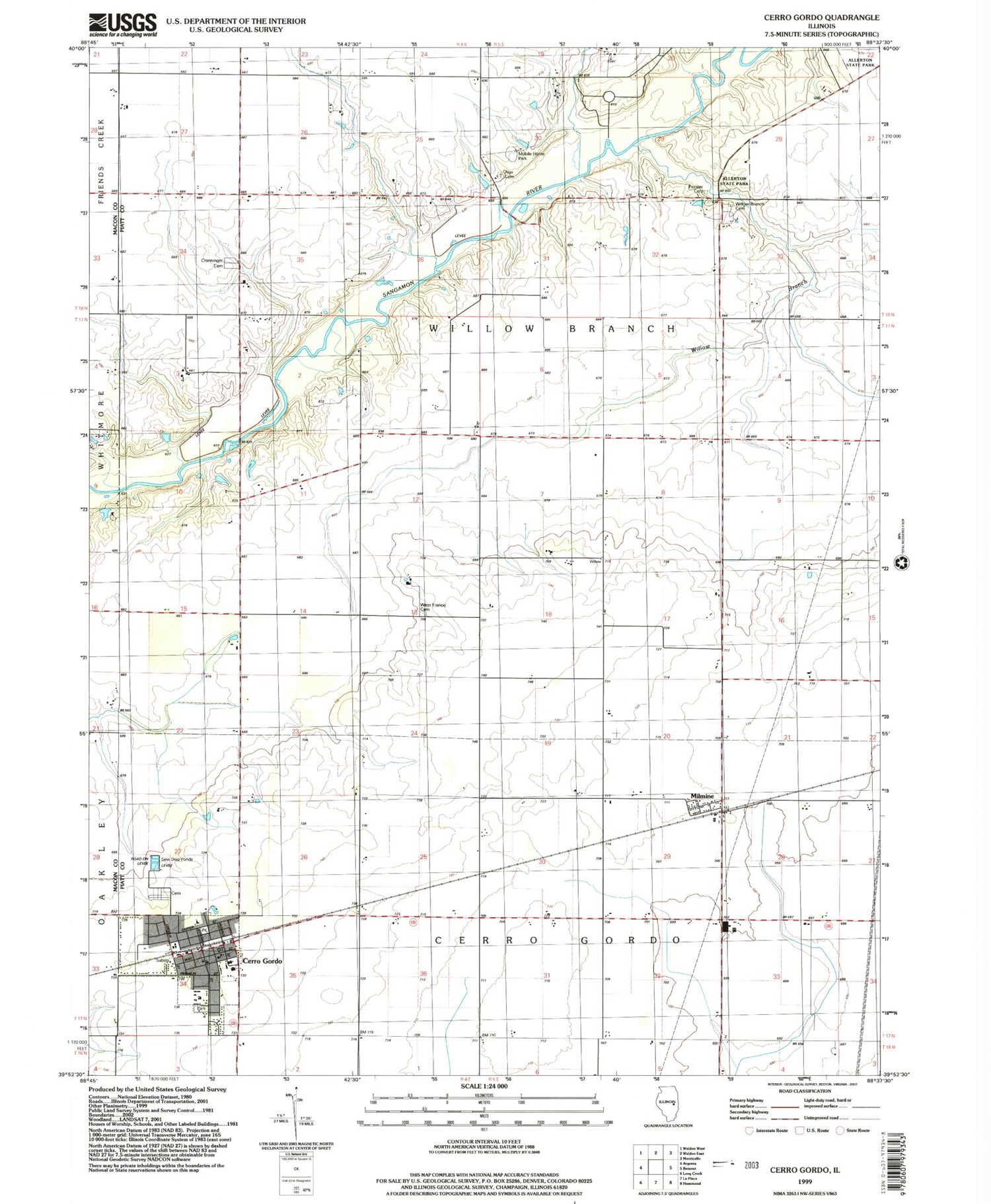
Classic USGS Cerro Gordo Illinois 7.5'x7.5' Topo Map
Couldn't load pickup availability
Historical USGS topographic quad map of Cerro Gordo in the state of Illinois. Typical map scale is 1:24,000, but may vary for certain years, if available. Print size: 24" x 27"
This quadrangle is in the following counties: Macon, Piatt.
The map contains contour lines, roads, rivers, towns, and lakes. Printed on high-quality waterproof paper with UV fade-resistant inks, and shipped rolled.
Contains the following named places: Ater Cemetery, Cerro Gordo, Croninger Cemetery, Milmine, East Frantz Cemetery, Willow Branch, Willow Branch Cemetery, County Line Bridge, Hog Chute Bridge, Township of Willow Branch, Cerro Gordo Cemetery, Cerro Gordo Elementary School, Cerro Gordo High School, Cerro Gordo Junior High School, Pioneer Cemetery, United Methodist Church of Cerro Gordo, Village of Cerro Gordo, Cerro Gordo Community Ambulance Service, Gaitros Airport (historical), Norfleet Airport, Cerro Gordo Fire Protection District, Cerro Gordo Village Police Department, Gaitros STOL Airport, Cerro Gordo Post Office