MyTopo
Classic USGS Cerro Hueco New Mexico 7.5'x7.5' Topo Map
Regular price
$16.95
Regular price
Sale price
$16.95
Unit price
per
Couldn't load pickup availability
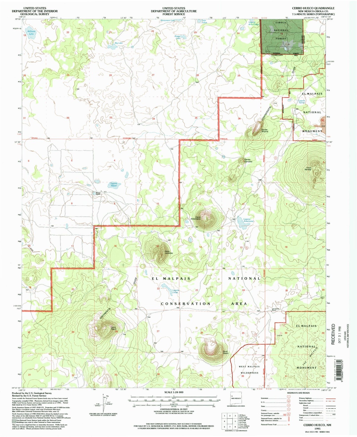
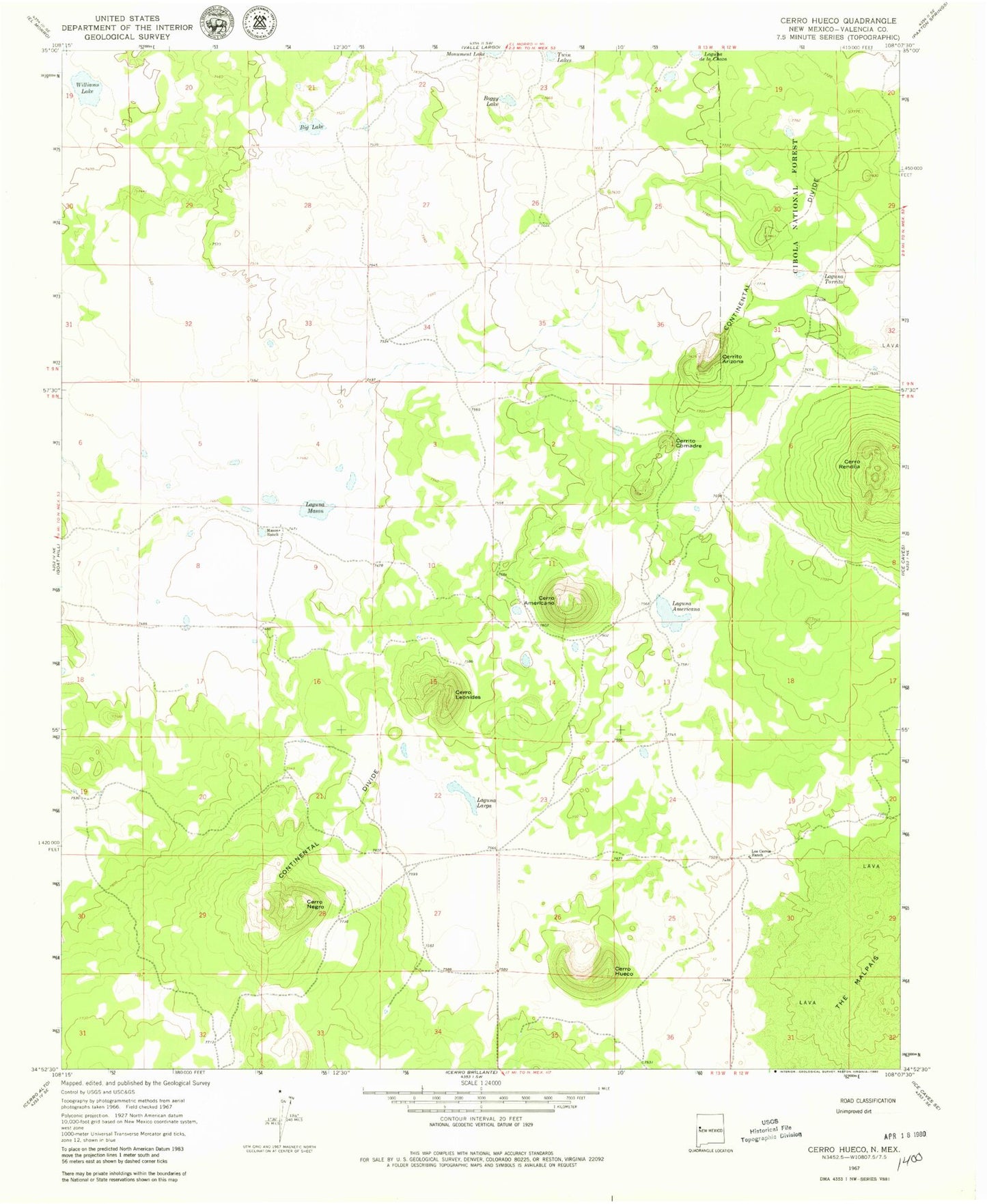
Historical USGS topographic quad map of Cerro Hueco in the state of New Mexico. Map scale may vary for some years, but is generally around 1:24,000. Print size is approximately 24" x 27"
This quadrangle is in the following counties: Cibola.
The map contains contour lines, roads, rivers, towns, and lakes. Printed on high-quality waterproof paper with UV fade-resistant inks, and shipped rolled.
Contains the following named places: Big Lake, Boggy Lake, Cerrito Arizona, Cerrito Comadre, Cerro Americano, Cerro Hueco, Cerro Leonides, Cerro Negro, Cerro Rendija, Jacks Peak, Laguna Americana, Laguna Larga, Laguna Mason, Laguna Tarrito, Los Cerros Ranch, Mason Ranch, Twin Lakes, Williams Lake