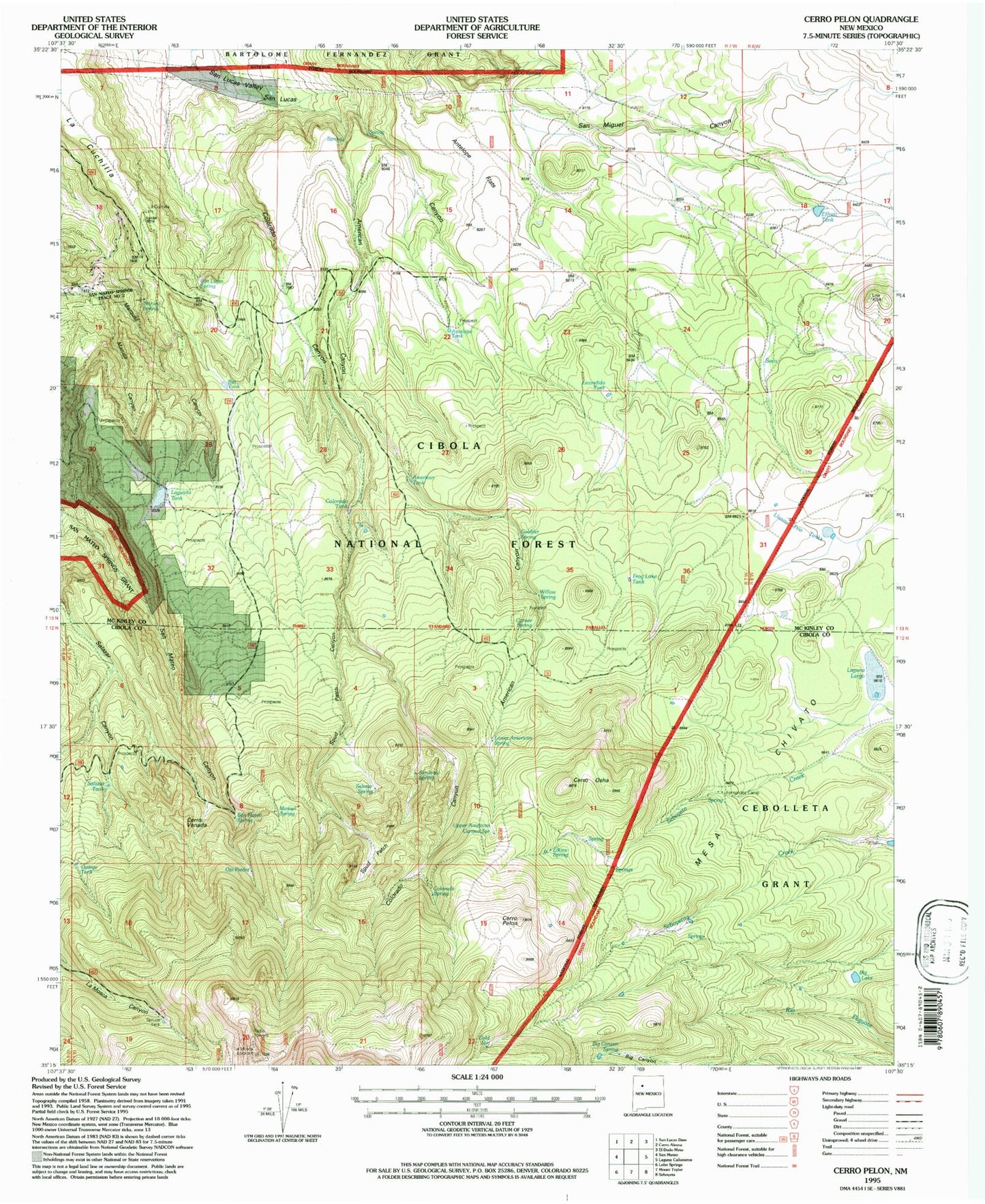
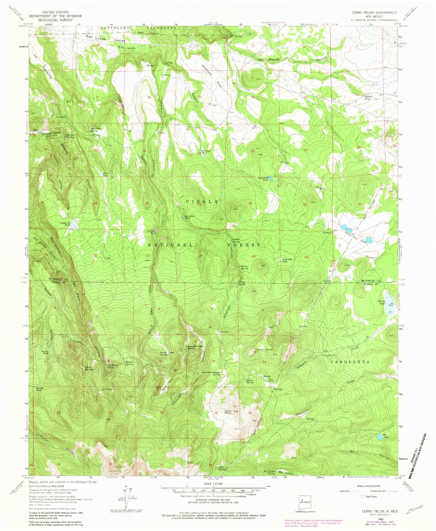
MyTopo
Classic USGS Cerro Pelon New Mexico 7.5'x7.5' Topo Map
Couldn't load pickup availability
Historical USGS topographic quad map of Cerro Pelon in the state of New Mexico. Typical map scale is 1:24,000, but may vary for certain years, if available. Print size: 24" x 27"
This quadrangle is in the following counties: Cibola, McKinley.
The map contains contour lines, roads, rivers, towns, and lakes. Printed on high-quality waterproof paper with UV fade-resistant inks, and shipped rolled.
Contains the following named places: American Canyon, Upper American Canyon Spring, American Tank, Antelope Flats, Antelope Tank, Big Canyon Spring, Big Lake, CCC Spring, Cerro Osha, Cerro Pelon, Cerro Venada, Cold Spring, Colorado Tank, Corner Spring, Effran Tank, Elkins Camp, Elkins Spring, Escondido Tank, Fernandez Camp, Frog Lake Tank, George Tank, Gobbler Spring, La Cuchilla, Laguna Largo, Lagunita Tank, Llanito Frio Tanks, Manuel Spring, Maruca Canyon, Maruca Spring, Ojo Piedra, Salazar Spring, Salazar Tank, San Lucas Spring, San Mateo Spring, Sandoval Spring, Silt Tank, Spud Patch, Spud Patch Canyon, Willow Spring, Lower American Spring, La Mosca Lookout Tower, Cold Spring Water Well, Spruce Tank, Seco, KLLT-FM (Grants), La Cuchilla Pit Mine, San Mateo Springs Tract Number Two, Colorado Spring