MyTopo
Classic USGS Cerro Pomo New Mexico 7.5'x7.5' Topo Map
Regular price
$16.95
Regular price
Sale price
$16.95
Unit price
per
Couldn't load pickup availability
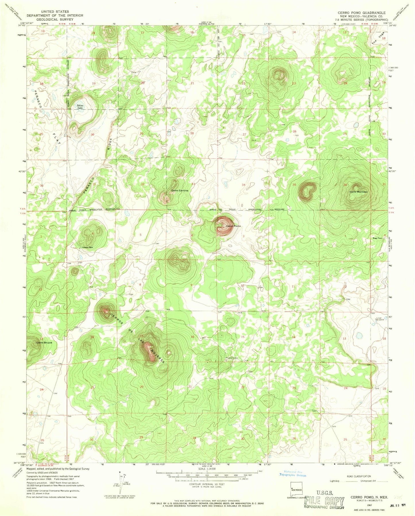
Historical USGS topographic quad map of Cerro Pomo in the state of New Mexico. Map scale may vary for some years, but is generally around 1:24,000. Print size is approximately 24" x 27"
This quadrangle is in the following counties: Cibola.
The map contains contour lines, roads, rivers, towns, and lakes. Printed on high-quality waterproof paper with UV fade-resistant inks, and shipped rolled.
Contains the following named places: Cerro Brujos, Cerro Cantina, Cerro Montoso, Cerro Pomo, Cerros de Las Mujeres, Grassie Place, Hogg Place, Julian Windmill, Julian WML Water Well, Montoso Tank, Mujeres Camp, Penasco Flat, Penasco Ridge, Sokno Lake